Country:
 City:
City:


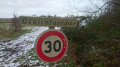
Park in the car park at La Clairière du Verbamont campsite.
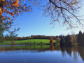
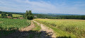
(S/E) Walk down the tarmac road and turn left onto the stony path, then continue to the end of the path. Carry on along the dirt track and head down towards the valley until you reach the junction with another path at the Forge Neuve pond.
(1) Turn left, follow the white signposts and go down the small flight of steps. Cross the bridges over the River Ourche to reach the tarmac road. Turn right onto it towards Forge Neuve, pass a telephone exchange, go through the barrier and follow the dirt track at the bottom of the valley. Leave the statue of Notre-Dame du Doux Nid on your left, carry on and cross the Ruisseau de la Houdrie.
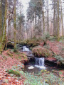
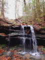
(2) Continue along the stone path and head uphill, following the river with numerous waterfalls below. Pass a small cave with a statue of the Virgin Mary in a recess on the right. Carry on until you emerge from the forest and walk alongside the field. Pass the ruins of the Ferme de la Houdrie on your right and continue until you reach the D164 road. Follow it for a few metres to the left, cross the Ruisseau de la Houdrie and you’ll immediately come to a path junction on your right.
(3) Jump over the ditch to the right opposite kilometre marker 66, then carry on straight ahead along this trench until you reach the junction withthe GR®7. Turn right onto it and follow it until you reach the junction at the Étang des Brocs. Leave the GR®7 at this junction and carry on straight ahead to rejoin the D164. There is a picnic table here.
(4) Turn left onto the Tranchée de la Fléchière and follow it to the crossroads with four perpendicular roads.
(5) Turn left onto the Route Forestière de Clairfontaine. Leave the woodland and pass through the hamlet of Clairfontaine. Underneath the high-voltage power line, reach the edge of the woodland at a gate.
(6) Turn right onto the track, quickly join theGR®7and continue until you reach another barrier.
(7) Turn left, head down to the Saône and arrive below the hamlet of La Bataille.
(8) Turn right and follow the Saône. Pass through the ruins of an old glassmakers’ village and continue along theGR® to reach the bridge at the confluence of the Saône and the Ruisseau des Bocards.
(9) Follow the stone path to the right, signposted ‘Orange VTT’. After a gentle climb, you’ll reach the Tranchée des Truites crossroads.
(10) Ignore the trench on your right and carry on straight ahead along a straight stretch of path, then veer left. You will then reach the Tranchée des Carrières junction.
(11) Turn right here and, following another straight stretch, reach the junction with the D164 at the entrance to the village of Hennezel.
(12) Turn 90° left onto the road opposite, pass the mobile phone mast and continue along the tarmac road to reach the junction in the hamlet of La Grange Bresson.
(13) Leave the road and walk alongside the ponds on your left, in particular the Scie pond. You’ll reach the Tranchée de Clairey. Turn left here and continue to the junction of the roads leading to this hamlet.
(14) Leave Clairey on your right and head straight ahead, cross the Ruisseau de Brisseverre and re-enter the forest to reach the four-way crossroads at Cul des Champs.
(15) Turn right onto the Bisval Tranchée along a path. Leave the forest, cross the hamlet of La Frison, then walk past a large farm. Continue along the edge of the park until you reach the forest again and the Route Forestière Jean Gaspard.
(16) Carry on along this track, heading down to the gravel road, where you’ll come to another crossroads. Turn right to reach the Clairière du Verbamont car park (S/E).



 Tourism professional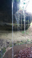
 Moderate
 Easy
Easy