From the Ourche to the Saône

A lovely circular walk with some steep sections, ideal for lovers of history, legend and the forest.

Details

n°4533261
Creation:
Last update:
Last review:
  • Walking
    Activity: Walking
  • ↔
    Distance: 11.45 mi
  • ◔
    Average duration: 6h 00 
  • ▲
    Difficulty: Average

  • ⚐
    Back to start: Yes
  • ↗
    Ascent: + 889 ft
  • ↘
    Descent: - 912 ft

  • ▲
    Highest point: 1,230 ft
  • ▼
    Lowest point: 827 ft
  • ⚐ Country: France
  • ⚐ City: Claudon (88410)
  • ⚑
    Start/End: N 48.043864° / E 6.079935°
  • ❏
    IGN map(s): Ref. 3318SB, 3319SB
  • Hour-by-hour weather

Photos

Description of the walk

Park in the Clairière du Verbamont car park.

(S/E) Set off along the tarmac road heading south on a long, almost flat straight stretch to the hamlet of Henricel.

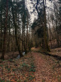
(1) Turn right and take the dirt track which soon enters the woodland; follow it to reach the hamlet of La Sybille.

(2) Turn right onto the tarmac road and cross the hamlet. Enter the woodland again and turn right at thefirst junction onto a dirt forest track. Follow this track until you reach the D5E road.

(3) Turn right onto it, heading downhill, and you’ll reach a junction with a dirt track.

(4) Follow the Blue Ring markings to the left, beginning a lovely climb along this narrow dirt track.

(5) At a left-hand bend, pass the Grotte de l’Ours, where there is a sign explaining the legend of this cave. Carry on until you reach the Polissoir, where another sign explains the prehistoric history of the area and the use of stone for polishing prehistoric tools.

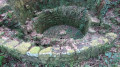
(6) Continue along the Blue Ring route. You’ll reach the village washhouse, a small shelter in case of rain where, long ago, the people of Claudon used to gather to do their washing.

(7) Carry on until you reach the D5 road, situated slightly higher up.

(8) Turn right onto it and follow it for a few metres. At thefirst junction, turn left onto the Tranchée de la Roche Vinaigre; continue along this dirt track, keeping straight on, until you reach the junction with the path leading to Pont Tatal. You’ll see an old stone quarry on your left.

(9) Take a detour to the right to reach this 43-metre bridge spanning the River Ourche. Return to the junction and continue straight ahead along the old railway line, which has now been dismantled. Keep going straight on until you reach the local road and the old Couchaumont Bridge, of which only the two piers remain.

(10) Turn right as you head downhill and walk through the hamlet of Couchaumont until you reach the hairpin bend.

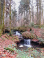
(11) Turn right at the hairpin bend and take the small dirt track below, following the Saône for a few metres. Also note the Roche Vinaigre, an impressive rock formation at the foot of the Saône. Continue straight on until you reach the D5.

(12) Turn left onto this road, cross the Ourche and continue for 800 m. After the right-hand bend, you’ll reach the hamlet of La Cabiole.

(13) Turn right and head up through the field, leaving the Cabiole farm on your left whilst following the ‘Green Ring’ signposts. Carry on to reach the Tranchée de la Cabiole. Head straight ahead along it to reach a right-angled junction with a stony path.

(14) Take this path to the right and head down towards the hamlet of Droiteval, with its castle and former abbey. Go round the pond on the left and return to the crossroads you passed on the way there.

(4) Head down to the right along the path signposted ‘La Glacière’ and follow it to reach Notre-Dame de la Source, crossing the small bridge over a stream.

(15) Head due north along the path to reach a road running alongside the pond. Turn right onto it, heading east, and follow it.

(16) Walk past a fountain near the former Senennes Forest Ranger’s House before turning right into the hamlet of Senennes, between the ponds.

(17) Turn left onto the path that climbs up, signposted ‘Tranchée des Deux Maisons’, leaving the pond and the forest house behind you. You’ll reach a gate at the trench.

(18) Pass the red-and-white gate on your right, along with the stone path running perpendicular to the path you are on. Turn left onto the dirt track, following the boundary of the plot along an almost flat path until you reach a limestone track.

(19) Turn right onto it and follow it to the forest road. Walk past the Verbamont campsite and easily make your way back to the car park at the Verbamont clearing (S/E).

Waypoints

  1. S/E : mi 0 - alt. 1,135 ft - Car park at La Clairière du Verbamont campsite
  2. 1 : mi 0.7 - alt. 1,158 ft - Henricel
  3. 2 : mi 1.7 - alt. 1,148 ft - La Sybille
  4. 3 : mi 3.02 - alt. 1,037 ft - On the right-hand side of the road
  5. 4 : mi 3.45 - alt. 912 ft - Junction shared by both circular loops
  6. 5 : mi 3.77 - alt. 932 ft - Bear’s Cave
  7. 6 : mi 4 - alt. 988 ft - Le Polissoir
  8. 7 : mi 4.21 - alt. 968 ft - Washing house
  9. 8 : mi 4.26 - alt. 994 ft - Junction of the D5 and the Raymond Georges trail
  10. 9 : mi 5.25 - alt. 915 ft - Pont Tatal
  11. 10 : mi 5.92 - alt. 925 ft - The old Couchaumont Bridge
  12. 11 : mi 6.05 - alt. 876 ft - Hairpin bend
  13. 12 : mi 6.56 - alt. 840 ft - D5 junction at Pont Tatal Bas. Cross the - Ourche (rivière)
  14. 13 : mi 7.07 - alt. 883 ft - Le Cabiole, near the - La Saône
  15. 14 : mi 8.06 - alt. 1,040 ft - The ‘Tranchée de la Cabiole’ junction
  16. 15 : mi 8.92 - alt. 879 ft - Notre-Dame de la Source
  17. 16 : mi 9.71 - alt. 873 ft - Fountain at the old forester’s house
  18. 17 : mi 9.8 - alt. 876 ft - Tranchée des Deux Maisons on the left
  19. 18 : mi 10.42 - alt. 1,073 ft - Dirt track on the left
  20. 19 : mi 10.98 - alt. 1,093 ft - Limestone path on the right
  21. S/E : mi 11.45 - alt. 1,135 ft - Car park at La Clairière du Verbamont campsite

Notes

You can take shelter under the jumping shelter or further down beneath the bridge. There is a picnic table near the bridge pier and also at the end of the bridge
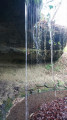
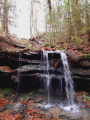
At Notre-Dame de la Source, you can also take shelter under the rock and admire the waterfall and a statue of the Virgin Mary.

Worth a visit

Tatal Bridge: bungee jumping takes place here on certain Sundays.
Between (9) and (10), you’ll find a beautiful carpet of periwinkles here in spring.
Between (3) and (4), enjoy a lovely view of a magnificent mansion and the pond.
Note: if you’re lucky, you might hear the old organ from the Salle Poirel in Nancy, which has been installed in this little chapel of Notre-Dame de Droiteval.
Before reaching the fountain directly in front of you, you’ll spot some Highland cattle, recognisable by their long horns.

Places to see on the route: the Hutte Arboretum, Polissoir, the Grotte de l’Ours, Notre-Dame de la Source, the Saône, the Ourche, the Roche Vinaigre, the Tatal Bridge, Notre-Dame de Droiteval, the Droiteval ice house, the Droiteval manor house, the Highland cattle, and the hamlet of La Scie.

Reviews and comments

4.3 / 5
Based on 2 reviews

Reliability of the description
4.5 / 5
Ease of following the route
4 / 5
Route interest
4.5 / 5
Christophe Mathis
Christophe Mathis ★

Thank you for your comment.
Kind regards
Christophe

Machine-translated

irma70
irma70

Overall rating : 4.7 / 5

Date of your route : Mar 25, 2025
Reliability of the description : ★★★★★ Very good
Ease of following the route : ★★★★☆ Good
Route interest : ★★★★★ Very good
Very busy route : No

A lovely walk that allows you to discover a beautiful part of the Vosges’ heritage; Droiteval is a magnificent place where peace and tranquillity wash over you – you’ll have only one desire: to stay. Just one comment on the route: at point 12, after turning left, I’d recommend taking the first road on the right which climbs into the forest. This avoids that stretch of tarmac, which isn’t particularly pleasant and adds nothing to the enjoyment of the walk. Apart from this minor detail, there’s nothing else to report about this route, which the author has kindly shared with us – and for which I’d like to thank them.

Machine-translated

Christophe Mathis
Christophe Mathis ★

Thank you, Francis

Machine-translated

Francis MICHEL
Francis MICHEL

Overall rating : 4 / 5

Date of your route : Apr 18, 2024
Reliability of the description : ★★★★☆ Good
Ease of following the route : ★★★★☆ Good
Route interest : ★★★★☆ Good
Very busy route : No

A lovely route we did with a group on a sunny day. Everyone was delighted. We were also welcomed by some very friendly people for our midday picnic.

Machine-translated

Other walks in the area

For more walks, use our search engine .

The GPS track and description are the property of this route's author. Please do not copy them without permission.