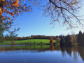
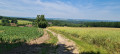
The Étang Bleu and the Étangs de Clairey in the heart of the forest

An adventurous walk through a diverse forest, past numerous ponds at Clairey, the Étang Bleu and the Morillon, the Museum of Glass, Iron and Wood, and the blueberry farm at Briseverre.

Details

28941687
Creation:
Last update:
Last review:
  • Walking
    Activity: Walking
  • ↔
    Distance: 9.15 mi
  • ◔
    Average duration: 4h 45 
  • ▲
    Difficulty: Moderate

  • ⚐
    Back to start: Yes
  • ↗
    Ascent: + 584 ft
  • ↘
    Descent: - 558 ft

  • ▲
    Highest point: 1,526 ft
  • ▼
    Lowest point: 1,027 ft
  • ⚐ Country: France
  • ⚐ City: Claudon (88410)
  • ⚑
    Start/End: N 48.044018° / E 6.08012°
  • ❏
    IGN map(s): Ref. 3318SB, 3319SB, 3419O
  • Hour-by-hour weather

Photos

Description of the walk

Park at the Clairière du Verbamont Eco-Campsite (public car park) or, alternatively, below the campsite (3 spaces).

(S/E) With your back to the campsite, turn left towards La Hutte. In the wide right-hand bend, on your left-hand side, is the entrance to the Chemin de l’Arboretum.

(1) Take this path, running parallel to the road, towards La Hutte. After a few hundred metres, you’ll rejoin the campsite road. Carry on straight ahead, cross the bridge over the Ourche and you’ll reach a crossroads.

(2) At the junction for La Hutte, ignore the path on the left and head straight up for about a hundred metres until you reach a house.

(3) Just past the house, take a flight of steps on the right leading into the forest. Follow the pink-painted arrow. After a 90° right-hand bend, continue south-east until you reach the junction with the Tranchée de Sainte-Marie and a wide path marked with a Red Triangle.

(4) Carry on straight ahead, heading east-north-east. About 200 metres after a right-hand bend, the path joins the D5d road, opposite a car park and a picnic area.
About a hundred metres to the right is the Museum of Iron, Glass and Wood. See Practical Information.

(5) From the picnic area, turn right, heading east, onto the Route de Clairey. A few dozen metres before the school, join a forest track branching off to the left (not shown on the IGN map)

(6) Follow this track, keeping an eye out for the Red Triangle markings, until you reach the junction with the Tranchée de Clairey.

(7) Cross the track and carry on straight ahead along the narrow path, then immediately turn right into the forest. Follow the track alongside the ponds until you reach the junction with the tarmac road.

(8) Turn right and cross the Ourche towards La Grange Bresson, then carry on to thefirst junction at La Grange Bresson.

(9) Take the road on the left which leads into the woods. After the bend to the right, carry on straight ahead, passing the Étang Coné-Fontaine (the Étang Bleu), then continue along the path for 1.5 km until you reach a junction with the Tranchée de Gruey.

(10) Turn right onto the Tranchée de Gruey; at the next two junctions, go straight on and continue to the T-junction at La Planchotte/Clairey.

(11) Turn left, pass La Planchotte and turn left again, taking the Tranchée de la Haute Saône for a few hundred metres.

(12) Take the first track on the right (Tranchée de la Fontaine aux Cerfs) and go straight on until you reach a four-way junction.

(13) Turn right and follow the Red Triangle signposts. At the junction with a road, carry on straight ahead, veering slightly to the left, towards La Hutte. Continue straight on until you reach a cross-path. Turn left and you’ll reach Henricel.

(14) Turn right and continue along the forest track, heading north, until you return to the Clairière du Verbamont car park (S/E).

Waypoints

  1. S/E : mi 0 - alt. 1,135 ft - La Clairière du Verbamont Campsite
  2. 1 : mi 0.12 - alt. 1,083 ft - Upper entrance on the campsite side of the arboretum - Arboretum de la Hutte Verbamont
  3. 2 : mi 0.55 - alt. 1,037 ft - La Hutte crossroads - Ourche (rivière)
  4. 3 : mi 0.61 - alt. 1,033 ft - Staircase on the path to Hennezel - Ourche (rivière)
  5. 4 : mi 1.16 - alt. 1,234 ft - Tranchée de Sainte-Marie crossroads
  6. 5 : mi 1.66 - alt. 1,332 ft - D5d – Picnic area - Musée du verre, du fer et du bois (Hennezel)
  7. 6 : mi 1.9 - alt. 1,355 ft - Clairey School
  8. 7 : mi 2.21 - alt. 1,404 ft - Clairey crossroads
  9. 8 : mi 2.85 - alt. 1,362 ft - Junction of the tarmac road – La Grange Bresson
  10. 9 : mi 2.94 - alt. 1,365 ft - Between the houses – the Grange Bresson
  11. 10 : mi 5.19 - alt. 1,526 ft - Crossroads and a view of millions of blueberries
  12. 11 : mi 6.21 - alt. 1,453 ft - T-junction – La Planchotte
  13. 12 : mi 6.6 - alt. 1,470 ft - The Fontaine aux Cerfs trench
  14. 13 : mi 7.16 - alt. 1,332 ft - Crossroads
  15. 14 : mi 8.39 - alt. 1,161 ft - Henricel
  16. S/E : mi 9.15 - alt. 1,132 ft - La Clairière du Verbamont Campsite

Notes

(5) Picnic area at the Museum of Glass, Iron and Wood. You can visit the museum on Easter and All Saints’ Day afternoons. The museum is situated 100 m south of the trail.

(S/E) La Clairière du Verbamont eco-campsite.

Worth a visit

Museum of Glass, Iron and Wood.
The Clairey Ponds.
Coné-Fontaine Pond (swimming).
The blueberry farm at Briseverre.

Reviews and comments

3.9 / 5
Based on 3 reviews

Reliability of the description
4 / 5
Ease of following the route
4 / 5
Route interest
3.7 / 5
Christophe Mathis
Christophe Mathis ★

Thank you for your comment

Machine-translated

François VERNIER
François VERNIER

Overall rating : 4 / 5

Date of your route : Mar 24, 2025
Reliability of the description : ★★★★☆ Good
Ease of following the route : ★★★★☆ Good
Route interest : ★★★★☆ Good
Very busy route : No

A pleasant walk, but watch out for areas under forestry operations where branches lying across the path make it difficult to get through. That’s why we chose to take the signposted path between points 6 and 7, which initially follows the edge of the forest and thus avoids the area under forestry operations.

Machine-translated

castel martine
castel martine

Overall rating : 3.7 / 5

Date of your route : Apr 18, 2023
Reliability of the description : ★★★★☆ Good
Ease of following the route : ★★★★☆ Good
Route interest : ★★★☆☆ Average
Very busy route : No

An easy route.
A few lovely spots, but lots of monotonous forest tracks.

Machine-translated

Christophe Mathis
Christophe Mathis ★

Thank you for your comment.
Kind regards
Christophe

Machine-translated

irma70
irma70

Overall rating : 4 / 5

Date of your route : Apr 04, 2023
Reliability of the description : ★★★★☆ Good
Ease of following the route : ★★★★☆ Good
Route interest : ★★★★☆ Good
Very busy route : No

A lovely forest walk; we had a bit of trouble finding the path at point 3 (we went too low) and ended up at the foot of Sainte Marie. Otherwise, everything was fine – lovely ponds, beautiful forests and a bit of road, but it’s hard to avoid that. Thank you for this walk, which we really enjoyed.

Machine-translated

Other walks in the area

For more walks, use our search engine .

The GPS track and description are the property of this route's author. Please do not copy them without permission.