Country:
 City:


The route starts at the entrance to the car park of the La Clairière du Verbamont eco-campsite. If you’re coming by car, you can park 30 metres above the campsite’s ‘Welcome’ sign, at the side of the road heading towards Henricel. A gravel area next to the road can accommodate 4 to 5 cars.
(S/E) Take the tarmac road downhill, leaving the eco-campsite on your left. Opposite is a fountain that flows intermittently. Continue downhill to the Fork in the road with the first gravel forest track, just below the campsite, which is on your left.
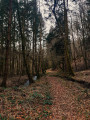
(1) Take the forest track to the timber lorry turning area, where you’ll also find a large clearing. The piles of wood laid out there will make you think of a large campfire site.
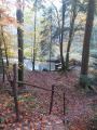
(2) At this point, leave the track and head down the narrow path. In some places, wooden steps have been fitted. You’ll come to a wooden railing with, in front of you, a wider dirt track running perpendicular to it and, further down, a pond.
(3) Turn right and carry on until you see a house in front of you.
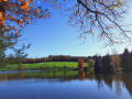
(4) Turn left, walking across the wooden planks, then carry on straight ahead towards the road. Cross the stone bridge over the River Ourche. Continue to the road. Turn right and carry on along the tarmac road to the iron bridge at La Hutte. Cross this bridge, walk through the whole of the hamlet of La Hutte, keeping the ponds on your left, until you reach the second left-hand bend.
(5) Take the path on the right and head uphill just behind the house towards the arboretum. Follow the arboretum path, passing a stone bench and two recent sandstone sculptures. Continue along this path until you reach the tarmac road. Turn right. You can also visit the second part of the Arboretum just before reaching the tarmac road by turning left in front of the Sempervirens sequoias.
(1) Take the same path back as on the way there to return to the Verbamont car park (S/E).
 Tourism professional
 Difficult

 Easy