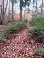
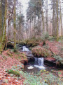
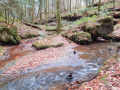
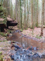
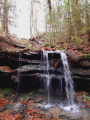
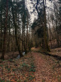
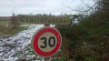
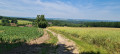
Waterfall, carpet of moss and an unusual sculpture at the Gorge le Loup

An “adventure” walk along the Houdrie Valley and the Gorge le Loup Valley, above and alongside the Ruisseau de Thiètry, with beautiful green moss on the rocks and lovely waterfalls if the water level permits. The walk takes you along unpaved roads and forest paths. The best time of year for this route is spring. We recommend using the Visorando app, as some sections of the trail are poorly marked.

Details

28946844
Creation:
Last update:
Last review:
  • Walking
    Activity: Walking
  • ↔
    Distance: 5.07 mi
  • ◔
    Average duration: 2h 40 
  • ▲
    Difficulty: Easy

  • ⚐
    Back to start: Yes
  • ↗
    Ascent: + 390 ft
  • ↘
    Descent: - 390 ft

  • ▲
    Highest point: 1,198 ft
  • ▼
    Lowest point: 925 ft
  • ⚐ Country: France
  • ⚐ City: Claudon (88410)
  • ⚑
    Start/End: N 48.044189° / E 6.080179°
  • ❏
    IGN map(s): Ref. 3318SB, 3319SB
  • Hour-by-hour weather

Photos

Description of the walk

Park in the car park at La Clairière du Verbamont campsite or below the campsite on the stony path.

(S/E) Walk down towards the arboretum below the campsite, taking the stony path on your left. At the end of the path, turn right to walk down the hill, following the white signposts (small plastic arrows). You’ll reach the Forge Neuve valley with the pond opposite.

(1) Cross the path and go over the small bridge. Carry on to the tarmac road, then turn right and pass the crossroads at Droiteval, La Grange au Bois and La Hutte.

(2) At the small car park where there is an electrical transformer, go through the barrier and take the road leading into the forest. Leave Notre-Dame du Doux Nid on your right and follow the stream called the Houdrie, which runs below you on your right. Continue to the point where the stream splits into two.

(3) Cross the stream and take the path on the right. Take care – this is a damp area. Then follow the Gorge le Loup stream. Cross it and take the path on the right. Walk past a carved stone, the ‘Homme Sauvage’, with a beautiful waterfall below it.

(4) Head down the tiny forest path on the right to the stream: this junction is marked by pointed stones (see photo). Cross the stream and follow the path, now with the stream on your left. You’ll spot piles of stones here and there, built by passers-by.

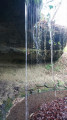
Walk past a large overhanging rock which serves as a picnic spot (green blanket in the background). Continue along the narrow path; at the junction, cross the stream, follow the path alongside it, then cross it one last time.

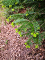
Immediately afterwards, follow the path between the small spruce trees and leave the valley, heading towards the stony track. Join the Tranchée de la Gorge le Loup.

(5) Turn right onto it and you’ll soon come to a forest track.

(6) Turn left at a 90° angle and continue in a straight line to the Champ de la Houdrie meadow. After a left-hand bend, you’ll come to a path junction with a small wooden signpost marked ‘Route Boerderig’, although the writing is facing the other way.

(7) Head off to the right and follow the path downhill to a tarmac road. You’ll cross fields and pass through a few fence crossings (wooden fence steps), until you reach a spot where you’ll find information in Dutch; from here, head up the hill through the woods towards the road (higher up).

(8) Follow the road to the right for about a hundred metres, then turn left onto the Tranchée Alfred Irroy and continue along the stone path. Take a left-hand bend and, immediately afterwards, you’ll come to a crossroads of footpaths.

(9) Turn right onto the path that runs alongside plots 653 and 654: you’ll see both numbers marked on the trees. Continue along this path until you reach a steep descent towards La Hutte. Then take the tarmac road on the left, negotiate the right-hand bend as you cross the Ourche, then pass in front of the chapel and carry on to the entrance to the arboretum.

Turn right into the arboretum (see the sign explaining its history) and continue along the track running parallel to the tarmac road. Walk past some majestic trees, including one of the tallest sequoias in France, and carry on to the Sequoia sempervirens. Then leave the arboretum and head up to the tarmac road above. Carry on to the car park at the Clairière du Verbamont eco-campsite (S/E).

Waypoints

  1. S/E : mi 0 - alt. 1,132 ft - Car park at the - La Clairière du verbamont
  2. 1 : mi 0.58 - alt. 932 ft - Ourche (rivière)
  3. 2 : mi 0.71 - alt. 932 ft - Electrical substation - Étangs de la Forge Neuve
  4. 3 : mi 1.39 - alt. 961 ft - Crossing the stream
  5. 4 : mi 1.81 - alt. 1,066 ft - Turn right at the fork
  6. 5 : mi 2.58 - alt. 1,132 ft - The Gorge le Loup trench
  7. 6 : mi 2.85 - alt. 1,161 ft - Forest track junction
  8. 7 : mi 3.4 - alt. 1,148 ft - Sign for Route Boerderig
  9. 8 : mi 3.82 - alt. 1,138 ft - Tarmac road
  10. 9 : mi 4.19 - alt. 1,142 ft - Path between plots 653 and 654
  11. S/E : mi 5.07 - alt. 1,132 ft - Car park at the - La Clairière du verbamont

Notes

Sturdy (waterproof) walking shoes. You’ll be crossing the stream several times.

Worth a visit

The ponds at Forge Neuve.
Notre-Dame du Doux Nid in the forest.
Carved stones.
A cave.
The Verbamont clearing, eco-campsite
De Natuurlijke Tijd, nature education centre
The Hutte Arboretum – Verbamont, with magnificent sequoias.

Reviews and comments

3.7 / 5
Based on 4 reviews

Reliability of the description
3.5 / 5
Ease of following the route
3 / 5
Route interest
4.5 / 5
Mimilafleur
Mimilafleur

Overall rating : 3.7 / 5

Date of your route : Jul 17, 2024
Reliability of the description : ★★★★☆ Good
Ease of following the route : ★★★☆☆ Average
Route interest : ★★★★☆ Good
Very busy route : No

A lovely route for the first half of the walk, but then it got a bit more chaotic. There was a clear lack of signposting on the second half, and the route was much less interesting and poorly maintained. We made our way through overgrown woodland and mud up to our calves, only to end up at a makeshift camp set up by some Dutch people right in the middle of the forest. We nearly walked straight through their living room… a bit awkward, but it did give us a good laugh. We met a few people on the first section but didn’t see anyone else on the second.
A pleasant walk nonetheless.

Machine-translated

charpao88
charpao88

Overall rating : 4 / 5

Date of your route : Jun 26, 2023
Reliability of the description : ★★★★☆ Good
Ease of following the route : ★★★☆☆ Average
Route interest : ★★★★★ Very good
Very busy route : No

A superb, well-shaded route with no major difficulties; the signposting could do with a bit of improvement, but otherwise it’s a lovely discovery.

Machine-translated

marcellarcher
marcellarcher

Overall rating : 3.7 / 5

Date of your route : May 31, 2023
Reliability of the description : ★★★☆☆ Average
Ease of following the route : ★★★☆☆ Average
Route interest : ★★★★★ Very good
Very busy route : Yes

There are a few difficulties in finding the start, and towards the end there’s a clear lack of landmarks to help you find the right direction. If it’s rainy, it’s best not to even think about it, as some sections will be tricky even in walking boots.

Machine-translated

le saut de bonneille

Overall rating : 3.3 / 5

Date of your route : Apr 04, 2023
Reliability of the description : ★★★☆☆ Average
Ease of following the route : ★★★☆☆ Average
Route interest : ★★★★☆ Good
Very busy route : No

We encountered difficulties along the route as it was very poorly signposted
Right from the start, there were no white arrows
and towards the end, when we went through the woods, there were no markings at all
That’s a real shame because the route is lovely
Not to be attempted after rain as it’s difficult to cross the stream

Machine-translated

Other walks in the area

For more walks, use our search engine .

The GPS track and description are the property of this route's author. Please do not copy them without permission.