Country:
 City:


The walk starts at the entrance to the car park of the ‘La Clairière du Verbamont’ eco-campsite. If you’re coming by car, you can park 30 metres above the campsite’s ‘Welcome’ sign, at the side of the road heading towards Henricel. A gravel area next to the road can accommodate 4 to 5 cars.
(S/E) Take the tarmac road downhill, leaving the eco-campsite on your left. Continue downhill to the first gravel forest track, just below the campsite, which is on your left around a bend.
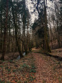
(1) Follow the forest track to the timber lorry turning area. You’ll also find a large circle with pieces of wood arranged in such a way that it looks like a large campfire site.
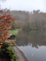
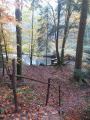
(2) At this point, leave the track and head down the small path. In some places, wooden steps have been installed. You’ll come to a wooden railing. Opposite you is a pond, situated further down, and a wider dirt track running perpendicular to it.
(3) Turn left onto it and continue until you reach another wooden railing.
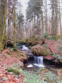
(4) If you head down towards the ponds, in summer you’ll find a tea room and a spot for swimming in the pond. The suggested route does not go in this direction; it continues straight on along the River Ourche, which you can still see on your right. Follow the River Ourche along a narrow dirt track. Pass patches of deciduous trees and stands of Douglas fir and larch on your left. Carry on until you reach a path and a crossroads.
(5) Turn right and head down the stony path to the small hamlet of Sennenes, which has a large lodge and a chalet. Carry on to the T-junction before the chalet and turn left.
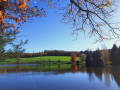
(6) Walk alongside the Étang de Sennenes, which is on your right, then continue along this path to its end, where you’ll find a three-way junction.
(7) At the bridge, take the path on the left towards a forest cutting that climbs very steeply. Follow this cutting. You can use the markings on the trees to guide you. Do not cross the small stream but follow its course until you reach the stony path.
(8) Turn right onto this path and continue to the right until you reach the tarmac forest road.
(9) Turn left onto the road towards the eco-campsite. Return to your starting point (S/E).
 Tourism professional

 Difficult
 Easy