La Femma Mountain Hut – La Leisse Mountain Hut

Day3 of a two-circular route in the Vanoise National Park, from the Refuge de la Femma to the Refuge de la Leisse.
There’s nothing particularly complicated about this hike, where we’ll descend the Femma valley before climbing back up alongside the Leisse valley, which I’m particularly fond of.

This walk is part of a multi-day hike: Circuit de 5 jours à deux boucles autour de la Grande Casse

Details

n°35969
Creation:
Last update:
Last review:
  • Walking
    Activity: Walking
  • ↔
    Distance: 9.10 mi
  • ◔
    Average duration: 5h 35 
  • ▲
    Difficulty: Difficult

  • ⚐
    Back to start: No
  • ↗
    Ascent: + 1,654 ft
  • ↘
    Descent: - 1,230 ft

  • ▲
    Highest point: 8,146 ft
  • ▼
    Lowest point: 6,686 ft

Description of the walk

(S) From the Refuge de la Femma, follow the path to the right of the Rocheure stream to the chalet of the same name

(1). You will then come to a small road which you should follow. Cross the bridge and continue to follow the stream, this time on the left-hand side. Stay on the path at the bottom of the valley at all times.

(2) At Balme Froide, take the path to the right and pass the small houses. A descent begins, running a little closer to the stream.

(3) When you reach the Renaudière bridge, head to the right (do not go down to the bottom of the valley). You are now at the junction of three valleys. To the left is theGR®5, to the right theGR®55. Take the latter. Once you have crossed the bridge, head towards the Pefuge d’entre Deux Eaux and then pass the little Chapelle Saint-Pierre.

(4) Further on, at the Croé-Vie bridge, do not cross the bridge but continue straight on along theGR®55.

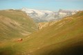
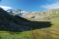
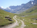
(5) You then enter the Leisse valley, which becomes more deeply incised from this point onwards. Simply keep following the Leisse torrent on your right. This valley is quite impressive, with its high peaks and the moraines visible all along the path on your left.
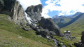
In the distance, perched on a hill, is the Refuge de la Leisse, which you’ll reach by continuing to follow the path that runs alongside the stream.
One last steep climb and you can finally catch your breath at the refuge (E).

Waypoints

  1. S : mi 0 - alt. 7,723 ft - La Femma mountain hut - Refuge de la Femma
  2. 1 : mi 1.54 - alt. 7,379 ft - Chalet de la Rocheure
  3. 2 : mi 3.85 - alt. 7,136 ft - Balme Froide
  4. 3 : mi 4.77 - alt. 6,699 ft - Renaudière Bridge - Refuge d'Entre Deux Eaux
  5. 4 : mi 5.92 - alt. 6,896 ft - The Leisse - Pont de Croë-Vie
  6. 5 : mi 7.08 - alt. 7,290 ft - Valley of the - Leisse (cours d'eau)
  7. E : mi 9.1 - alt. 8,146 ft - Refuge de la Leisse

Notes

IGN 1:25,000 maps or GPS recommended.
A good hooded sleeping bag and a groundsheet.
A water bottle.

Worth a visit

For this section of the route, there are several possible alternatives:
- a hiker suggests the same route but with a more challenging route (and in the opposite direction) at the following address:
https://www.visorando.com/randonnee-sent...
- At Pont-de-Croe, you can leave this route for good and head to Champagny-le-Haut via Pralognan and Le Grand Bec. Take inspiration from the following two routes (please note, they are in the opposite direction):
https://www.visorando.com/randonnee-1e-j...
https://www.visorando.com/randonnee-4e-j...
which form part of another four-day route:
https://www.visorando.com/randonnee-bouc...

Always be cautious and plan ahead when you're outdoors. Visorando and the author of this route cannot be held responsible for any accidents occurring on this route.

The GR® and PR® markings are the intellectual property of the Fédération Française de Randonnée Pédestre.

Reviews and comments

4.5 / 5
Based on 2 reviews

Reliability of the description
4.5 / 5
Ease of following the route
4.5 / 5
Route interest
4.5 / 5
waldin
waldin

Overall rating : 5 / 5

Date of your route : Aug 02, 2017
Reliability of the description : ★★★★★ Very good
Ease of following the route : ★★★★★ Very good
Route interest : ★★★★★ Very good

A lovely section of a two-day route! Val Claret > Refuge de la Femma and Refuge de la Femma > Val Claret. A peaceful, relaxing stretch, early in the morning on a hot day.
Great

Machine-translated

schiever
schiever

Overall rating : 4 / 5

Date of your route : Jul 31, 2014
Reliability of the description : ★★★★☆ Good
Ease of following the route : ★★★★☆ Good
Route interest : ★★★★☆ Good

We set off from the Refuge de la Femma, passing via the Col de Pierre Blanche. An unmarked path along the mountainside, marked by small mounds of stone. A steep climb, but magnificent scenery with a profusion of flowers.

Machine-translated

Other walks in the area

For more walks, use our search engine .

The GPS track and description are the property of this route's author. Please do not copy them without permission.