


Carte IGN détaillé ou un GPS.
Un bon duvet avec capuche et éventuellement un tapis de sol.
De bonnes chaussures de marche.
Une gourde.
Circuit de 5 jours à deux boucles autour de la Grande Casse

Circuit de 5 jours à deux boucles autour de la Grande Casse.
Au départ de la belle vallée de Champagny-le-Haut, ce circuit, dont le point culminant est le col de la Rocheure à 2911 m, propose de traverser des vallées sauvages au coeur du massif de la Vanoise.
Details
Creation:
Last update:
Last review:
–
–
-
 Activity: Walking
 -
 Distance: 50.96 mi
 -
 Average duration: 5 days
 -
 Difficulty: Difficult
 -
-
 Back to start: Yes
 -
 Ascent: + 14,039 ft
 -
 Descent: - 14,035 ft
 -
-
 Highest point: 9,557 ft
 -
 Lowest point: 4,816 ft
-
 Country:
France
Country:
France
-

-
 City:
Champagny-en-Vanoise (73350)
City:
Champagny-en-Vanoise (73350) -
 Start/End: N 45.458928° / E 6.744338°
 -


 Hour-by-hour weather
Photos
Stages of the route
This route needs several days, find the details below:
Notes
Other walks in the area
Champagny-le-Haut – Refuge du Col du Palet
 Visorando Member
9.25 mi
+4,757 ft
-1,115 ft
8h 25
Difficult
Visorando Member
9.25 mi
+4,757 ft
-1,115 ft
8h 25
Difficult
 Departure from Champagny-en-Vanoise (Savoie)
Day1 of a two-circular route in the Vanoise National Park, from Champagny-le-Haut to the Refuge du Col du Palet. A fairly demanding ascent of 1,100 metres, but with a beautiful panorama to reward your efforts, particularly the view over Lac de la Plagne.
Circular route via the Passage de la Frête from Champagny-le-Haut
6.99 mi
+3,615 ft
-3,615 ft
6h 20
Difficult
Departure from Champagny-en-Vanoise (Savoie)
A circular route from Champagny-le-Haut has been made possible by the recent upgrading of a section of the path just below the Passage de la Frête. The latter is the highlight of the route, offering unobstructed views towards the Vanoise. This route can be walked in exactly the same way in the opposite direction, offering the same rewards. This also gives you the chance to buy some cheese at the Chalet d’Alpage du Lécheron on the way back.
Refuge du Bois - Pralognan
 11.38 mi
+5,187 ft
-5,358 ft
9h 45
Difficult
Departure from Champagny-en-Vanoise (Savoie)
11.38 mi
+5,187 ft
-5,358 ft
9h 45
Difficult
Departure from Champagny-en-Vanoise (Savoie)
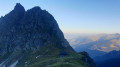
Day 4 of the circular route around the Grande Casse, from Champagny-le-Haut to Pralognan via the Tour du Merle and the Grand Bec.
Pointe des Chardes
 8.38 mi
+4,747 ft
-4,744 ft
8h 00
Difficult
Departure from Champagny-en-Vanoise (Savoie)
8.38 mi
+4,747 ft
-4,744 ft
8h 00
Difficult
Departure from Champagny-en-Vanoise (Savoie)
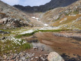
The Pointe des Chardes doesn’t seem to be very well known, yet it’s a beautiful, wild hike that isn’t too difficult, with an incredible view from the summit. We’re right in the heart of the Vanoise.
Loop on the left bank of the Doron de Champagny via La Sauvire
7.36 mi
+4,236 ft
-4,232 ft
7h 05
Difficult
Departure from Champagny-en-Vanoise (Savoie)
Alpine hike for experienced walkers on the wild left bank of the Doron de Champagny, with views of the chain of glaciers and rock faces stretching from the Grand Bec to the Grande Motte via the Grande Casse.
Lécheron mountain chalet
 3.34 mi
+2,008 ft
-2,008 ft
3h 15
3.34 mi
+2,008 ft
-2,008 ft
3h 15
 Moderate
Departure from Champagny-en-Vanoise (Savoie)
Moderate
Departure from Champagny-en-Vanoise (Savoie)
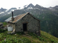
One of the first hikes to do when discovering the Champagny-le-Haut valley and a great way to pick up some cow's or goat's cheese for lunch. This hike can be extended to Froide Fontaine.
Les Hommes Courbés
 6.01 mi
+3,169 ft
-3,176 ft
5h 30
Difficult
Departure from Champagny-en-Vanoise (Savoie)
6.01 mi
+3,169 ft
-3,176 ft
5h 30
Difficult
Departure from Champagny-en-Vanoise (Savoie)
Locals call this section of the hike “Les Hommes Courbés” (The Bent Men) because of the shape of the mountain. You be the judge...
This pleasant and varied hike is particularly suitable for a hot day as two-thirds of the route is in the shade.
For information on the difficulty, see the ‘Practical Information’ section.
 Very difficult
 For more walks, use our search engine .
The GPS track and description are the property of this route's author. Please do not copy them without permission.

