


 Country:

 City:
City:


You can reach Bessans town centre via the D902 road, either from Lanslebourg by turning left towards “Bessans” just after crossing the Arc, or from Bonneval-sur-Arc by turning right towards “Lanslebourg via Bessans – Town Centre” near the biathlon stadium.
Park on the Place de la Poste (or Place de la Mairie – they share the same building). If you can’t find a space there, there’s no shortage of parking options in the village.
(S/E) Turn left and drive a few dozen metres towards Bonneval along Rue de Saint-Sébastien (the main road following the route of the D902A).
(1) Take the first right to pass beneath the church which overlooks the embankment. Walk past the superb mission cross, known as the “Croix du Coq”. Continue along Rue Saint-Antoine. At the end of this street, turn left onto Rue de la Chapelle.
(2) At the left-hand bend in this street, carry on straight ahead along the path heading due south, with the Pointe de Soliet in your sights.
(3) Halfway along, leave the track on your left which joins the road and which you will take on your return at the end of the route.
At the end of the path, turn left onto a short track that joins the road. Cross the D902 with care and continue straight ahead towards the woods.
(4) Turn right onto the path which, 300 metres further on,
(6) Cross the Ribon via a lovely bridge. After the bridge, the path leads back to the road.
Follow the road to the left towards Lanslebourg, and after 150 m, take the path on the left.
(6) At the first junction (signpost), leave the Petit Bonheur path on your right and head towards “Lac de Soliet”. The path climbs steeply, often in steps.
(7) At the next fork, leave the sign for “Ruisseau de la Plate” on your right and follow the sign for “Lac de Soliet”.
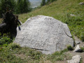
(8) After a long climb, there is another junction: leave the signposted “Pierre des Saints” or “Col du Mont Cenis” to your right and turn left towards “Lac de Soliet”. The climb ends as you reach the Plan du Lau plateau, then you pass close to Lac de Soliet and several small lakes.
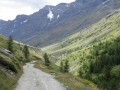
Continue along the path heading south. The balcony-like path offers splendid views over the Ribon valley, with the Rochemelon glacier always in sight as the valley stretches out ahead.
As you approach the bottom of the valley, you cross a footbridge over the Ribon, then a ford. Continue straight on until you are overlooking the Ribon water intake.
(9) Immediately afterwards, the path descends and turns northwards, running alongside the Ribon.
Leave the ford on your right, and further on cross the Ribon via the footbridge.
(10) Once you reach the track, follow it southwards along the right bank of the stream. The track passes through the hamlet of Pierre Grosse, then, about 1.5 km further on, the small hamlet of Jaffa.
(11) Just after Jaffa, leave the track and take a path that runs closer to the stream. This path leads to the hamlet of l’Arcelle, where the track also ends.
(12) Continue along the path, keeping to the right bank, as far as the Tête hill.
(13) The path continues towards the Rochemelon glacier and the headwaters of the Ribon. For us, the route ends here, so we turned back.
(12) At the entrance to the hamlet of l’Arcelle, turn right onto the track which descends parallel to the path taken on the way out.
(11) Pass through Jaffa and Pierre Grosse again, and continue to the junction you passed on the way there.
(10) Continue along the track on the right bank, overlooking the Ribon, which becomes increasingly enclosed.
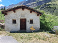
(14) A path on the right leads to the nearby Oratoire Sainte-Anne. Carry on straight ahead.
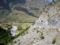
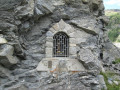
(15) Walk past the Oratoire Saint-Antoine, set into the rock to the right of the track. Continue along the track overlooking the Ribon bridge and the Bessans plain. After a hairpin bend to the left, you’ll reach a car park, then join the D 902. Cross it carefully and rejoin the path leading back to Bessans.
(3) Turn right onto Rue de la Chapelle.
(2) Continue along Rue de la Plan Fenette.
(16) Turn right onto the main street and head for the post office/town hall car park (S/E).



 Visorando Member
 Moderate
 Easy
Easy 
 Very difficult
