


Refine your search for walks in Faverges
Faverges walks


 The Biel Spring
 Tourist office
 2.40 mi
 +299 ft
 -299 ft
 1h 20
 Easy
 Departure from Faverges (Haute-Savoie)
Along the water’s edge, accessible on foot from the town centre of Faverges-Seythenex, discover the Source du Biel (a geological site in the Bauges Park).
The circular route of the Postman and Seythenex Bridge
 Visorando Member
 5.40 mi
+1,270 ft
-1,253 ft
3h 35
 Moderate
Departure from Faverges (Haute-Savoie)
Starting from Faverges, a varied, easy circular route offering beautiful views of the surrounding mountains (Bornes, Aravis, Dent de Cons, La Sambuy...).
 Faverges route: the abbey, Col de Tamié and Col du Vorger, via Ugine
 30.37 mi
+2,766 ft
-2,762 ft
3 hrs
 Difficult
Departure from Faverges (Haute-Savoie)
A route via the Col de Tamié with an easy climb, a brief visit to Tamié Abbey and Tamié Fort, followed by a short push up to the small pass of Tamié, then a lovely descent to Chevronnet. Next comes a slightly steeper climb towards the Col du Vorger, followed by a descent via Thénésol.
The return journey follows a cycle path that passes beneath Ugine, where a short stop is a must at a rest area with a lovely lake.
Roc de Viuz
 3.64 mi
+1,637 ft
-1,631 ft
3h 05
Moderate
Departure from Saint-Ferréol (Haute-Savoie)
At the southernmost tip of the Tournette massif, a balcony crossing leads to the impressive Roc de Viuz promontory. This large, steep slope, clearly visible from the road, is well worth a visit.
Pointe du Velan via the three chalets
 7.14 mi
+3,081 ft
-3,123 ft
6h 00
Difficult
Departure from Seythenex (Haute-Savoie)
A lovely walk passing by the chalets at La Servaz, Les Barbus and L’Eau Froide. Breathtaking 360° views from the Pointe du Velan, overlooking Lake Annecy and Mont Blanc.
Circular on the heights of Giez
 6.31 mi
+2,595 ft
-2,595 ft
5h 10
Moderate
Departure from Giez (Haute-Savoie)
This route is mainly through forest with regular beautiful views of the surrounding area, both towards Les Bauges and Les Aravis. A hike that has the great advantage of being easily accessible even after several days of heavy rain.
Le Crêt des Mouches from Le Fontany
 6.70 mi
+4,304 ft
-4,285 ft
6h 50
Difficult
Departure from Saint-Ferréol (Haute-Savoie)
A classic hike, on a path that is mostly quite steep but generally well-marked.
The charms of Seythenex
 5.10 mi
+879 ft
-879 ft
3h 05
Moderate
Departure from Seythenex (Haute-Savoie)
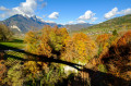
Explore the Tamié valley and the famous Seythenex bridge in a peaceful, bucolic setting.
La Pointe de la Sambuy circular starting from Seythenex
 7.53 mi
+3,655 ft
-3,655 ft
6h 40
Difficult
Departure from Seythenex (Haute-Savoie)
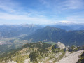
Hike offering a superb 360° view at Pointe de la Sambuy over Lake Annecy and Mont Blanc.
La Belle Étoile from Les Combes
 6.79 mi
+3,294 ft
-3,294 ft
6h 00
Difficult
Departure from Seythenex (Haute-Savoie)
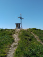
La Belle Étoile is a very popular destination for walkers and trail runners, with most people setting off from the “Les Teppes” car park at a place called La Ramaz. The route I’m suggesting, however, is much less well-trodden. You may not come across a single person for three-quarters of this route, which runs largely through woodland. On the higher ground, you’ll need to use your hands for certain sections.
The Marlens Rock Circuit
 1.87 mi
+636 ft
-633 ft
1h 25
Moderate
Departure from Marlens (Haute-Savoie)
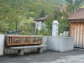
On the border between Savoie and Haute-Savoie, this walk allows you to discover a pretty Savoyard village, beautiful woodland and views over the Faverges-Seythenex valley.
Warning from the moderator on 2 October 2020: Caution! A very steep section of the path. See reviews
The Col du Fer from Marlens
 6.76 mi
+3,373 ft
-3,360 ft
6h 05
Difficult
Departure from Marlens (Haute-Savoie)
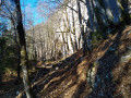
If you enjoy elevation changes, steep slopes, forests, the sound of flowing water and the somewhat wild side of nature, then this hike is for you. Located in the southernmost part of the Aravis mountain range, this route no longer poses any orientation problems, as it has recently been marked out. There are no particular technical difficulties, but some sections along the cliffs will require your full attention.
Roc de Nantbellet
 4.05 mi
+594 ft
-587 ft
2h 25
Easy
Departure from Marlens (Haute-Savoie)
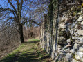
A family hike whose route offers a first section in the forest, then panoramic views of the surrounding peaks such as Arclosan, Charvin, Hautes Bauges, Mont Blanc, and the Tamié valley.
Chalets de l’Eau Froide – Stream Fourchu car park
10.52 mi
+2,142 ft
-4,190 ft
6h 40
Difficult
Departure from Giez (Haute-Savoie)
The second day of a two-day route around the Pointe d’Arcalod, the highest point in the Bauges, passing through wild areas, valleys and along rivers. The proposed route mainly follows the western section of the GR® de Pays Tour de l’Arcalod, marked in yellow and red. Spectacular views of the mountains and Lake Annecy. This wild and little-used route is situated mainly within a sensitive, regulated area. The terrain is good and presents no particular difficulties.
From the Baraque de l'Abbaye to the Chalet de l'Alpettaz
 9.20 mi
+3,583 ft
-2,201 ft
7h 20
Difficult
Departure from Seythenex (Haute-Savoie)
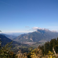
This hike takes you to the heart of the Faverges-Seythenex valley, following the Lac d'Annecy with the Torrent de Saint-Ruph, which is the lake's main source of water, ending with a view of Albertville and Mont Blanc at the Col de l'Alpettaz (alt. 1,580 m).