Pointe du Velan via the three chalets

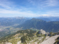
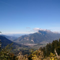
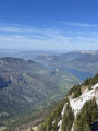
A lovely walk passing by the chalets at La Servaz, Les Barbus and L’Eau Froide. Breathtaking 360° views from the Pointe du Velan, overlooking Lake Annecy and Mont Blanc.

Details

48131161
Creation:
Last update:
Last review:
  • Walking
    Activity: Walking
  • ↔
    Distance: 7.14 mi
  • ◔
    Average duration: 6h 00 
  • ▲
    Difficulty: Difficult

  • ⚐
    Back to start: Yes
  • ↗
    Ascent: + 3,081 ft
  • ↘
    Descent: - 3,123 ft

  • ▲
    Highest point: 5,846 ft
  • ▼
    Lowest point: 2,884 ft

Photos

Description of the walk

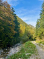
Park at the side of the track at the start of this walk; there is space for four vehicles. To get there: from Faverges (74210), pass through the hamlet of Glaise, then continue along the road and the forest track towards the Pont de Saint-Ruph car park, where you can also park.

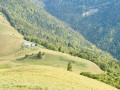
(S/E) Turn right onto the yellow and red-markedGRP® trail of the Massif des Bauges from the ‘Les Clavins’ signpost. The path is steep at the start, then becomes slightly gentler and more even, before steepening again. You will reach the Chalet de la Servaz.

(1) Keep to the right on theGRP® and carry on straight ahead, first slightly uphill followed by an easy descent to reach the Chalet des Barbus.

(2) Turn left and resume the climb to reach the junction at the Chalets de l’Eau Froide.

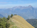
(3) Leave theGRP® here and turn left onto a small, clearly visible path heading due east. Continue until you reach the ridge; in some places you may need to use your hands to get over the rocks. Turn left and follow the ridge to the Pointe du Velan.

(4) Descend via a small, well-marked path – which can be a little slippery in places due to the stones – to the Chalet de la Servaz, which you passed earlier.

(1) Turn right onto theGRP® alternative route, reaching the place known as Les Rois, then the junction marked by the ‘Ruisseau des Rois’ sign.

(5) Leave this signposted path and take a clearly visible but unmarked path opposite this sign. Walk down to the forest track and rejoin theGRP® of the Massif des Bauges.

(6) Turn left onto it, then follow the right bank of the Torrent de Saint-Ruph until you reach the bridge and then the Clavins car park (S/E).


Waypoints

  1. S/E : mi 0 - alt. 2,943 ft - Les Clavins car park
  2. 1 : mi 1.56 - alt. 4,721 ft - Chalet de la Servaz
  3. 2 : mi 2.31 - alt. 4,738 ft - Chalet des Barbus
  4. 3 : mi 3.04 - alt. 5,318 ft - Chalet de l’Eau Froide
  5. 4 : mi 3.52 - alt. 5,771 ft - Pointe du Vélan
  6. 5 : mi 5.22 - alt. 4,068 ft - Sign: Ruisseau des Rois
  7. 6 : mi 5.5 - alt. 3,698 ft - GRP
  8. S/E : mi 7.14 - alt. 2,930 ft - Les Clavins car park

Notes

Walking poles are strongly recommended for this walk.
(3) Take care here: this is the slightly more challenging part of the walk; the path is very steep at the start and should be avoided by inexperienced walkers if the ground is wet or too dry, as there is a high risk of slipping.

Worth a visit

Reviews and comments

5 / 5
Based on 2 reviews

Reliability of the description
5 / 5
Ease of following the route
5 / 5
Route interest
5 / 5
Bruno grandidier
Bruno grandidier

Overall rating : 5 / 5

Date of your route : Aug 17, 2026
Reliability of the description : ★★★★★ Very good
Ease of following the route : ★★★★★ Very good
Route interest : ★★★★★ Very good
Very busy route : No

A lovely walk with stunning views!
Highly recommended!

Machine-translated

FlickaPatsy
FlickaPatsy

Overall rating : 5 / 5

Date of your route : May 28, 2026
Reliability of the description : ★★★★★ Very good
Ease of following the route : ★★★★★ Very good
Route interest : ★★★★★ Very good
Very busy route : No

A lovely walk, for which we altered the start and finish points. We set off from the first car park at the forest ranger’s house and headed towards the Chalet du Gros Tilleul, which took us past Raoul Falcy’s mausoleum. On the way back, we took the route recommended by Visorando for the ascent, which allowed us to avoid points 5 and 6 and, in particular, the forest road on the return: 13 km and 1,050 m of elevation gain.
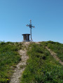
Not a difficult hike, but take care on the ridges between the Pointe du Velan and the cross. The climb above the Chalet de l’Eau Froide is very steep (trekking poles recommended).
A very warm welcome at the Chalet de La Servaz, and after the hike, do stop off at the hamlet of Glaise, home to an excellent chocolatier: Daniel Boitte.

Machine-translated

Other walks in the area

For more walks, use our search engine .

The GPS track and description are the property of this route's author. Please do not copy them without permission.