


 Country:

 City:
City:


Start from the car park situated between the D1508 and the D142, at the roundabout at the entrance to Faverges, coming from Annecy.
(S/E) From the car park, take the D2508, Route d’Annecy, towards Faverges Centre – Col de Tamié, and carry on straight ahead until you reach the junction at Place Carnot in the town centre.
(1) Turn right onto Rue Simon Tissot-Dupont, towards Seythenex and the Col de Tamié. Follow the D12 and begin the climb towards the Col de Tamié with a steep 6 per cent gradient, followed by a gentler stretch. After about 10.5 km, just before the pass, you’ll reach a hamlet, with the Florimontains Holiday Centre on your right.
(2) Turn right, ride past the holiday centre and, along a small uphill road, head for the car park at Tamié Abbey.
(3) Continue on to the abbey.
(4) Turn back towards the car park.
(3) Take the road on the right which runs on level ground. At the D12, continue to the right, pass the Col de Tamié and you’ll soon reach the next junction.
(5) Turn left onto the D104, towards Mercury, and climb up to the next road on the right.
(6) Take this road and make a short round trip to Fort de Tamié.
(7) After taking in the views, return to the previous junction.
(6) Carry on, heading uphill to the right, along the D104 to the Collet de Tamié, the highest point of the route.
(8) Carry on along the D104 and head downhill to the junction at the bottom of the slope, just past La Soffaz.
(9) Turn left onto the D104, Route du Roc Rouge, towards Pallud. You’ll reach a junction marking the end of the descent.
(10) Continue along the D104, towards Pallud, and climb up to a four-way junction.
(11) Turn left onto the D63, towards Chevronnet, and, after a 250-metre climb, you’ll reach the first houses in Allondaz.
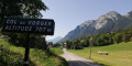
(12) Continue to the right on the D63 towards Thénésol, climb a little further, and arrive at the Col de Vorger.
(13) Continue downhill, pass through Thénésol, and reach the junction at the bottom of the slope.
(14) Do not join the D129 a little further down; instead, leave the D63 and turn left onto the C1, Route de l’Épignier, towards Marthod. Follow this small road, cross a departmental road, then continue along the Route Impériale, where the cycle route begins. Ride alongside a lake on your right, then past a football pitch, and carry on to the end of this road.
(15) Turn left onto the D129, then take the cycle path alongside the expressway, and, at Ugine, you’ll reach a rest area with a small lake.
(16) Continue along the greenway, pass over Faverges, cross the industrial estate, and arrive at the junction at the corner of the Ginette Kolinka School Complex (tennis courts opposite, on the right).
(17) Leave the cycle path and turn left. Join the route you took at the start, continue to the right and, following the opposite route to the outward journey, reach the roundabout at the entrance to Faverges and the car park between the D1508 and the D142 (S/E).
 Visorando Member
 Very difficult
