The Biel Spring

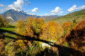
Along the water’s edge, accessible on foot from the town centre of Faverges-Seythenex, discover the Source du Biel (a geological site in the Bauges Park).

Details

n°2328548
Creation:
Last update:
Last review:
  • Walking
    Activity: Walking
  • ↔
    Distance: 2.40 mi
  • ◔
    Average duration: 1h 20 
  • ▲
    Difficulty: Easy

  • ⚐
    Back to start: Yes
  • ↗
    Ascent: + 299 ft
  • ↘
    Descent: - 299 ft

  • ▲
    Highest point: 1,982 ft
  • ▼
    Lowest point: 1,683 ft
  • ⚐ Country: France
  • ⚐
    Areas: Alps, Bauges
  • ⚐ City: Faverges (74210)
  • ⚑
    Start/End: N 45.747367° / E 6.2975°
  • ❏
    IGN map(s): Ref. 3431OT, 3431OTR, 3432ET, 3432OT, 3432OTR
  • Hour-by-hour weather

Description of the walk

Start at the Carré des Tisserands car park in Faverges.

(S/E) Join the Route d’Albertville (D2508) and follow it to the left, towards Faverges town centre. Cross Rue Gambetta on the right-hand side and continue along Rue Carnot.

(1) At the next junction, turn right onto Rue Carnot. At the next junction, you’ll see the Sources du Lac d’Annecy Tourist Office on your right. Then turn left into Rue Victor Hugo. Take thesecond left, Rue de la Fontaine. You’ll cross Rue de la Garderie on your left; carry on for about a hundred metres.

(2) Before the boules court, take a path on the right and follow the Glière stream on your left. Further on, pass a football stadium on your right, return to the tarmac and reach a junction. Then turn left onto Route de Favergettes, cross the Glière and proceed to the next junction.

(3) Turn left onto Route de Lachat. Pass Impasse de la Digue on your left and reach a Fork in the road. Take the path branching off to the right and head uphill through the woods. Keep heading south-east until you reach a crossroads

(4) Turn sharply left towards Lachat. Reach the hamlet and walk through it, ignoring a street on the left. Continue along a path, pass under a power line and cross the Glière again. As you leave the bridge, turn left and walk alongside the boules court on your right.

(2) Continue along Rue de la Fontaine. At the first Fork in the road, turn right into Rue de la Garderie. Immediately ignore a street on the left and carry on straight ahead. At the end, turn left into Rue Simon Tissot Dupont (D12). Follow this main road straight ahead, ignoring the other side streets.

(1) Continue straight on along Rue Carnot (D2508). Pass Rue Gambetta on your left, continue along the Route d’Albertville and you’ll find the car park where you started on your right (S/E).

Waypoints

  1. S/E : mi 0 - alt. 1,683 ft - Carré des Tisserands car park
  2. 1 : mi 0.15 - alt. 1,693 ft - Crossroads: first circular loop
  3. 2 : mi 0.45 - alt. 1,729 ft - Junction for the second circular loop – Torrent de la Glière - Eau Morte (rivière)
  4. 3 : mi 1.01 - alt. 1,696 ft - Junction
  5. 4 : mi 1.55 - alt. 1,982 ft - Crossroads
  6. S/E : mi 2.4 - alt. 1,683 ft - Carré des Tisserands car park

Notes

How to get there:
- Lihsa bus, route no. 51, Annecy–Albertville.
- Coming from Annecy via the D1508, head towards Faverges-centre then follow signs for Albertville. Park in the Tisserands car park on the right.

Shops in the town centre. Toilets and drinking fountain at Parc Simon Berger. Farmers’ market on Friday evenings (4pm–8pm) in front of the Tourist Office.

You can take part in a treasure hunt along this route – pop into the Tourist Office!

Worth a visit

Butterfly Museum and Archaeological Museum in Viuz (2 km from the starting car park).
The keep of Faverges Castle (100 m from the car park).

Walk organised by the Sources du Lac d’Annecy Tourist Office.

Reviews and comments

4 / 5
Based on 2 reviews

Reliability of the description
4 / 5
Ease of following the route
4 / 5
Route interest
4 / 5
kaolak
kaolak

Overall rating : 4.3 / 5

Date of your route : Sep 04, 2023
Reliability of the description : ★★★★☆ Good
Ease of following the route : ★★★★☆ Good
Route interest : ★★★★★ Very good
Very busy route : No

A really lovely walk. But make sure you wear proper walking shoes. Not suitable for young children.

Machine-translated

Lexr8
Lexr8

Overall rating : 3.7 / 5

Date of your route : Sep 29, 2020
Reliability of the description : ★★★★☆ Good
Ease of following the route : ★★★★☆ Good
Route interest : ★★★☆☆ Average
Very busy route : Yes

There are plenty of runners and walkers on the first section. It’s not particularly interesting, but it’s very easy; it could be a Sunday stroll for beginners or a short run to get back into the swing of things.

Machine-translated

Other walks in the area

For more walks, use our search engine .

The GPS track and description are the property of this route's author. Please do not copy them without permission.