The Marlens Rock Circuit

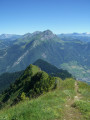
On the border between Savoie and Haute-Savoie, this walk allows you to discover a pretty Savoyard village, beautiful woodland and views over the Faverges-Seythenex valley.
Warning from the moderator on 2 October 2020: Caution! A very steep section of the path. See reviews

Details

n°3193714
Creation:
Last update:
Last review:
  • Walking
    Activity: Walking
  • ↔
    Distance: 1.87 mi
  • ◔
    Average duration: 1h 25 
  • ▲
    Difficulty: Moderate

  • ⚐
    Back to start: Yes
  • ↗
    Ascent: + 636 ft
  • ↘
    Descent: - 633 ft

  • ▲
    Highest point: 2,175 ft
  • ▼
    Lowest point: 1,512 ft

Photos

Description of the walk

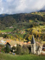
Park in the church car park.

(S/E) Go round the back of the church onto Rue Saint-François, then turn right onto Route de la Flamme Olympique.
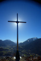
Continue along the road until you come to a cross on your left.

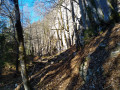
(1) Take the path that climbs through the forest until you reach a fork.

(2) Follow the sign for “Rocher d’Escalade” to the right. A fairly steep path takes you to the foot of the rock. Continue uphill and walk through undergrowth carpeted with periwinkles in spring.

(3) Just after crossing a stream, head far to the left to follow the right bank.

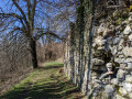
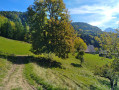
(4) Head down to the right onto a stony path. Carry on straight ahead across the meadow towards Marlens.
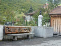
Once you reach the “Banc du droit”, turn left to return to the car park where you started (S/E).

Waypoints

  1. S/E : mi 0 - alt. 1,572 ft - Marlens Church
  2. 1 : mi 0.4 - alt. 1,512 ft - Chemin des Barmes. Near the - Chaise (rivière)
  3. 2 : mi 0.55 - alt. 1,608 ft - Head towards “Rocher d’escalade”
  4. 3 : mi 1.07 - alt. 1,978 ft - Turn left after the stream
  5. 4 : mi 1.28 - alt. 1,765 ft - Across the meadow
  6. S/E : mi 1.87 - alt. 1,572 ft - Marlens Church

Notes

Although very short and with little elevation gain, one section of the route is very steep and may be difficult for inexperienced walkers

Take care on the steep path leading to the climbing rock: sturdy footwear is strongly recommended.

Worth a visit

In Marlens, a fish farm with locally bred trout.
Climbing rock for amateurs.
Marlens lake for refreshments and/or fishing.

Reviews and comments

3.6 / 5
Based on 3 reviews

Reliability of the description
3 / 5
Ease of following the route
4.3 / 5
Route interest
3.3 / 5
Phonsy
Phonsy

Overall rating : 4.7 / 5

Date of your route : Jun 26, 2023
Reliability of the description : ★★★★★ Very good
Ease of following the route : ★★★★★ Very good
Route interest : ★★★★☆ Good
Very busy route : No

Thank you for posting this walk on Visorando. It is essential to tackle this route in dry weather. Do not take young children, and even with teenagers, you should still take care during the ascent. It helps to feel ‘steady on your feet’ during the walk, as some sections are steep. Let’s just say it’s a good way to get your legs going at the start of your stay in the region.

Machine-translated

grandin
grandin ★

Thank you for your feedback. I have added a warning to the description of this walk

Machine-translated

Lexr8
Lexr8

Overall rating : 2.7 / 5

Date of your route : Oct 02, 2020
Reliability of the description : ★★☆☆☆ Disappointing
Ease of following the route : ★★★☆☆ Average
Route interest : ★★★☆☆ Average
Very busy route : No

This walk description should clearly be flagged as completely inaccurate. There is a climb of around 200 metres, including some steep sections to scale on the way to the Marlens rock. The difficulty level should be raised to ‘moderate’ rather than ‘easy’, even though it is a short walk; otherwise, some people will be taken by surprise.
55 minutes seems about right to me too; personally, I’d allow at least 1 hour 15 minutes.

Machine-translated

Meije2706
Meije2706

Overall rating : 3.3 / 5

Date of your route : Aug 19, 2020
Reliability of the description : ★★☆☆☆ Disappointing
Ease of following the route : ★★★★★ Very good
Route interest : ★★★☆☆ Average
Very busy route : No

Right,
I’d set off on a recce for a Level 2 Health Hike
IBP <50 – here 34 = E2 FFRP rating
Distance < 9 km, here 3.7 km, perfect
Elevation gain <300 m, here 200 m – perfect
Well, the contour lines on the map showed a steep section; in fact, YOU HAVE TO USE YOUR HANDS = T4 FFRP
and the difficulty rating is 3-
Slope analysis: 767 m at over 10 per cent, 68 m at 28 per cent, 100 m at 26 per cent, 296 m at 31 per cent!!!
So, this route is just right for a solo leg-stretcher, but it’s NOT ‘EASY’!
E2T4R3
Kind regards.
Meije74

Machine-translated

Other walks in the area

For more walks, use our search engine .

The GPS track and description are the property of this route's author. Please do not copy them without permission.