


yvesmerciey@free.fr

 Visorando Member
 Premium user
 - Gender: man
Sign up:
Published route(s)
 Port de Fontargente loop via the ponds
 6.45 mi
 +1,896 ft
 -1,873 ft
 4h 35
4h 35
 Moderate
 Departure from Ariège
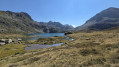
This is an easy hike. It is ideal in June when flowers and rhododendrons are everywhere. The ponds are magnificent. If you feel like swimming, choose the second one, as it will be less crowded. In summer, the site can be very busy. We preferred to do the loop in an anti-clockwise direction: fewer people and a more even climb.
The Pic de Casamanya from the Col d'Ordino
4.55 mi
+2,415 ft
-2,415 ft
4h 10
Moderate
Departure from Ordino (Andorra)
A different side of Andorra if you want to get away from the shopping centres!
A demanding hike (it’s a tough climb) without being difficult, but offering sublime 360° views of the surrounding Pyrenean peaks and valleys.
At the start and finish, in the shade of mountain pines, and if you’re hiking in late August, there are raspberries to enjoy all along the way.
Pic de Razels from Col de Port
 4.18 mi
+1,647 ft
-1,647 ft
3h 20
Moderate
Departure from Boussenac (Ariège)
4.18 mi
+1,647 ft
-1,647 ft
3h 20
Moderate
Departure from Boussenac (Ariège)
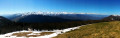
A short, easy Sunday hike (500 m elevation gain) leading to Pic de Razels (1,600 m) with a magnificent 360° view. After a winding climb, you reach the ridge, which you follow to the left through a pretty wood to the peak. Lovely views all along the way.
Pic de Tarbésou and Étang Noir from Col de Pailhères
 5.24 mi
+2,087 ft
-2,073 ft
4h 15
Moderate
Departure from Ascou (Ariège)
5.24 mi
+2,087 ft
-2,073 ft
4h 15
Moderate
Departure from Ascou (Ariège)
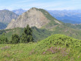
An easy hike from the Col de Pailhères. Magnificent 360° panorama from the summit of Tarbésou (2,364 m), then descent into a slightly more mineral landscape towards the Étang Noir de Rabassoles. The climb up to the Col de la Coumeilles de l'Ours is fairly quick, then a gentle descent back to the Col de Pailhères through the mountain pines.
Col de Risoul and Rancié Mines circular.
 5.66 mi
+1,680 ft
-1,667 ft
4h 05
Moderate
Departure from Sem (Ariège)
5.66 mi
+1,680 ft
-1,667 ft
4h 05
Moderate
Departure from Sem (Ariège)
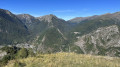
A beautiful route alternating between beech forests, stunning views of the Os Valley and old iron mines, starting from the small village of Sem, above Vicdessos. Best done in dry, clear weather.
Pic de la Coume d'Enfer circular from Pla de las Peyres
 8.04 mi
+3,642 ft
-3,612 ft
6h 50
8.04 mi
+3,642 ft
-3,612 ft
6h 50
 Difficult
Departure from Ariège
Difficult
Departure from Ariège
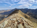
A very beautiful hike, wild and rocky, with splendid views of the surrounding peaks, Andorra and the Fontargente lakes.
This isa demanding hike due to the elevation gain, with some passages that may be tricky for inexperienced hikers, and very steep slopes both uphill and downhill. GPS recommended.
 Pic d'Estibat and Sommet des Griets circular from the Col de Port
 5.52 mi
+1,896 ft
-1,873 ft
6 hrs
Moderate
Departure from Boussenac (Ariège)
5.52 mi
+1,896 ft
-1,873 ft
6 hrs
Moderate
Departure from Boussenac (Ariège)
This is a beautiful hike accessible from the Col de Port, offering magnificent views of the Pyrenees mountain range, from Saint-Barthélémy in the east to Mont Valier and beyond in the west. After a fairly short climb to Pic d'Estibat, the hardest part is over, as the rest of the route continues in a circular fashion along a beautiful ridge before descending through woods and returning on the north side via a pretty valley past the Estibat hut.
Please take note of the comments in the practical information section.
Pic du Lion circular route from Bourg-d'Oueil
6.85 mi
+3,104 ft
-3,091 ft
6 hrs
Difficult
Departure from Bourg-d'Oueil (Haute-Garonne)
A magnificent snowshoe hike, mainly along ridges, with sumptuous views of the highest peaks in the Pyrenees.
Please read the practical information and description at the waypoint (2) and between waypoints (4) and (5) before attempting this challenging snowshoe hike.
Roc d'Agnel, Coroluna Caves, Roc de l'Aigle, Col de la Coussièro
 9.22 mi
+2,904 ft
-2,910 ft
6h 45
Moderate
Departure from Cabrespine (Aude)
9.22 mi
+2,904 ft
-2,910 ft
6h 45
Moderate
Departure from Cabrespine (Aude)
A magnificent circular hike around Cabrespine offering beautiful 360° views, walks through fragrant heath scrubland in bloom (especially in spring), surprising caves (best visited with a head torch) and historical remains (a Roman road, a castle, etc.).
Étangs de la Frèche, Soum de l'Escalette circular
 7.43 mi
+3,602 ft
-3,602 ft
6h 35
Difficult
Departure from Bagnères-de-Luchon (Haute-Garonne)
7.43 mi
+3,602 ft
-3,602 ft
6h 35
Difficult
Departure from Bagnères-de-Luchon (Haute-Garonne)
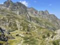
A beautiful route that is less frequented than those of the Étangs de Boums du Port de Vénasque or the Pic de Sauvegarde. The climb takes place in a pleasant valley, shaded in the morning. From the Soum de l'Escalette (2,466 m), the 360° panorama is magnificent. The descent begins with a beautiful ridge trail that offers magnificent scenery all along the way. This is an easy hike with fairly regular and moderate slopes for the most part.
Circular route to the summit of the Coume de Bourg and the Pic de Céciré
5.56 mi
+3,320 ft
-3,297 ft
5h 25
Difficult
Departure from Cazeaux-de-Larboust (Haute-Garonne)
A lovely, little-used circular route starting from the village of Castillon-de-Larboust. A slightly steep climb through a pretty valley, followed by a ridge walk offering magnificent views across all the mountain ranges of the Central Pyrenees. The paths are not signposted and are sometimes barely marked, but it is easy to find your way by sight with a basic sense of direction. A short section on the descent from the summit of the Coume de Bourg may be tricky for those prone to vertigo.
From Razecueillé to Tachoires via the Pic de Paloumère (or Pic de l'Aube)
8.30 mi
+3,471 ft
-3,547 ft
6h 50
Difficult
Departure from Razecueillé (Haute-Garonne)
A beautiful line hike, which requires you to leave a vehicle at the finish beforehand. From the village of Razecueillé, the route takes you directly to the Pic de Paloumère, offering magnificent views of the Piedmont to the north and the highest peaks to the south, east and west. The route to the finish is very varied: forestry paths, ridges, old paths that are a little forgotten and therefore poorly marked, beech forests frequented mainly by wild boar and roe deer.
Pic de Cagire as seen from Juzet d’Izaut
5.59 mi
+3,241 ft
-3,241 ft
5h 25
Difficult
Departure from Juzet-d'Izaut (Haute-Garonne)
A lovely hike that can be done in half a day. Half the route is through woodland. A pleasant path all the way and a magnificent view from the summit, modest though it may be.
Lac Redon, Tuc deth Port de Vielha, Lac de Rius from Espitau de Vielha
 8.65 mi
+4,022 ft
-4,022 ft
7h 30
Difficult
Departure from Vielha e Mijaran (Lleida)
8.65 mi
+4,022 ft
-4,022 ft
7h 30
Difficult
Departure from Vielha e Mijaran (Lleida)
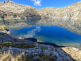
A lovely loop from Espitau de Vielha via Tuc deth port de Vielha (2,606 m), the magnificent Lac Redon (2,230 m), Coret deth Redon (2,454 m) and finally Lac de Rius (2,320 m). It goes up and down, and the slopes are quite steep. Very rocky landscape. Hike done in summer. Lac de Rius, which is pumped in summer and during periods of drought, can see its level drop by several metres, which detracts a little from its charm.
Pics of the Arraing and Serau in a circular loop from Balacet
7.36 mi
+3,087 ft
-3,074 ft
6h 05
Difficult
Departure from Balacet (Ariège)
A beautiful ridge walk offering magnificent views of the Pyrenean mountains, including Mont Valier and the Piedmont. Moderately challenging, it is fairly easy to complete. It is possible to stay overnight at the Cabane de l'Arraing: maximum four to five places.
Circular route of Cap de Salières from Cazarilh-Laspènes
6.65 mi
+2,854 ft
-2,831 ft
5h 35
Difficult
Departure from Cazaril-Laspènes (Haute-Garonne)
A beautiful hike in the hills above Bagnères-de-Luchon, featuring a long stretch along a ridge or balcony offering stunning views of the Pyrenean massif, the foothills, the town of Luchon and the Larboust valley. The paths are well marked except for a short section on the return journey, between (5) and (8), which is steep and requires sure-footedness.
From Banhs de Tredos to Refugi Saboredo via Port de Ratera
7.66 mi
+2,822 ft
-1,076 ft
6h 00
Difficult
Departure from Naut Aran (Lleida)
A lovely walk featuring a fairly steep climb to the Port de Ratera, but no other difficulties. Magnificent scenery of lakes, pine trees and rhododendrons (early in the season). A good overview of the Aigues Tortes park and the Encantats.
From the Refugi de Saboredo to Banhs de Tredos via the Tuc Gran de Sandrosa
5.49 mi
+1,365 ft
-3,120 ft
3h 45
Difficult
Departure from Alt Àneu (Lleida)
This second stage offers a return route to the Banhs de Tredos via the Sendrosa Pass (Coth deth tuc Gran de Sendrosa).
The ascent of the Tuc Gran de Sendrosa is optional for hikers with sure-footedness. This option, which is well worth the detour for the exceptional view from the summit, involves a 300-metre climb along the rocky ridge and requires using your hands on relatively easy climbing holds (PD), though there are a few exposed sections where a sure footing is essential. The descent is always slightly more technical than the ascent. Not recommended for inexperienced walkers or those prone to vertigo.
This route is well worth the effort for its wild scenery, the flowers and the abundant vegetation in June. The descent from the pass is quite long and a little steep before rejoining the Day 1 trail, just below the Taxis car park.
Around the Colomèrs lakes from Banh de Tredos
13.16 mi
+4,186 ft
-4,196 ft
2 days
Difficult
Departure from Naut Aran (Lleida)
This route around the Colomèrs lakes allows you to explore part of the magnificent Aigues Tortes (Les Encantats) National Park. Flowers, rhododendrons, torrents and streams, and peaks offering breathtaking views over all the lakes await you. This hike is suitable for those with some experience of mountain walking; less experienced walkers may choose to skip the two peaks on the route (Tuc de Ratera, 2,860 m – not covered on Day 1 – and Tuc Gran de Sendrosa, 2,703 m, on Day 2). The route is classified as difficult due to its length and the steep slopes on Day 1, as well as the summit on Day 2.
The route can be extended by starting with a night at the Colomers mountain hut, which will allow you to complete a longer loop around the lakes of the same name before reaching the Saboredo mountain hut.