Country:

 City:
City:


Enter the village of Castillon-de-Larboust, accessible from Bagnères-de-Luchon via the D618, then take the small road that winds down below the Church of Saint-Pierre, cross the river (Neste d’Oô) and continue up the opposite slope. After thethird major hairpin bend from the bridge, carry on for 500 metres and turn right onto a road that quickly turns into a track easily passable by car. Carry on along this track, past the barns at Labach, until you reach a hairpin bend beneath a hydroelectric installation (a tiny dam with a small building). Park along the track at the hairpin bend (alt. 1,450 m).
(S/E) Take the faintly marked path which climbs up the valley facing due south, keeping the stream on your left. Make your way along, trying to follow the path clearly; if not, proceed by sight, keeping to the right-hand side of the valley until you reach the Cabane de Barguères, which will be visible on the right
(1) Continue, heading first to the right, then quickly due south until, after a rocky outcrop, you reach a sort of jasse or grassy plateau (1,982 m).
(2) From there, follow the path, keeping an eye out for a rocky outcrop on the right which you’ll need to go round to the left. The ascent takes place up a fairly steep grassy gully, heading south-east. Then head for the clearly visible ridge on the right and join it.
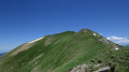
(3) Continue along the ridge, heading left (south-west). The path is better marked and leads quickly – with a slightly steep but unchallenging final stretch – to the summit of the Coume de Bourg (2,367 m).
(4) From the summit, continue along the ridge path heading due east. The path is marked, and you may occasionally need to use your hands, but there are no particular difficulties, except for those prone to vertigo. Reach the junction with the path coming from theGR®10.
(5) Continue along the ridge towards the Pic de Céciré, which is clearly visible and can be reached fairly quickly.
(6) From the Pic de Céciré (2,403 m), follow the ridge as it heads northwards, taking care not to get too close to the rocky barrier on your right. The path is poorly marked. Continue along the western slope of the ridge until you reach a pass (alt. 1,820 m).
(7) Descend into the valley, staying above the forest below, then turn right, following a contour line trodden by animals. Reach a ridge line.
(8) The track below is clearly visible: join it.
(9) Take the track, heading down to the left, to reach the starting point of the walk in a few minutes (S/E).

 Visorando Member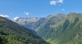
 Easy
Easy 
 Moderate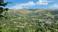
 Very difficult
 Association / Club / Walk leader