From the Refugi de Saboredo to Banhs de Tredos via the Tuc Gran de Sandrosa

This second stage offers a return route to the Banhs de Tredos via the Sendrosa Pass (Coth deth tuc Gran de Sendrosa).

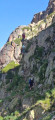
The ascent of the Tuc Gran de Sendrosa is optional for hikers with sure-footedness. This option, which is well worth the detour for the exceptional view from the summit, involves a 300-metre climb along the rocky ridge and requires using your hands on relatively easy climbing holds (PD), though there are a few exposed sections where a sure footing is essential. The descent is always slightly more technical than the ascent. Not recommended for inexperienced walkers or those prone to vertigo.

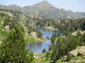
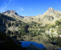
This route is well worth the effort for its wild scenery, the flowers and the abundant vegetation in June. The descent from the pass is quite long and a little steep before rejoining the Day 1 trail, just below the Taxis car park.

This walk is part of a multi-day hike: Around the Colomèrs lakes from Banh de Tredos

Details

100494566
Creation:
Last update:
Last review:
  • Walking
    Activity: Walking
  • ↔
    Distance: 5.49 mi
  • ◔
    Average duration: 3h 45 
  • ▲
    Difficulty: Difficult

  • ⚐
    Back to start: No
  • ↗
    Ascent: + 1,365 ft
  • ↘
    Descent: - 3,120 ft

  • ▲
    Highest point: 8,796 ft
  • ▼
    Lowest point: 5,761 ft

Description of the walk

(S) From the Refugi de Saboredo, take the path heading west (yellow markings).

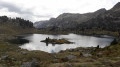
(1) Walk alongside Lake Baish de Saboredo on your left and continue west-north-west. The path then turns north.

(2) At a junction, turn left. Climb up a valley until you reach Le Coth.

(3) There are two options here, both marked on the map:
- Descend on the other side (west; yellow markings) and avoid the climb up Tuc Gran de Sendrosa.
- For those wishing to climb to the summit, turn left, heading due south. Climb whilst staying almost entirely on the ridge line. A few steps of rock climbing are required. Follow the cairns to the summit.

(4) Descend back to the pass via the same route.

(3) Head west (to the left as you return from the summit) and descend (following the yellow markings).

(5) At a fork, stay on the path on the right and continue the descent.

(6) At the next junction, go straight on. Descend to a stream.

(7) Turn sharply right towards the Bains de Tredos, cross a stream and continue the descent. Enter the forest and keep descending.

(8) You’ll come out onto a track; follow it to the right.

(9) Just before a slight bend to the right, leave the track and head off-track to the left (north-west). Cross a stream and continue north-west.

(10) You’ll rejoin a path you took at the start of the first stage; follow it to the right and downhill.

(11) Cross the stream again and continue along the path. Keep the stream on your left for a long stretch. This will take you to the Bains de Tredos car park (E).

Waypoints

  1. S : mi 0 - alt. 7,533 ft - Refugi de Saboredo
  2. 1 : mi 0.16 - alt. 7,448 ft - Lac de Baish de Saboredo
  3. 2 : mi 0.77 - alt. 7,612 ft - Junction
  4. 3 : mi 1.27 - alt. 8,022 ft - Còth deth Tuc Gran de Sendrosa (2451 m)
  5. 4 : mi 1.73 - alt. 8,796 ft - Tuc Gran de Sendrosa (2703 m)
  6. 5 : mi 2.36 - alt. 7,726 ft - Junction
  7. 6 : mi 2.64 - alt. 7,310 ft - Junction
  8. 7 : mi 2.9 - alt. 6,978 ft - Junction
  9. 8 : mi 3.77 - alt. 6,099 ft - Track junction
  10. 9 : mi 3.88 - alt. 6,093 ft - Off-track – Off the beaten track
  11. 10 : mi 3.96 - alt. 6,106 ft - Path junction
  12. 11 : mi 4.65 - alt. 6,027 ft - Crossing a stream
  13. E : mi 5.49 - alt. 5,761 ft - Bains de Tredos car park

Notes

Hike completed in June 2026.

Other walks in the area

For more walks, use our search engine .

The GPS track and description are the property of this route's author. Please do not copy them without permission.