Country:

 City:
City:


From the village of Salardù (between Vielha and the resort of Baqueira), at the roundabout on the way out of the village, take the small, narrow tarmac road on the right (signposted). After about 8 km, you’ll reach the Banhs de Tredos car park; park there.
(S) From the far end of the car park, take the path heading due south. Follow the course of a stream upstream and head towards Refugi de Colomers (yellow markings). Continue along this pleasant path through the woodland, ignoring a track below on the left.
(1) Cross the stream and continue climbing through the woodland.
(2) Cross the track and continue along the path, running roughly parallel to the track.
(3) Cross the track again and continue along the path.
(4) Cross the track one last time (well-maintained car park with numerous information boards). Take the path leading uphill to the left (south-east). The slope becomes steeper. Pass a pond on your left. Shortly afterwards, ignore a path branching off to the right, cross a stream and immediately reach a fork in the path (signposted).
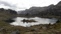
(5) Turn left towards Saboredo. Walk east-southeast through shaded woodland. Follow a few hairpin bends and arrive at a fork in the path at the edge of the lake.
(6) Turn right (ignore the sign on the left for the Refugi de Saboredo). At the fork shortly afterwards, turn left and walk along the lake on your left-hand side.
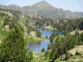
(7) At the southern tip of the lake, turn right and head uphill alongside a stream. You’ll reach a T-junction at the north-western tip of Estanh Long de Colomèrs.
(8) Head left, immediately ignoring a path branching off to the right, and follow the lake on your left. At a junction, turn left and stay as close to the lake as possible. Pass its south-western tip and you will soon reach Lac Redon.
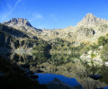
(9) Walk along the lake on your left. Go past the lake and continue south-east. Climb up to reach the north-western tip of Estanh Obago.
(10) Follow the lake on your left. Pass the south-western tip of the lake, cross a small stream and you will immediately reach a fork in the path.
(11) Turn left onto a path that runs along the southern shore of the lake (red and white markings). After about 250 m, turn right and climb steeply. Pass two small, unnamed passes, the first of which is clearly visible from the lake. Reach the Port de Ratera de Colomers.
(12) Descend on the other side (south-east) and you will soon reach a junction.
(13) Continue straight ahead and climb the Port de Ratera quickly.
(14) Retrace your steps back to the previous junction.
(13) Then take the path on the right towards the Refugi de Saboredo. Descend at a steady pace. Pass a small pond on the left and reach Lac de Naut.
(15) Walk along the right-hand side of the lake and continue northwards to Lake deth Miei.
(16) Walk along the left-hand side of the lake and continue north-north-east. You will then reach the Refugi de Saboredo (E).
 Visorando Member
 Moderate