thomdul

 Visorando Member
 Premium user
- Location: Longjumeau (91160)
- Gender: woman
Sign up:
Published route(s)
 From the Péclet-Polset mountain hut to Modane

 8.89 mi
 +1,562 ft
 -6,201 ft
 5h 25
 Difficult
 Departure from Pralognan-la-Vanoise (Savoie)
This final stage – the sixth of our journey – takes us over the Col de Chavière (2,796 m), which is often snow-covered and very steep, before descending through a lunar landscape towards Lac de la Partie, then into the lush Polset valley. The theme of the day: descent, descent and… descent (watch out for your knees).
The final descent towards Modane and the return to the town follows a good path that leads straight to the station, after a short detour via the Fort du Replaton.
From the Lacs Merlet refuge to the Péclet-Polset refuge
 9.96 mi
+3,438 ft
-3,232 ft
7h 35
Difficult
Departure from Saint-Bon-Tarentaise (Savoie)
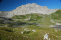
After the long stages of the previous days, this one is more leisurely.The climb to the Col du Soufre is gradual until you reach the edge of the Gébroulaz glacier.The beauty of the Col du Soufre (the day’s highest point), with its ochre and white colours, more than makes up for the day’s efforts.
From the Col de la Vanoise refuge to the Lacs Merlet refuge
 11.38 mi
+4,829 ft
-5,167 ft
8 hrs
 Very difficult
Departure from Pralognan-la-Vanoise (Savoie)
Another great stage for this fourth day, culminating in the ascent of Petit Mont-Blanc (2,677 m), before finishing at the tiny Lacs Merlet refuge, tucked away in its lush green setting. The suggested route avoids the main roads and Pralognan as much as possible (Lac des Vaches is, admittedly, very pretty, but it’s a motorway all the way).
From the Fond des Fours Refuge to the Col de la Vanoise Refuge
 14.55 mi
+3,097 ft
-3,156 ft
9h 25
Difficult
Departure from Val-d'Isère (Savoie)
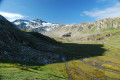
A long stage for this third day with very varied landscapes and terrain.It’s a shame that the road section after the Refuge de la Femma can’t be avoided, as it’s rather uninteresting. You’ll have to wait until the Refuge d’Entre Deux Eaux to finally get back on a trail.The difficulty is mainly due to the distance, as the elevation gains aren’t too steep and the trails are in good condition.
From the Refuge du Carro to the Refuge du Fond des Fours
 11.19 mi
+2,782 ft
-3,530 ft
7h 35
Difficult
Departure from Bonneval-sur-Arc (Savoie)
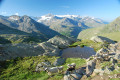
A stunning start, almost entirely on level ground along the balcony path, offering a constant panorama of the peaks and mountain ranges (Pointes de la Levanna, 3,619m), the Glacier des Sources de l’Arc, the Glacier du Grand Méan, the Cirque des Évettes, Pointe de l’Albaron (3,637m) and the Glacier du Vallonnet.At the end of the day, the Pointe des Fours (3,072 m) offers a 360° view and, in clear weather, you can see Mont Blanc.
From Bonneval to the Carro refuge
 8.16 mi
+4,446 ft
-1,273 ft
7h 40
Difficult
Departure from Bonneval-sur-Arc (Savoie)
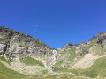
This first stage, starting from one of the most beautiful villages in France, is a gentle warm-up that culminates (for the more adventurous) at the Col du Carro (3,149 m), the border between France and Italy and a magnificent viewpoint in fine weather, offering views of the surrounding peaks and glaciers.
6-day Maurienne–Vanoise crossing, from Bonneval-sur-Arc to Modane
 64.14 mi
+20,154 ft
-22,559 ft
6 days
Difficult
Departure from Bonneval-sur-Arc (Savoie)
This 6-day hike from mountain hut to mountain hut will take you from Bonneval-sur-Arc back to Modane.
There are no particular technical difficulties; the walk follows good paths, partly along theGRP® Tour de Haute-Maurienne route and partly along theGR®55.
The scenery is magnificent and, if you’re lucky, you might spot bearded vultures, which are beginning to re-establish themselves in the area.
Ferme du Désert – Glandage
 13.96 mi
+5,377 ft
-5,377 ft
8 hrs
Very difficult
Departure from Treschenu-Creyers (Drôme)
Another very difficult and long stage, starting in a landscape of mountain pastures and ending in a vast, dark forest. The view of the Dévoluy peaks (Obiou, Grand Ferrand) from the Jocou (2,051 m, the highest point of these five days) makes up for the gruelling climb leading up to it.
Clelles - Ferme du Désert
 13.59 mi
+4,829 ft
-3,383 ft
8 hrs
Very difficult
Departure from Clelles (Isère)
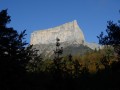
The first day is a long one, starting at the foot of Mont-Aiguille with alternating steep climbs and gentler passages through mountain pastures and forests.
Cirque de Férisson and Cime de la Valette de Prals
 5.54 mi
+2,644 ft
-2,671 ft
4h 50
 Moderate
Departure from Belvédère (Alpes-Maritimes)
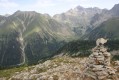
A circular hike starting from the Férisson cattle shed and passing through all the ridges around the Férisson cirque.
Superb views all along the way, with the sea on one side and the Mercantour peaks on the other.
As the end of the route is off-trail and unmarked, a good sense of direction and route-finding skills are essential.
Summit of Gélas
 7.01 mi
+4,672 ft
-4,672 ft
8 hrs
 Extremely difficult
Departure from Saint-Martin-Vésubie (Alpes-Maritimes)
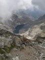
This route, which is closer to simple mountaineering than standard hiking, provides access to the highest peak in the Mercantour. From the summit, there is an exceptional panorama of the surrounding mountains and a view of the sea, stretching as far as Corsica on a clear day.
The proposed ascent is via the small pass Saint-Robert and the west-southwest ridge, descending via the northeast ridge and the Balcon du Gélas.
Summit of the Agnellière (2,700 m)
 6.56 mi
+2,749 ft
-2,749 ft
5h 25
Difficult
Departure from Saint-Martin-Vésubie (Alpes-Maritimes)
A hike that isn’t too long there and back but isn’t exactly easy either, with a very rocky final stretch where you need sure-footedness, the ability to find your own way and navigate by sight rather than relying on paths and cairns.
From up there, a magnificent view of the Mercantour peaks, particularly the Gélas.
All along the way, chamois and griffon vultures keep a watchful eye on us...
Lac des Adus loop
 5.05 mi
+1,886 ft
-1,857 ft
4h 00
Moderate
Departure from Saint-Martin-Vésubie (Alpes-Maritimes)
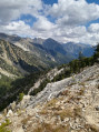
This short circular loop takes you past Lac des Adus, then on a short way towards Pointe des Adus, before returning via theGR®®52.As it runs mainly through woodland, it’s particularly pleasant on hot days.
Walk to Lake Adus
 3.55 mi
+1,690 ft
-1,713 ft
3h 05
Moderate
Departure from Saint-Martin-Vésubie (Alpes-Maritimes)
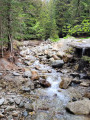
This short walk, mainly through the forest, will take you to a pretty little mountain lake (2,130 m).
It's a good warm-up or an easy goal that can be done with children who are good walkers (be warned, it's still in the mountains, so... it's uphill).
Chalet du Gioberney – Vallonpierre Mountain Hut
 6.84 mi
+3,442 ft
-1,358 ft
6h 10
Difficult
Departure from La Chapelle-en-Valgaudemar (Hautes-Alpes)
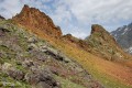
The sixth stage is a fairly easy climb up to the Vallonpierre Refuge.
This allows you to arrive at the refuge early and, if you wish, carry on to the Col des Chevrettes, where marmots are guaranteed.
Refuge du Pigeonnier – Chalet du Gioberney
 5.79 mi
+909 ft
-3,468 ft
3h 25
Moderate
Departure from La Chapelle-en-Valgaudemar (Hautes-Alpes)
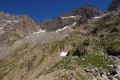
An easy fifth stage, mainly downhill, to recover from the previous days.
The crossing of the Gioberney glacial cirque at its highest point, before descending towards the Aiguille de la Vache (a great spot for a picnic), is fantastic!
Refuge du Clot (Xavier Blanc) – Refuge du Pigeonnier
 5.88 mi
+3,963 ft
-610 ft
6h 10
Difficult
Departure from La Chapelle-en-Valgaudemar (Hautes-Alpes)
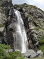
The fourth stage begins gently through the meadows, watched over by marmots, before reaching a major tourist attraction: the stunning Voile de la Mariée waterfall. Once you’ve passed Lac du Lauzon, you’ll find yourself alone again to enjoy the magnificent Lac Bleu. The Pigeonnier mountain refuge, perched on its promontory, is superb with its large bay windows.
Olan Mountain Hut – Clot Mountain Hut (Xavier Blanc)
 8.28 mi
+1,152 ft
-4,216 ft
4h 50
Moderate
Departure from La Chapelle-en-Valgaudemar (Hautes-Alpes)
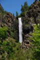
A very beautiful third stage, albeit a little long, mainly at the bottom of the valley along the Séveraisse.
Refuge des Souffles - Refuge de l'Olan
 5.32 mi
+3,061 ft
-1,837 ft
5h 05
Difficult
Departure from Villar-Loubière (Hautes-Alpes)
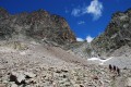
A magnificent second stage in a very mineral setting, culminating in the Pas de l'Olan pass.
From the Souffles refuge, continue on theGR® 54 towards Lac Lautier, then the Col des Colombes and finally the Pas de l'Olan (caution: technical passage).
From the pass, admire the landscape before gently descending to the Refuge de l'Olan.