Olan Mountain Hut – Clot Mountain Hut (Xavier Blanc)

A very beautiful third stage, albeit a little long, mainly at the bottom of the valley along the Séveraisse.

This walk is part of a multi-day hike: Tour du Valgaudemar

Details

124882
Creation:
Last update:
Last review:
  • Walking
    Activity: Walking
  • ↔
    Distance: 8.28 mi
  • ◔
    Average duration: 4h 50 
  • ▲
    Difficulty: Moderate

  • ⚐
    Back to start: No
  • ↗
    Ascent: + 1,152 ft
  • ↘
    Descent: - 4,216 ft

  • ▲
    Highest point: 7,684 ft
  • ▼
    Lowest point: 3,566 ft

Photos

Description of the walk

(S) From the Olan refuge, head down towards La Chapelle-en-Valgaudemar via theGR®54alternative route.

(1) At the junction with the path coming directly from the Col de Colombes, stay on the path leading downwards until you reach the road (signposted – you can’t go wrong).

(2) Turn right onto the road (D48) and head towards La Chapelle-en-Valgaudemar (refreshments, welcoming terraces).

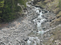
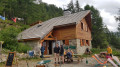
(3) In the centre of the village, turn left to rejoin theGR® de Pays du Tour du Vieux Chaillol. Follow the path that runs alongside the Séveraisse. At the hamlet of Le Bourg, turn left onto the bridge, then right onto the opposite bank, and continue straight on until you reach the Refuge du Clot – Xavier Blanc (1,397 m) (E).

Waypoints

  1. S : mi 0 - alt. 7,661 ft - Refuge de l'Olan
  2. 1 : mi 1.85 - alt. 5,669 ft - Junction
  3. 2 : mi 3.53 - alt. 3,602 ft - Picnic by the water’s edge - Séveraissette (rivière)
  4. 3 : mi 3.98 - alt. 3,583 ft - Turn left to rejoin the GR
  5. E : mi 8.28 - alt. 4,583 ft - Refuge du Clot - Xavier Blanc

Notes

Accommodation at the Refuge du Clot (Xavier Blanc) (1,397 m)

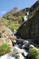
(2) Just before reaching the road, there’s a spot for a picnic by the river (on the other side of the water), in the shade.

Note: it may seem odd to head back down the valley you left the day before, but there isn’t really any other option. The direct route between the Olan and the Pigeonnier via the Col du Bâton is mountaineering and not hiking.

Worth a visit

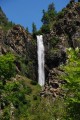
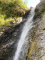
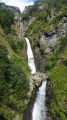
Don’t miss the Combe Froide waterfall as you pass by.
Once on the road, it’s just a five-minute detour to reach La Chapelle-en-Valgaudemar, where you can enjoy a well-deserved ice cream on a terrace (or something else, depending on your preference).

Always be cautious and plan ahead when you're outdoors. Visorando and the author of this route cannot be held responsible for any accidents occurring on this route.

The GR® and PR® markings are the intellectual property of the Fédération Française de Randonnée Pédestre.

Reviews and comments

4.8 / 5
Based on 3 reviews

Reliability of the description
5 / 5
Ease of following the route
4.7 / 5
Route interest
4.7 / 5
User 22875755

Overall rating : 4.3 / 5

Date of your route : Jun 21, 2025
Reliability of the description : ★★★★★ Very good
Ease of following the route : ★★★★☆ Good
Route interest : ★★★★☆ Good
Very busy route : No

The descent from the refuge is long, steep and very hard on the knees.
The rest of the hike follows the riverbed and does not present any particular difficulties.
On this last section, the markings are sometimes missing.

Machine-translated

luluschnaps
luluschnaps

Overall rating : 5 / 5

Date of your route : Aug 23, 2021
Reliability of the description : ★★★★★ Very good
Ease of following the route : ★★★★★ Very good
Route interest : ★★★★★ Very good
Very busy route : Yes

Rolling trail
with varied terrain
breathtaking views over the valley
passing by beautiful waterfalls

Machine-translated

hippolyte09
hippolyte09
• Edited:

Overall rating : 5 / 5

Date of your route : Jul 07, 2016
Reliability of the description : ★★★★★ Very good
Ease of following the route : ★★★★★ Very good
Route interest : ★★★★★ Very good

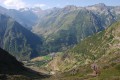
Hello. The second day of our circular walk. A very easy path, but only on the descent towards the village. Beautiful views all along the descent of the village and the peaks opposite. After passing through the village, the path follows a lovely stream through the trees before reaching the Xavier Blanc mountain refuge.

Machine-translated

Other walks in the area

For more walks, use our search engine .

The GPS track and description are the property of this route's author. Please do not copy them without permission.