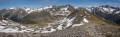
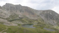
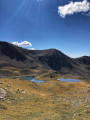
Summit of the Agnellière (2,700 m)

A hike that isn’t too long there and back but isn’t exactly easy either, with a very rocky final stretch where you need sure-footedness, the ability to find your own way and navigate by sight rather than relying on paths and cairns.
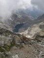
From up there, a magnificent view of the Mercantour peaks, particularly the Gélas.
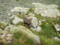
All along the way, chamois and griffon vultures keep a watchful eye on us...

Details

n°132597
Creation:
Last update:
Last review:
  • Walking
    Activity: Walking
  • ↔
    Distance: 6.56 mi
  • ◔
    Average duration: 5h 25 
  • ▲
    Difficulty: Difficult

  • ⚐
    Back to start: Yes
  • ↗
    Ascent: + 2,749 ft
  • ↘
    Descent: - 2,749 ft

  • ▲
    Highest point: 8,793 ft
  • ▼
    Lowest point: 6,257 ft

Photos

Description of the walk

Park in the large car park just before the Madone de Fenestre, at the hairpin bend where marker 356 is located.

(S/E) From the car park, head to marker 356 and follow the path signposted ‘Cime du Pisset 1h15’.
The winding path starts off quite steeply until you pass the last larch trees. After that, it levels out almost completely until you reach the Cime du Pisset.

(1) Take care at a short, tricky section (especially if it’s raining) where you cross a dry, deeply eroded stream. Do not climb too high up the right-hand slope (several trail heads lead to false trails) but cross as soon as the path reaches the level of the ravine.

(2) At the Cime du Pisset (marker 430), there is virtually no path left.
Head eastwards towards the visible summit. You’ll soon come across a more or less marked path, with cairns from time to time. The climb is steep again. Continue in the same direction, keeping the visible summit in sight at all times.

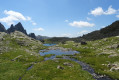
After 45 minutes, you’ll come out onto a flat area and begin to see your destination (not the grassy summit opposite, but the rocky massif on the right). Carry on climbing, keeping well to the right, and about an hour after leaving the Cime du Pisset, you’ll finally see the route leading to the Cime de l’Agnellière. Reach the Collet de Juisse and start traversing along the ridges (clearly visible path).

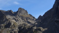
(3) This is where it gets a bit tricky: you need to continue traversing directly below the Cime de l’Agnellière, trying to spot a very faint path, then climb towards the summit by eye, following the route that looks most passable. A few cairns provide some guidance, but they’re easy to lose sight of. A large cairn marks the summit (about 1 hour from the small pass and 3 hours in total from the car park).

(4) For the return journey, you can either take the same route (which is what we did, but cutting across the grassy valley once we’d come down from the Collet de Juisse), or head down towards the Pas des Ladres and then join theGR®52towards the Madone de Fenestre to complete a circular journey and return to the car park (S/E).

Waypoints

  1. S/E : mi 0 - alt. 6,257 ft - Car park at marker 356
  2. 1 : mi 0.85 - alt. 7,129 ft - Dried-up stream
  3. 2 : mi 2.04 - alt. 7,320 ft - Cime du Pisset
  4. 3 : mi 3.06 - alt. 8,346 ft - Collet de Juisse
  5. 4 : mi 3.25 - alt. 8,789 ft - Summit of the Agnellière
  6. S/E : mi 6.56 - alt. 6,257 ft - Car park at marker 356

This route passes through a protected area, which may be subject to special regulations:

Worth a visit

(Very good) cheese at the Madone dairy, situated just below.
Griffon vultures at l’Agnellière.

Always be cautious and plan ahead when you're outdoors. Visorando and the author of this route cannot be held responsible for any accidents occurring on this route.

The GR® and PR® markings are the intellectual property of the Fédération Française de Randonnée Pédestre.

Reviews and comments

5 / 5
Based on 1 review

Reliability of the description
5 / 5
Ease of following the route
5 / 5
Route interest
5 / 5
jl1309m
jl1309m

Overall rating : 5 / 5

Date of your route : Oct 27, 2019
Reliability of the description : ★★★★★ Very good
Ease of following the route : ★★★★★ Very good
Route interest : ★★★★★ Very good

Option to complete the circular route, which is 15 km long with a total elevation gain of 1,065 m
Descend from the summit of the Agneline towards the summit of Juisse, following the cairns.
No difficulties on the scree slope. Then a long descent through grassy terrain to marker 431, ‘Pas des ROUBINES de MAIRIS’, and descend to the right to marker 421. A rapid descent through the forest.

Machine-translated

Other walks in the area

For more walks, use our search engine .

The GPS track and description are the property of this route's author. Please do not copy them without permission.