Country:

 City:




Start from the Xavier Blanc refuge.
(S) Stay on theGR®54(continue along the previous day’s path) towards the Vallonpierre refuge.
(1) At the first junction (altitude 1522), stay on the left-hand path (towards Chambournéou and the Cabane du Pis) until the next junction, which comes shortly afterwards.
(2) At the second junction (altitude 1,550), turn sharply left onto the Sentier du Ministre, heading towards the Chalet du Gioberney.
(3) As you approach the first car park, look out for the (one and only) bridge that takes you across the Gioberney torrent.
Note: the next bridge is much, much further on, near the Cabane du Gioberney. Head up to the right along the road until you reach it.
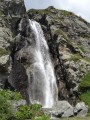
Cross the road and join the very busy path opposite, which climbs above the magnificent Voile de la Mariée waterfall.
(4) From the waterfall, the clearly marked (and very busy) path branches off to the left, climbing up to Lac du Lauzon.
(5) At Lac du Lauzon (you can go round it on the right or the left), continue along the path northwards towards the Refuge du Pigeonnier.
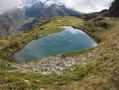
(6) At the junction before descending to cross the torrent (altitude 2,022), take a short detour to the left to Lac Bleu (2,125 m) – it takes no more than 30 minutes to get there.
(7) Here, describe the instructions from the junction.
(6) Back at the junction, this time take the path on the left which crosses the stream and climbs towards the Refuge du Pigeonnier (2,423 m) (E).

 Visorando Member

 Very difficult
 Moderate