Refuge du Pigeonnier – Chalet du Gioberney

An easy fifth stage, mainly downhill, to recover from the previous days.
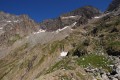
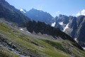
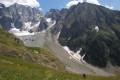
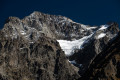
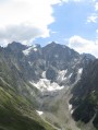
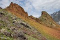
The crossing of the Gioberney glacial cirque at its highest point, before descending towards the Aiguille de la Vache (a great spot for a picnic), is fantastic!

This walk is part of a multi-day hike: Tour du Valgaudemar

Details

n°124889
Creation:
Last update:
Last review:
  • Walking
    Activity: Walking
  • ↔
    Distance: 5.79 mi
  • ◔
    Average duration: 3h 25 
  • ▲
    Difficulty: Moderate

  • ⚐
    Back to start: No
  • ↗
    Ascent: + 909 ft
  • ↘
    Descent: - 3,468 ft

  • ▲
    Highest point: 8,491 ft
  • ▼
    Lowest point: 5,371 ft

Photos

Description of the walk

(S) From the Refuge du Pigeonnier, take the path leading up towards the Cirque du Gioberney.

(1) At thefirst junction, keep to the left to go as high as possible. The path reaches its highest point at 2,569 m, then descends. Keep a close eye out for the markings, which are sometimes very faint. There is a short, tricky section over a rocky outcrop – please take care.

(2) You can opt to head left up towards the Aiguille de la Vache. This route is off-trail, so you’ll need to navigate by sight.

(3) Return in the opposite direction to the previous junction.

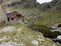
(2) Descend via switchbacks to the Cabane du Vaccivier.

(4) Keep to the left to continue the descent. You will reach the vicinity of the Cabane du Gioberney

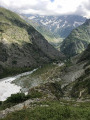
(5) Cross the tributary of the Torrent de Gioberney. Then keep to the right bank of the stream and continue to the Chalet du Gioberney (E).

Waypoints

  1. S : mi 0 - alt. 7,946 ft - Refuge du Pigeonnier
  2. 1 : mi 0.26 - alt. 8,015 ft - 1st junction
  3. 2 : mi 2.39 - alt. 8,425 ft - Return walk to the Aiguille de la Vache
  4. 3 : mi 2.48 - alt. 8,442 ft - Aiguille de la Vache
  5. 4 : mi 3.86 - alt. 6,919 ft - Vaccivier Hut
  6. 5 : mi 5.15 - alt. 5,636 ft - Gioberney Hut
  7. E : mi 5.79 - alt. 5,371 ft - Chalet-Hôtel du Giobernay

Notes

Accommodation at the Chalet du Gioberney
It’s well worth it just for the dinner!
Please note: You are hiking in the heart of the Écrins National Park.__
The Écrins massif is an exceptional area, open to all, with a unique natural, cultural and scenic heritage. To protect these treasures, the heart of the park is marked by blue, white and red painted flags, and regulations must be observed in this area. Please familiarise yourself with these regulations when planning your hike, to help preserve this shared heritage, at https://www.ecrins-parcnational.fr.

Reviews and comments

4.3 / 5
Based on 2 reviews

Reliability of the description
4 / 5
Ease of following the route
4.5 / 5
Route interest
4.5 / 5
rslme
rslme

Overall rating : 4.3 / 5

Date of your route : Oct 18, 2021
Reliability of the description : ★★★★☆ Good
Ease of following the route : ★★★★☆ Good
Route interest : ★★★★★ Very good
Very busy route : No

A magnificent walk starting from the Refuge du Pigeonnier. We did it with a mixed-ability group (8 people) carrying large rucksacks, which were a bit cumbersome on certain sections. There’s a whole section off the beaten track where you have to follow the cairns, but it’s not difficult if you have a map as well.

There are a few sections where you need to use your hands and which can be a bit vertiginous, but the members of the group concerned managed them fine. The walk crosses a few streams; it’s best to avoid them when the water level is too high.

There is a much shorter route, but the detour is well worth it – we were treated to some stunning views throughout the walk, which is very quiet and really brings home the sheer vastness of the surrounding mountains!

Machine-translated

Mitchoum1950
Mitchoum1950

Overall rating : 4.3 / 5

Date of your route : Aug 05, 2017
Reliability of the description : ★★★★☆ Good
Ease of following the route : ★★★★★ Very good
Route interest : ★★★★☆ Good

After passing the rocky outcrop (just before point 2), the path isn’t clearly marked; you’ll need to navigate by sight if you want to climb to point 3.
A lovely walk through a magnificent cirque.

Machine-translated

Other walks in the area

For more walks, use our search engine .

The GPS track and description are the property of this route's author. Please do not copy them without permission.