


Schlatter

 Visorando Member
 Premium user
 - Location: Rixheim (68170)
- Gender: man
Sign up:
Published route(s)
 The Col de Rimbach and the Belacker from Moosch
 8.84 mi
 +1,988 ft
 -1,982 ft
 5h 50
5h 50
 Average
 Departure from Moosch (Haut-Rhin)
Starting from the Mine d'Argent campsite in Moosch, a beautiful circular route through the beautiful forests of the Vosges. At the Col de Rimbach, there is a beautiful view of the Masevaux valley and the Ballon d'Alsace mountain range. At Belacker, there is a beautiful panorama of the Grand Ballon massif and a beautiful view of the Alsace plain.
Saint-Amarin - Mehrbächel - Geishouse circular
 7.64 mi
+1,644 ft
-1,670 ft
4h 55
Average
Departure from Saint-Amarin (Haut-Rhin)
7.64 mi
+1,644 ft
-1,670 ft
4h 55
Average
Departure from Saint-Amarin (Haut-Rhin)
A beautiful hike starting from Saint-Amarin, which will take you to Hochstein, then to Mehrbächel, and back via the Vue des Alpes in Geishouse.
From Kruth to Schafert
 5.94 mi
+1,742 ft
-1,719 ft
4h 15
Average
Departure from Kruth (Haut-Rhin)
5.94 mi
+1,742 ft
-1,719 ft
4h 15
Average
Departure from Kruth (Haut-Rhin)
A beautiful hike in the rear valley of the Thur, near Lake Kruth-Wildenstein, which will take you to the heights of Kruth, with beautiful views of the upper valley and the Rossberg-Thannerhubel massif.
The hilltop village of Saint-Julien-le-Montagnier
 2.95 mi
+423 ft
-436 ft
1h 45
2.95 mi
+423 ft
-436 ft
1h 45
 Easy
Departure from Saint-Julien (Var) (Var)
Easy
Departure from Saint-Julien (Var) (Var)
Located on a hilltop at an altitude of 580 metres, overlooking the plain, the historic old village of Saint-Julien-le-Montagnier offers a superb panorama of the Durance valley, the Verdon mountains, the Montagne de Lure and, on a clear day, Mont Ventoux.
The Vineyard Trail in Conques
 3.00 mi
+656 ft
-640 ft
1h 55
Easy
Departure from Conques (Aveyron)
3.00 mi
+656 ft
-640 ft
1h 55
Easy
Departure from Conques (Aveyron)
Located in the heart of the Lot Valley, Conques-en-Rouergue, listed as one of the "Most Beautiful Villages in France" and "Villages of Charm in France", is an essential stop on one of the Saint James' Ways, the GR®65 - the Via Podiensis. As you walk around the Abbey Church of Sainte-Foy (12th-13th centuries) and through the narrow streets, you can admire the beautiful half-timbered houses.The hike crosses the medieval village, then passes through the vineyards, offering beautiful views of Conques and the Dourdou valley.
The medieval village of Cotignac
 4.14 mi
+840 ft
-837 ft
2h 40
Average
Departure from Cotignac (Var)
4.14 mi
+840 ft
-837 ft
2h 40
Average
Departure from Cotignac (Var)
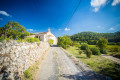
The medieval village of Cotignac is one of the "Most Beautiful Villages in France" and was voted "France's Favourite Village" in 2022. The impressive Tuf Rock and its troglodyte dwellings, the Chapel of Notre-Dame-de-Grâces, the old 16th and 17th century houses lining the narrow streets, the Cours Gambetta with its beautiful façades and plane trees, the 17th century Church of Notre Dame de l'Annonciation, the Grand-Rue, the Town Hall Square, the 17 fountains and the two 14th-century towers are the main attractions in Cotignac. The route crosses the Cours Gambetta, climbs up to the Chapel of Notre-Dame des Grâces, continues along the Chemin de Notre Dame, descends towards the village through the Les Verdares and Le Derroc districts, then passes through the Ville-Haute and the Rocher cliff.
The waterfront circuit in Reiningue
 5.13 mi
+20 ft
-20 ft
2h 20
Easy
Departure from Reiningue (Haut-Rhin)
5.13 mi
+20 ft
-20 ft
2h 20
Easy
Departure from Reiningue (Haut-Rhin)
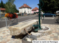
The "Au fil de l'eau" circuit, between the Doller and Leimbach rivers, crosses a magnificent oak-lined avenue before entering the Vorwald oak forest, passes by two series of blockhouses, then the Müatergottesgartla Chapel, and reaches the banks of the Doller via farmland north of Reiningue.
The entire route is marked with the Anneau Vert (Green Ring) sign by the Club Vosgien de Guewenheim
From Linsdorf to Bettlach via the Casemates Trail
 6.63 mi
+384 ft
-384 ft
3h 25
Average
Departure from Linsdorf (Haut-Rhin)
6.63 mi
+384 ft
-384 ft
3h 25
Average
Departure from Linsdorf (Haut-Rhin)
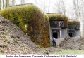
Starting from Linsdorf, between forest and fields, the route climbs to the Eichwald plateau, alternating between woods and fields, leading successively to the Abri de la Fuste, on the heights of Bettlach, and the Sentier des Casemates, connecting three imposing forts of the Maginot Line. The Casemates Trail is dotted with information panels explaining the history of the Maginot Line. The route also offers beautiful views of the Ill Valley and the Jura Mountains.
Circular Lurs, a hilltop village in Provence
 5.20 mi
+719 ft
-719 ft
3h 00
Average
Departure from Ganagobie (Alpes-de-Haute-Provence)
5.20 mi
+719 ft
-719 ft
3h 00
Average
Departure from Ganagobie (Alpes-de-Haute-Provence)
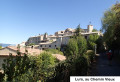
Lurs, a Provençal village perched on a rocky outcrop, with its shaded paved slanting streets, surrounded by a landscape of olive trees, offers an exceptional panorama of the Pre-Alps, the Durance valley, the Valensole plateau, the Montagne de Lure and the Luberon mountain range.
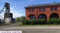
Natural heritage, historical heritage and mining history of Wittelsheim
 6.43 mi
+43 ft
-39 ft
3h 00
Average
Departure from Wittelsheim (Haut-Rhin)
6.43 mi
+43 ft
-39 ft
3h 00
Average
Departure from Wittelsheim (Haut-Rhin)
The route allows you to discover part of the town of Wittelsheim, its historical and natural heritage, and above all its mining past, thanks to the Potash Mine Memory Circuit. The route partly follows the Wittelsheim Discovery Route and the new Anneau Bleu route, marked by the Club Vosgien.
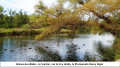
The ruins of Pujol and the banks of the Verdon, starting from Gréoux-les-Bains
 4.15 mi
+351 ft
-322 ft
2h 15
Average
Departure from Gréoux-les-Bains (Alpes-de-Haute-Provence)
4.15 mi
+351 ft
-322 ft
2h 15
Average
Departure from Gréoux-les-Bains (Alpes-de-Haute-Provence)
A pleasant and easy circular hike in Gréoux-les-Bains, a medieval Provençal village well known for its Roman baths. Starting from Cité Paradis, the route climbs up to Château Laval, leads to the Pujol ruins, runs along the banks of the Verdon, crosses Morelon Park and returns to the starting point via the centre of Gréoux-les-Bains.
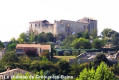
Route of the two castles starting from the Gréoux-les-Bains thermal baths
 4.57 mi
+548 ft
-545 ft
2h 35
Average
Departure from Gréoux-les-Bains (Alpes-de-Haute-Provence)
4.57 mi
+548 ft
-545 ft
2h 35
Average
Departure from Gréoux-les-Bains (Alpes-de-Haute-Provence)
This hike offers beautiful panoramic views of the Verdon valley. The route passes through the beautiful Château Laval park, reaches the Château des Templiers and the historic centre with its beautiful, typical narrow streets, and ends at the lively Rue Grande.
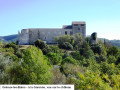
Gréoux-les-Bains circular, Les Plaines and the Ravin de la Goutette
 3.58 mi
+400 ft
-400 ft
2h 00
Average
Departure from Gréoux-les-Bains (Alpes-de-Haute-Provence)
3.58 mi
+400 ft
-400 ft
2h 00
Average
Departure from Gréoux-les-Bains (Alpes-de-Haute-Provence)
Starting from the Château des Templiers district overlooking Gréoux-les-Bains, this easy hike climbs via the Ravin de la Goutette towards the Plaines plateau and its lavender fields, offering panoramic views of the peaks of the Verdon Regional Nature Park, the Alpes de Haute-Provence and the Luberon mountains.
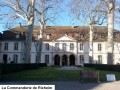
Rixheim Hills Route
 5.74 mi
+463 ft
-436 ft
3h 00
Average
Departure from Rixheim (Haut-Rhin)
5.74 mi
+463 ft
-436 ft
3h 00
Average
Departure from Rixheim (Haut-Rhin)
The Rixheim Hills Route crosses the southern part of the town, passing through an urban area, then winds through the countryside and orchards on the heights overlooking the Alsace plain, offering beautiful views of the Hardt Forest, the Black Forest, the Jura, the Vosges, and, on a clear day, the peaks of the Swiss Alps.
The entire route is marked with the Red Ring by the Club-Vosgien.