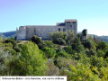
Route of the two castles starting from the Gréoux-les-Bains thermal baths

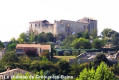
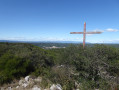
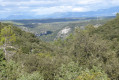
This hike offers beautiful panoramic views of the Verdon valley. The route passes through the beautiful Château Laval park, reaches the Château des Templiers and the historic centre with its beautiful, typical narrow streets, and ends at the lively Rue Grande.

Details

91487424
Creation:
Last update:
Last review:
  • Walking
    Activity: Walking
  • ↔
    Distance: 4.57 mi
  • ◔
    Average duration: 2h 35 
  • ▲
    Difficulty: Moderate

  • ⚐
    Back to start: Yes
  • ↗
    Ascent: + 548 ft
  • ↘
    Descent: - 545 ft

  • ▲
    Highest point: 1,280 ft
  • ▼
    Lowest point: 1,007 ft

Photos

Description of the walk

Start of the hike: Esplanade Charles de Gaulle, Thermes car park.

(S/E) Head down Rue des Eaux Chaudes, running alongside the Thermes car park.

(1) Turn left onto Chemin de Babaou and follow it to the picnic area by the Canal de Pontoise, where it joins the GR®4 and the GRP® Tour du Lac d’Esparron. Turn left and continue to Route de Riez (D952).

(2) Cross with care and take the track slightly to the left opposite, which climbs as it enters the forest. Follow the dual signposting to reach the crossroads at the ruins of Pujols.

(3) Cross the junction, keeping to the right of the ruins, continue straight on for 50 m then first turn left then right. After 100 m, the route joins the Chemin des Pyrèthres, which you follow to the right as far as the Château Laval estate.

(4) At the first building, turn right, enter and walk around the magnificent Château Laval park, then return to the junction (some parts of the park are off-limits).

(4) Pass to the left of the building, head down towards the Ruisseau Notre-Dame, ignoring the two paths on the left.

(5) At the third junction, turn right following the GRP® markings, head downhill and cross the Ruisseau Notre-Dame. Then turn right and head back up via the Chemin de Laval to join the Route de Valensole. Turn right and follow the road carefully for about 150 m, passing the three-way junction.

(6) Turn left, crossing the road with care, and continue along the signposted track that circles the Vallon des Riayes. At the junction at the bottom of the valley, follow the track to the left, joining the Impasse des Riayes at the first houses.

(7) Keep to the right, ignoring the Impasse des Oliviers, and continue along the Impasse des Riayes.

(8) At the junction of Allée des Platanes and Chemin des Riayes Basses, continue straight on along Chemin des Riayes until you reach the junction with Chemin Neuf (D82 – Route de Manosque).

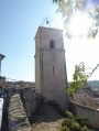
(9) Cross the D82 with care, then begin the steep climb towards the castle by turning slightly right onto Rue Bassins. Cross Rue Jean-Baptiste Balon and continue the climb along Rue des Oliviers. Further up, cross Chemin des Seigneurs, turn left and climb up to the castle via Chemin des Hospitaliers. Walk around the south side of the castle whilst admiring the superb panoramic view over the Verdon valley. Negotiate the right-hand bend and walk about twenty metres along Rue Arnaud de Trian.

(10) Go down the steps on the left, under the Vieil Horloge gate, then continue straight down to Rue Grande. (You can either continue straight down or take a stroll through the beautiful, typical narrow streets of the old village).

(11) Turn left and walk slightly uphill along Rue Grande. Take a short detour to the right to see the pretty Placette Pauline, return to Rue Grande and continue the route to the right to reach Avenue des Marronniers. Continue downhill, heading straight along this avenue until you reach the large roundabout.

(12) Go round the roundabout on the right, crossing Avenue des Alpes, then turn immediately right onto Avenue du Verdon (D8) to return to the Thermes car park (S/E).

Waypoints

  1. S/E : mi 0 - alt. 1,040 ft - Esplanade Charles de Gaulle
  2. 1 : mi 0.08 - alt. 1,010 ft - Chemin de Babaou. Near the - Verdon (rivière)
  3. 2 : mi 1.12 - alt. 1,083 ft - Route de Riez / D952
  4. 3 : mi 1.49 - alt. 1,204 ft - Ruins of Pujol
  5. 4 : mi 2.09 - alt. 1,148 ft - Château Laval
  6. 5 : mi 2.63 - alt. 1,096 ft - Crossroads
  7. 6 : mi 2.85 - alt. 1,122 ft - Route de Valensole / D8
  8. 7 : mi 3.39 - alt. 1,237 ft - Impasse des Riayes
  9. 8 : mi 3.63 - alt. 1,132 ft - Allée des Platanes x Chemin de Riayes Basses
  10. 9 : mi 3.81 - alt. 1,181 ft - Route de Manosque / D82. Towards the - Château des Templiers (Gréoux-les-Bains)
  11. 10 : mi 4.08 - alt. 1,230 ft - Porte du Vieil Horloge
  12. 11 : mi 4.14 - alt. 1,155 ft - Rue Grande
  13. 12 : mi 4.4 - alt. 1,086 ft - Roundabout
  14. S/E : mi 4.57 - alt. 1,040 ft - Esplanade Charles de Gaulle

Notes

Variation 1: the route (+ 300 m) can be started from the Guinguette du Verdon, following the GR®4 along the Verdon via the Promenade Henri Atger and then the Chemin de Saint-Christol, joining the Chemin de Babaou at the picnic spot and then the Route de Riez.

Option 2: from the point (11), walk slightly up Rue Grande, turn right at Place de l'Hôtel de Ville (you may wish to visit the church). Turn left and walk down Rue de l'Église for 80 m, turn left to cross the beautiful Placette Pauline and return to Rue Grande. Turn right to complete the described route.

My hiking equipment: a phone with GPS enabled, Visorando for reading GPX tracks and recording the route, and good hiking boots.

Slideshow: The two castles of Gréoux-les-Bains route

Worth a visit

On the route:

(3) the Ruins of Pujol, (4) Château Laval and its beautiful park, the Château des Templiers and its panoramic view of the Verdon valley, the lively Rue Grande (11), Placette Pauline, the thermal baths and their magnificent park.

Nearby: the Gréoux-les-Bains dam, Lake Esparon, Esparon-de-Verdon, Quinson, the Lower Gorges of the Verdon, etc.

Not to be missed: the wonderful and lively Provençal market in Gréoux-les-Bains, every Thursday on the Place des Maronniers.

Always be cautious and plan ahead when you're outdoors. Visorando and the author of this route cannot be held responsible for any accidents occurring on this route.

The GR® and PR® markings are the intellectual property of the Fédération Française de Randonnée Pédestre.

Reviews and comments

3.7 / 5
Based on 1 review

Reliability of the description
4 / 5
Ease of following the route
4 / 5
Route interest
3 / 5
Schlatter
Schlatter

Dear Daniel, thank you for your review and your feedback. It is indeed a rather urban route, designed to introduce the many spa-goers and tourists to Gréoux-les-Bains, a quintessential Provençal village.
During our last visit to the Château Laval park, we didn’t notice any ‘no entry’ signs. I have amended the description (4).
PS: I have been a spa guest in Gréoux-les-Bains for many years.

Machine-translated

DanielJ04
DanielJ04

Overall rating : 3.7 / 5

Date of your route : Apr 06, 2026
Reliability of the description : ★★★★☆ Good
Ease of following the route : ★★★★☆ Good
Route interest : ★★★☆☆ Average
Very busy route : No

An easy and pleasant walk, though a little too urban. One thing to note: the route around the ‘magnificent park’ of Château Laval is blocked by several ‘no entry’ signs, so we didn’t dare to go on.

Machine-translated

Other walks in the area

For more walks, use our search engine .

The GPS track and description are the property of this route's author. Please do not copy them without permission.