


jpleclercq

 Visorando Member
 Premium user
 - Gender: man
Sign up:
Published route(s)
 The Rasteau plateau between Cairanne, Saint-Romain-de-Malegarde and Rasteau
 11.32 mi
 +1,339 ft
 -1,325 ft
 6h 20
6h 20
 Moderate
 Departure from Cairanne (Vaucluse)
A loop around the Rasteau plateau between Cairanne, Saint-Romain-de-Malegarde and Rasteau, with lovely panoramic views of the Dentelles de Montmirail and the Enclave. Designed for Nordic walking, with a target time of under four hours.
Circular route between Vacqueyras, Beaumes and Gigondas
 10.26 mi
+1,745 ft
-1,749 ft
6h 15
Moderate
Departure from Vacqueyras (Vaucluse)
10.26 mi
+1,745 ft
-1,749 ft
6h 15
Moderate
Departure from Vacqueyras (Vaucluse)
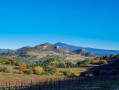
This walk links three villages famous for their Côtes du Rhône wines. It follows a section ofthe GRP® des Dentelles de Montmirail and passes two chapels: Notre-Dame d'Aubune and the Saint-Hilaire Chapel on the Courens plateau.
Boucle au départ de Beaumes-de-Venise
 11.48 mi
+1,654 ft
-1,627 ft
6h 45
11.48 mi
+1,654 ft
-1,627 ft
6h 45
 Difficult
Departure from Beaumes-de-Venise (Vaucluse)
Difficult
Departure from Beaumes-de-Venise (Vaucluse)
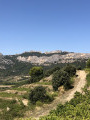
Cette randonnée utilise le GRP® des Dentelles de Montmirail, entre Beaumes-de-Venise et le Barroux puis propose un retour passant par le pittoresque village de la Roque-Alric.
Son itinéraire est assez simple et toujours balisé.
Circular ridge walk around Lafare
 10.02 mi
+3,360 ft
-3,360 ft
7h 30
10.02 mi
+3,360 ft
-3,360 ft
7h 30
 Very difficult
Departure from Lafare (Vaucluse)
Very difficult
Departure from Lafare (Vaucluse)
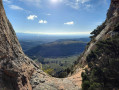
This route links various ridges around Lafare. The first part is the most difficult, as you’ll need to use your hands in various sections—some of which are exposed—and it even includes a section where you have to downclimb a horizontal slab, which can pose problems if you’re not familiar with basic climbing techniques. The second section consists of a series of steep slopes, both on the ascent and the descent. For the most part, the path is not signposted and you will need to use a GPS. The whole route requires a good level of fitness.
Circular ridge loop around the Cirque de Saint-Amand
 12.81 mi
+2,753 ft
-2,766 ft
8h 15
Difficult
Departure from Le Barroux (Vaucluse)
12.81 mi
+2,753 ft
-2,766 ft
8h 15
Difficult
Departure from Le Barroux (Vaucluse)
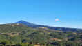
This route takes you round the wide depression bordered by the Gippières, the Crête de Saint-Amand and the Devès. It consists of sections along winding paths through woodland and tarmac sections, avoiding busy roads as much as possible. Some slopes are steep, but there are no exposed sections and the route is fairly straightforward to follow. The GPX track may prove useful.
The three ridges of the Dentelles de Montmirail
 7.01 mi
+2,428 ft
-2,415 ft
5h 20
Difficult
Departure from Lafare (Vaucluse)
7.01 mi
+2,428 ft
-2,415 ft
5h 20
Difficult
Departure from Lafare (Vaucluse)
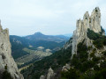
A circular route that seems fairly short but features steep slopes and sections that aren’t always easy to navigate, meaning you won’t be able to walk very quickly. It’s best to stick to this route, particularly for the first section, which is already difficult going uphill but becomes even more challenging if you have to climb back down.
The Montmirail tour off the beaten track
 7.77 mi
+1,496 ft
-1,493 ft
4h 55
Moderate
Departure from Vacqueyras (Vaucluse)
7.77 mi
+1,496 ft
-1,493 ft
4h 55
Moderate
Departure from Vacqueyras (Vaucluse)
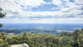
Here is a route of moderate difficulty that circles the former spa resort of Montmirail, a small hamlet outside the village of Vacqueyras, but within the municipality of Gigondas.The aim is to use, as far as possible, little-used and therefore unmarked paths in an area that can be very busy at weekends and in summer.A short trip off the beaten track, best avoided during wild boar hunts, which are common in autumn and winter.
Circular starting from La Roque-Alric
7.20 mi
+1,781 ft
-1,788 ft
4h 50
Moderate
Departure from La Roque-Alric (Vaucluse)
The route passes successively through two peaks near La Roque-Alric to reach Le Barroux, then returns via Le Devès. It mainly consists of paths through the woods, some of which are steep, but unfortunately there is a section of tarmac road after Le Barroux.
Circular route between Beaumes-de-Venise and Lafare
7.44 mi
+1,378 ft
-1,375 ft
4h 35
Moderate
Departure from Beaumes-de-Venise (Vaucluse)
This is a half-day hike offering a variety of paths, both in terms of their nature and their exposure. Crossing some of the less frequented undergrowth can lead to surprising encounters (eagles, wild boars, etc.).
Circular route from Gigondas to the Saint-Amand ridge
12.02 mi
+2,073 ft
-2,070 ft
7h 20
Difficult
Departure from Gigondas (Vaucluse)
A fairly long route, without any major difficulty, following marked and fairly wide paths. Nevertheless, it is nearly 20 km long with a significant elevation gain. The first section is shaded and exposed to the mistral. Some paths in Suzette are tarmac-surfaced, but the alternatives cross private land or areas with rather noisy dogs.