Country:

 City:
City:


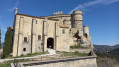
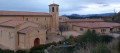
Park in the car park and picnic area at Sainte-Madeleine Abbey.
(S/E) Follow the Chemin des Rabassières downhill towards the north. At the next junction, join theGRP®® Tour des Dentelles de Montmirail trail. Take it straight ahead and follow the yellow and red markings until you reach the Bois Long signpost.
(1) Leave theGRP®® and continue straight ahead along the Chemin de l’Aqueduc. Walk alongside the Ravin des Gipières aqueduct (a stop is recommended) and then continue along the Chemin des Ambrosis. At the Font Pertus crossroads, you’ll reach an oratory.
(2) Turn left onto a path leading uphill towards the Gîte de la Colline. Pass to the right of the lodge and continue along the same path uphill. At a bend, you’ll reach a series of terraced steps.
(3) Climb the steps on the right, then turn sharply left to follow a ledge until you reach the top of the cliff.
(4) Head down to the right until you rejoin theGR®® 4. Turn left onto theGR®®, ignore the paths on the right and climb back up to the Col Clairier.
(5) Leave theGR®® and take the path on the right. Continue slightly uphill along the cliff face until you reach the Sommet des Gippières.
(6) Begin the descent by following the ridge line and reach a fork at a place called Les Granges Rouges.
(7) Turn left, then right at the second ruin, join theGRP®® des Dentelles de Montmirail and take it to the right to reach the Col de la Chaîne.
(8) Cross the D90 with care and follow it to the left for just over 100 m. Leave the road and continue to the right on theGRP®®, then follow an easy climb to reach the Combe Fréu signpost.
(9) Continue uphill to the right, then reach the Pas du Loup.
(10) Just before the ‘La Pousterle’ signpost, leave theGRP®® and follow a blue-marked path to the left which climbs up through the scree. You will reach the paragliding launch site.
(11) Carry on along this blue-marked path to reach the highest point near the first antennas.
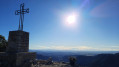
(12) Begin the descent, then walk alongside further antennas to the viewpoint and the cross on the Crête de Saint-Amand.
(13) Continue the descent, now following the yellow-marked path to the right. At the first Fork in the road, turn left, continue down the tarmac road and reach the ‘Les Clapas’ signpost.
(14) Turn left onto the path marked in yellow. Walk down through the vineyards to the ‘La Bori’ signpost.
(15) Carry on straight ahead and you will very quickly reach the D90. Cross it carefully and follow a path to the right, below the road, until you reach a car park opposite Suzette Town Hall.
(16) Head up to the right, take Rue de Suza and you’ll soon come to a Y-junction.
(17) Turn left onto Chemin de Roubiol. Cut across the nature trail and continue downhill through the vineyards. Pass Anrès, then Les Lentilles, and reach the Pont de Roubiol.
(18) Keep to the right, join the D90a and follow it to the left. About a hundred metres after the hairpin bend, take the path on the left. At the first fork, carry on straight ahead; do the same at the next one. Ford a stream, begin a long, fairly steep climb and reach a crossroads next to an olive grove.
(19) Carry on straight ahead and go round a small cliff on the right. At a small pass, pass a path on the right and then another on the left. A little further on, the track joins the path leading down from the Devès. Continue in the same direction and join a wider track at a left-hand bend, at a place called Les Roures.
(20) Continue eastwards, skirting a vineyard; at the end of the vineyard, take a downhill track to the left and reach the Suzette road.
(21) Walk alongside the road to the right, then at the next junction cross it carefully to take the Chemin de Pied Gros opposite – this is also theGRP®® marked in yellow and red. Follow it to a four-way junction near Saint-Madeleine Abbey.
(22) Leave theGRP®® by taking the path on the right and turn left a little further on. Cross the Chemin du Devès and continue uphill to reach the car park at Sainte-Madeleine Abbey (S/E).

 Visorando Member
 Average
 Easy
Easy