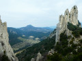
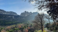
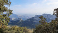
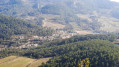
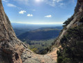
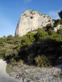
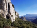
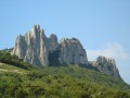
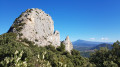
The three ridges of the Dentelles de Montmirail

A circular route that seems fairly short but features steep slopes and sections that aren’t always easy to navigate, meaning you won’t be able to walk very quickly. It’s best to stick to this route, particularly for the first section, which is already difficult going uphill but becomes even more challenging if you have to climb back down.

Details

n°69548954
Creation:
Last update:
Last review:
  • Walking
    Activity: Walking
  • ↔
    Distance: 7.01 mi
  • ◔
    Average duration: 5h 20 
  • ▲
    Difficulty: Difficult

  • ⚐
    Back to start: Yes
  • ↗
    Ascent: + 2,428 ft
  • ↘
    Descent: - 2,415 ft

  • ▲
    Highest point: 1,949 ft
  • ▼
    Lowest point: 630 ft

Photos

Description of the walk

Park at the Lafare Waterfall car park, which is the starting point of the route.

(S/E) Follow the blue markings (dots), first along the left bank, then the right bank of the stream.

(1) When you reach the waterfall itself, turn left into a wide gully that climbs up along the foot of the cliff. There are fixed holds on the first slab, along with a fixed rope. The climb continues up a dihedral-chimney where you’ll need to use both hands.

(2) At the top of the dihedral, there are several possible routes, but carry on straight ahead along the cliff face (between 10 and 20 m), trying to follow the blue markers, which are quite far apart. This will take you to a fork in the path. 

(3) Take the path on the right that leads uphill and you’ll arrive below the Brèche de Deux Heures.

(4) Begin your descent whilst staying on the path marked with blue dots. Some sections are equipped with ropes and metal steps.

(5) Follow the entire Clapis ridge as far as the Pas de la Chèvre, where the path widens (still marked with blue dots). Continue to the Col d’Alsau and join the track suitable for vehicles. Carry on to the right for about a hundred metres. 

(6) Leave the track at a small wall and take a marked path on the right, following the Blue markers. There are several sections where you can cross the Dentelles Sarrasines, but stay on the path until you reach the Brèche de la Pousterle.

(7) Do not go straight down, but take the path on the left (blue markers). Follow the clearly marked path to the bottom of the slope to reach the Col du Cayron. 

(8) Turn right for about 50 metres, then left towards the ‘rocher école’.

(9) At the ‘rocher école’ (signposted), take the steps on the left, then a steep slope leading to the small cliff; the path continues to the right of it. Yellow markers appear alongside the blue ones.

(10) When the path splits, turn left (yellow markers) and continue along the ridge. After two changes of direction, the path joins a wider track leading to the Pas de l’Aigle.

(11) Head in the opposite direction, descending to the right. At the nearby junction, carry on straight ahead along the track which joins a road in poor condition leading to the hamlet of Château Neuf Redortier.

(12) Turn right and walk past a farm to join a path marked in yellow (PR®). Turn left after about a hundred metres and follow the PR® to the Chemin des Dentelles at the foot of the Chapelle Saint-Christophe.

(13) Keep going in the same direction, following the road for about 100 metres, then take a path branching off to the right. Continue down this path until you reach the stream and arrive at the car park for the Cascade de Lafare (S/E).

Waypoints

  1. S/E : mi 0 - alt. 630 ft - Car park - Cascade de Lafare
  2. 1 : mi 0.13 - alt. 719 ft - Cascade de Lafare
  3. 2 : mi 0.24 - alt. 1,060 ft - Summit of the dihedral-chimney
  4. 3 : mi 0.55 - alt. 1,365 ft - Junction
  5. 4 : mi 0.69 - alt. 1,391 ft - Brèche de Deux Heures
  6. 5 : mi 1.17 - alt. 1,417 ft - Pas de la Chèvre
  7. 6 : mi 1.81 - alt. 1,473 ft - Alsau Pass
  8. 7 : mi 2.35 - alt. 1,739 ft - Brèche de la Pousterle
  9. 8 : mi 2.7 - alt. 1,302 ft - Col du Cayron
  10. 9 : mi 2.93 - alt. 1,260 ft - Training rock
  11. 10 : mi 3.94 - alt. 1,755 ft - Junction
  12. 11 : mi 4.82 - alt. 1,558 ft - Pas de l’Aigle
  13. 12 : mi 5.23 - alt. 1,532 ft - Château Neuf Redortier
  14. 13 : mi 6.73 - alt. 955 ft - Chapelle Saint-Christophe
  15. S/E : mi 7.01 - alt. 630 ft - Car park - Cascade de Lafare

Worth a visit

Village of Lafare.

Always be cautious and plan ahead when you're outdoors. Visorando and the author of this route cannot be held responsible for any accidents occurring on this route.

The GR® and PR® markings are the intellectual property of the Fédération Française de Randonnée Pédestre.

Reviews and comments

4.2 / 5
Based on 2 reviews

Reliability of the description
4 / 5
Ease of following the route
3.5 / 5
Route interest
5 / 5
jpleclercq
jpleclercq

It’s true that you don’t need an ice axe or crampons, although some winters …

Machine-translated

suzie0405
suzie0405

Oh, but you’re following me!! Haha!!
Thanks, but I go hiking in the mountains, and the trails on Mont Ventoux are like motorways compared to the trails on some other peaks… but I really enjoyed the view.

Machine-translated

jpleclercq
jpleclercq

Thank you all, and well done for your stamina on the north face of Mont Ventoux!

Machine-translated

suzie0405
suzie0405

Overall rating : 4.7 / 5

Date of your route : Apr 26, 2025
Reliability of the description : ★★★★★ Very good
Ease of following the route : ★★★★☆ Good
Route interest : ★★★★★ Very good
Very busy route : No

Thanks to the author – I really enjoyed it; it’s nice to stray off the beaten track every now and then.
Well done on the route description, as the signposting is sometimes very subtle.

Machine-translated

jpleclercq
jpleclercq
• Edited:

Hello,
Thank you for your feedback.
It’s true that below the ‘two-hour breach’, the path has been fitted out with a few steps and some ropes, some of which are sheathed. This section is, nevertheless, much easier than the initial dihedral.
I’ll amend the description to include these details.
Just one comment: this route is intended to be challenging, and the start is one of the difficult sections, as is the final ridge. There are plenty of alternative routes to make it less difficult, but then it’s no longer the same hike.

Machine-translated

jacques.nys
jacques.nys

Overall rating : 3.7 / 5

Date of your route : Mar 07, 2025
Reliability of the description : ★★★☆☆ Average
Ease of following the route : ★★★☆☆ Average
Route interest : ★★★★★ Very good
Very busy route : No

As we are not mountaineers at heart, and having had a very bad experience in a chimney in the Spanish Pyrenees, we began this hike by climbing the path that links the starting point directly to the peak (2). It wasn’t easy, but there was no mountaineering or rock climbing on this section. It was simply a constant struggle to stay on a proper path rather than one of the many uncertain tracks.
Progress was extremely slow (nearly an hour for a single kilometre) but the experience was splendid right up to the point (4) where things started to get complicated: the route description made no mention whatsoever of ropes, descending rock faces or crampons!
We abandoned the idea of reaching the Pas de la Chèvre (5) when we saw several metal rungs enabling us to climb a rock face several metres high, without having any idea – or any description – of what lay ahead on the route. We decided to turn back and head down to the ‘Mon Rêve’ car park to take the Grand Montmirail path, aiming to reach the Col d’Alsau via the Tour Sarrasine.
At the Col d’Alsau, we resumed the original route to the Col du Cayron … a magnificent route, not particularly difficult and offering splendid views.
Given how far behind schedule we’d fallen on the route to the Col du Cayron, we decided to skip the northern section and head straight to the St Christophe Chapel via the Cayron and Dentelles paths.
Do make the detour to the Chapel of St Christophe: it’s well worth a look!
On reflection, and after discussing it with one of our sons, there is a less ‘acrobatic’ route linking points (4) and (6) whilst avoiding the Pas de la Chèvre (5). At km 1.5, head down the path for about 100 metres, then turn right onto the path marked with a blue dot … it passes beneath the Pas de la Chèvre and clearly presents no particular difficulties.

Machine-translated

Other walks in the area

For more walks, use our search engine .

The GPS track and description are the property of this route's author. Please do not copy them without permission.