Country:
 City:
City:


In Cairanne, there is a small car park by the post office and a larger, signposted one just opposite.
(S/E) Take the Route de Carpentras northwards, then the Allée des Travers, less than 100 m on the right. Follow it up on the left, then take the Route de Saint-Romain de Malegarde (D51) opposite, veering slightly to the right, for 250 m to reach a junction with an FFRP signpost.
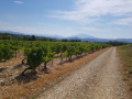
(1) Leave the Route de Saint-Romain and head towards Ventabren via theGRP® (yellow and red markings). Climb through the vineyards, following the markings, and continue in the same direction until you reach the Col du Débat, where you rejoin the Route de Saint-Romain: look for the ‘Ventabren’ signpost.
(2) Cross over and take the track on the right, continuing to follow the GRP®.
(3) At the “La Montagne Ouest” signpost, leave the track and turn left onto a stony path called the Chemin du Débat, which eventually joins a tarmac road at a seven-way junction: “Serre de la Garde” signpost.
(4) Leave the road and take a path on the right that climbs, staying on theGRP® (yellow and red markings). After a stony descent where walking poles are very useful, reach the crossroads where the “Le Ligneul” signpost is located.
(5) Take the tarmac road on the right (still following theGRP®).
(6) When the road climbs, curving slightly to the right, leave it and take a path opposite. Follow the path to the ‘Combe des Amoureux’ signpost.
(7) Turn right onto the path, which climbs steeply for a few hundred metres before reaching the plateau, where it crosses a track at an open shelter equipped with tables.
(8) Continue straight ahead on theGRP®, heading due south. Go round the Roberty farm on the right and continue along the path to the “Maut Pertu” signpost.
(9) Turn right onto the Chemin Vieux de Roaix.
(10) Ignore the turn-off to Les Geaux on the right and carry straight on to reach Rasteau.
(11) Turn right onto Rue des Remparts, which becomes a flight of steps at the end. Turn left onto Rue de l’Horloge. Pass under the tower, then turn right onto Rue de l’Ancienne Mairie, which leads after 20 metres to Rue Saint-Antoine; turn left here. Follow this road to the end and continue straight ahead along a path that leads to Traverse des Girards.
(12) Carry on straight for about 600 metres, then turn left onto Chemin des Girards and follow it until the left-hand bend.
(13) Carry on straight ahead and keep going in the same direction until you reach the Chemin des Coustiats.
(14) First turn right then left to join the Chemin des Girards. Continue to the Saint-Martin junction.
(15) Carry straight on, staying on the same road, until you come out onto the Route de Saint-Romain-de-Malegarde (D51); follow this, turning left until you reach the junction where you left it on the way there.
(1) Follow the route you took on the way there in the opposite direction (or visit the village, which is well worth a visit) to return to the starting car park (S/E).

 Visorando Member
 Easy
Easy