The Toulourenc terraces

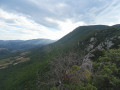
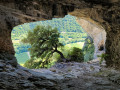
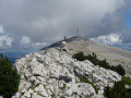
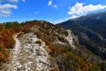
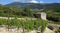
A circular route around the Gorges du Toulourenc, following theGR® trails between the hamlets of Veaux and Saint-Léger-du-Ventoux. The path first climbs up the right bank (north), then, after reaching and crossing the river, continues along the left bank, on the northern slope of Mont Ventoux and then La Plate, without ever reaching the ridges.

Details

n°66607691
Creation:
Last update:
Last review:
  • Walking
    Activity: Walking
  • ↔
    Distance: 14.38 mi
  • ◔
    Average duration: 9h 10 
  • ▲
    Difficulty: Very difficult

  • ⚐
    Back to start: Yes
  • ↗
    Ascent: + 2,907 ft
  • ↘
    Descent: - 2,890 ft

  • ▲
    Highest point: 3,199 ft
  • ▼
    Lowest point: 1,004 ft

Photos

Description of the walk

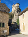
The start is at the car park near the hamlet of Veaux, on the left bank of the Toulourenc, alongside the D242.

White-and-red markings,GR® 91.

(S/E) Walk up from the car park until you reach the road, which you follow to the left. Pass through the hamlet of Veaux and you’ll arrive at the bridge over the Toulourenc (Pont de Veaux).

(1) Immediately afterwards, at the ‘Pont de Veaux’ signpost, take the path directly in front of you and turn right straight away. A winding climb begins along a stony but fairly passable path.

(2) At the fork, by the ‘Gorges du Toulourenc’ signpost, carry on towards Saint-Léger-du-Ventoux. With a bit of luck, you’ll be able to spot some climbers on the cliffs, which feature some of the most challenging routes in France (and the world).
Gradually, make your way down to the level of the Toulourenc. TheGR® turns left and heads uphill; leave it and continue along the path directly in front of you. Shortly afterwards, you’ll reach a car park and rejoin the GR®.

(3) Turn right onto the tarmac road which leads to a bridge. Cross it and head towards the entrance to a farm on the right.

End of the white-and-red markings

(4) Immediately afterwards, take the grassy path leading uphill to the right. At the fork, take the hairpin bend to the left and continue to the next fork.

YellowPR®markings

(5) Take a sharp right-hand bend. At the three-way junction, keep left and join a forest track a few metres before the Waterfall de l’Arjalas.

(6) Shortly afterwards, ignore the track on the right and continue climbing, staying on the main route. After about 3.5 km, you’ll reach a four-way junction at the Arjalas signpost.

(7) Go straight on towards Sous le Col de Comte.

(8) At the junction, at the ‘Sous le Col de Comte’ signpost, turn right towards Coulet du Faus. From this point, the path descends gently and steadily for several kilometres.

(9) At the signpost for Tête de la Blache, enjoy the magnificent view and continue along the track. Pass six valleys, some more distinct than others, and you’ll reach a fork with two paths leading in opposite directions, at the signpost marked ‘Le Planet’.

White-redGR® 91markings

(10) Turn right onto the stony path, which is considerably less passable than the track you are leaving. Carry on, cross one path and arrive at a second.

(11) Continue along the path opposite, carefully making your way down through several scree slopes where the rocks give way to gravel. You’ll reach a road (D242) at the ‘Le Vallon’ signpost.

(12) Turn right onto this road and you’ll reach the car park about 600 m further on (S/E).

Waypoints

  1. S/E : mi 0 - alt. 1,050 ft - Car park in the hamlet of Veaux
  2. 1 : mi 0.61 - alt. 1,014 ft - FFRP signpost “Pont de Veaux” – 319 m - Toulourenc (rivière) - Affluent de l'Ouvèze
  3. 2 : mi 1.61 - alt. 1,677 ft - FFRP signpost – “Gorges du Toulourenc” – 540 m
  4. 3 : mi 3.43 - alt. 1,230 ft - Tarmac path to the right
  5. 4 : mi 4.34 - alt. 1,296 ft - Le Plan (farm)
  6. 5 : mi 4.48 - alt. 1,368 ft - Return to the GRP – ‘Yellow’ trail
  7. 6 : mi 5.33 - alt. 1,850 ft - Arjalas Spring and Waterfall
  8. 7 : mi 6.93 - alt. 2,795 ft - FFRP signpost – “L’Arjalas” – 857 m
  9. 8 : mi 7.61 - alt. 3,199 ft - FFRP signpost – “Sous le col du Comte”
  10. 9 : mi 10.58 - alt. 2,215 ft - FFRP signpost – “Tête de la Blache”
  11. 10 : mi 12.05 - alt. 1,824 ft - FFRP signpost – “Le Planet”
  12. 11 : mi 12.67 - alt. 1,778 ft - Junction between the footpath and the track
  13. 12 : mi 13.95 - alt. 1,115 ft - FFRP signpost – “Le Vallon” – 337 m
  14. S/E : mi 14.38 - alt. 1,050 ft - Car park in the hamlet of Veaux

Notes

Route designed for Nordic walking, to be completed in under 5 hours.

You can also start from another car park on the other side of the river, alongside theD40A.

(8) You can reach the Col de Comte, 200 m to the left, and enjoy a lovely view.

(11) Given the gradient, it’s best to have good walking poles (or thighs of steel).

Worth a visit

(S/E) The hamlet of Veaux.

(1) Toulourenc Gorges.

(2) The cliffs of Saint-Léger.

(4) Village of Saint-Léger-du-Ventoux.

(8) Col de Comte.

Always be cautious and plan ahead when you're outdoors. Visorando and the author of this route cannot be held responsible for any accidents occurring on this route.

The GR® and PR® markings are the intellectual property of the Fédération Française de Randonnée Pédestre.

Reviews and comments

5 / 5
Based on 1 review

Reliability of the description
5 / 5
Ease of following the route
5 / 5
Route interest
5 / 5
User 28658430

Overall rating : 5 / 5

Date of your route : Apr 13, 2026
Reliability of the description : ★★★★★ Very good
Ease of following the route : ★★★★★ Very good
Route interest : ★★★★★ Very good
Very busy route : No

A brilliant hike!!!

Machine-translated

Other walks in the area

For more walks, use our search engine .

The GPS track and description are the property of this route's author. Please do not copy them without permission.