


 Country:

 City:
City:


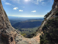
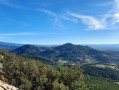
Park at the Waterfall de Lafare car park.
(S/E) Follow a blue-marked path which climbs up through the gorges to the waterfall: one section is equipped with a steel step to make a rocky passage easier.
(1) Just before the waterfall, turn right to reach a flat area: a right-hand ledge with the start of climbing routes. Follow the blue markings and proceed with caution into a chimney-like gully which is equipped but requires the use of both hands. Continue along the same marked path until you reach a scree slope leading down to the stream, which you must cross. Carry on through the woodland until you reach a fork in the road.
(2) Turn left and head up the Vallat de l’Aiguille, crossing the stream twice.
(3) Take the path on the left and head up to the cliff face at a large gap. In this section, numerous paths intersect.
(4) Pass through the gap and carefully descend the slab, following the important notes below:
- even though the slope is only 45°, it is best to descend facing the rock, without clinging to it, using the holes and good handholds on the rock for your hands and placing your feet more for friction,
- and above all: do not slide down on your bottom.
Then, via a series of steps, rejoin the path that runs alongside the cliff (blue markings) and follow it to the left.
(5) Leave the path beneath the cliff to take the one descending to the right. Here again, there are many possible routes; the key is to descend safely to the next point.
(6) Take the path opposite, then turn left at the next junction.
(7) When the path reaches a vineyard, follow the track that climbs to the right. Continue until you reach a tarmac road, ignoring several offshoots on either side.
(8) Follow the road as it winds down to the Chemin des Grandes Terres. Turn right, then left at the next junction just before reaching the Ruisseau de Salette. Ignore two turn-offs on the right and continue to the junction with the Route de Lafare (D90).
(9) Cross it very carefully and follow it to the left for about a hundred metres. Then take a track that climbs to the right, first through woodland and then alongside vineyards.
(10) At the junction, turn left between the vineyards, then right a good hundred metres further on. You’ll reach the Chemin de Bel Air.
(11) Follow it uphill to the left for about ten metres and take the second path on the right – the first is the entrance to a vineyard. Follow this for about 500 metres.
(12) After a wide bend to the left, leave the track and head up to the left onto a path in poor condition with a steep gradient. When the path reaches a wooded area, turn right and continue uphill.
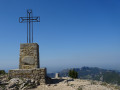
(13) Take the path leading uphill to the left, then turn right 50 metres further on. You’ll reach the summit of Carabelle.
(14) Continue along the track and, further down, take the path on the right (cairn). At the bottom of the slope, follow the path to the left and walk alongside a small cliff to the end, where you will reach the D90a. Cross it carefully and take the path opposite, on the other side of the safety barrier. Walk down to a vineyard and follow it to the right until you reach a wider track. Follow this track up to the right.
(15) 100 m further on, at a yellow marker on a tree to the left of the track, turn left onto the path which descends steeply and then climbs just as steeply. Continue uphill, turning left at the first junction and then left again at the next.
(16) Turn right and climb up a path that is at times very stony to reach the summit of Le Devès.
(17) After an initial descent, the path joins another (cairn). Turn right and continue down the path, which winds in several hairpin bends, until you reach a junction.
(18) Turn left, then, 200 m further on, turn right onto a somewhat hidden path through the woodland. Continue down the path, which runs alongside a vineyard; at the end of the vineyard, take the path on the right which continues in the same direction.
(19) Where the path splits, take the one straight ahead; then, as access is prohibited, leave this path and descend via a small track to an orchard. Walk along its left-hand side and take a narrow track leading to the edge of a slope. Descend this to reach the vineyard below. Then follow the fairly wide but very steep path that runs alongside the vineyard on the right.
(20) At the bottom of the vineyard, on the right, take the small path in very poor condition (torrent) which leads to a track. Follow it to the left as far as the Suze signpost.
(21) Turn left onto Chemin de Genenton. Then turn right onto Chemin de Roubiol, followed by the first road on the left, called Chemin du Bramadou.
(22) When the track is no longer tarmac, turn onto another track leading uphill to the right. On the ridge, turn right onto the tarmac Chemin des Sarrières, then take the hairpin bend to the left to join the Chemin de l’Ubac. Follow it straight on until you reach the D90, Route de Suzette.
(23) Follow the D90 for 200 m, then cross the road carefully and take the Chemin de Ramadieu on the right.
After crossing a stream, at a ruin, take the path on the left, which climbs steeply. Follow it until you reach the Chemin des Dentelles.
(24) At the ‘Le Collet’ signpost, cross the tarmac road and head towards the Chapelle Saint-Christophe on the road leading uphill opposite. At the start of a 90° right-hand bend, leave the road and take a path that descends to the left and leads directly to the starting car park (S/E).

 Visorando Member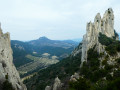
 Difficult
 Moderate
 Extremely difficult
