


DNA57

 Visorando Member
 Premium user
 - Location: La Chapelle-de-Guinchay (71570)
- Gender: man
Sign up:
Published route(s)
 Sainte Consorce-Marcy l'Etoile
 12.14 mi
 +1,864 ft
 -1,893 ft
 7h 10
7h 10
 Moderate
 Departure from Sainte-Consorce (Rhône)
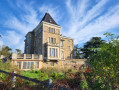
A hike of around 20km, starting and ending at the church in Sainte-Consorce. A varied route through woods, meadows and suburban areas.
Solutré - Vergisson - Mont de Pouilly via the Grange du Bois
 12.91 mi
+2,438 ft
-2,444 ft
8h 05
12.91 mi
+2,438 ft
-2,444 ft
8h 05
 Difficult
Departure from Solutré-Pouilly (Saône-et-Loire)
Difficult
Departure from Solutré-Pouilly (Saône-et-Loire)
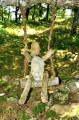
At the foot of the Roches de Solutré and Vergisson, you can admire the spectacular geology of these two rocky outcrops and their peaks. You will enjoy superb panoramic views of the Beaujolais, the Saône Valley and the Val Lamartine.This long route takes you along theGR®®76 trailthrough the cool forest of the Bois des Bruyères.On the way back, you can admire Chasselas, Mâcon, the Saône Valley and even the Alps from the Grange du Bois and the summit of Mont de Pouilly.
Circulars in the Pilat from the Col du Pavezin
 11.42 mi
+1,663 ft
-1,660 ft
6h 40
Difficult
Departure from Chuyer (Loire)
11.42 mi
+1,663 ft
-1,660 ft
6h 40
Difficult
Departure from Chuyer (Loire)
In the footsteps of Jean-Jacques Rousseau and Doctor Odouard, a circular eight between the Cols de Pavezin and Doizieu.
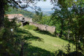
The first part leads to the Croix de Montvieux via the ruins of the Château de Bélize and the Crêts des Quatregrains, with a beautiful view of the Pîlât mountains. The second part goes to the Collet de Doizieux via pleasant forest tracks and views of Pélusin and the Rhône valley. The return route passes through the Neufond woods with two beautiful screes and the Baronnette trails.
Rochetaillé - Dams, Gouffre d'Enfer and Pas du Riot
 12.05 mi
+1,565 ft
-1,555 ft
6h 55
Moderate
Departure from Saint-Étienne (Loire)
12.05 mi
+1,565 ft
-1,555 ft
6h 55
Moderate
Departure from Saint-Étienne (Loire)
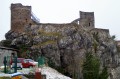
The Gouffre d'Enfer dam is one of the most famous sites in the Rhône-Alpes region and a popular walk in the Saint-Étienne area. It was built in 1860 in the Furan valley, near Rochetaillé, and completed 17 years later by the Pas du Riot dam. We then continue along the dam trail to the Pont de Souvignet. The return journey takes us via Les Palais, Les Sagnes and La Croix de Givet before joining theGR®42to arrive at Le Plateau and Rochetaillé.
Loop in the Monts d'Or starting from Saint-Romain
 13.50 mi
+2,569 ft
-2,549 ft
8h 25
Difficult
Departure from Saint-Romain-au-Mont-d'Or (Rhône)
13.50 mi
+2,569 ft
-2,549 ft
8h 25
Difficult
Departure from Saint-Romain-au-Mont-d'Or (Rhône)
This loop follows the Grand Tour and Tour intérieur des Monts d'Or trails. We start at the Saint-Romain cemetery and head towards Mont Cindre via the Sentier des Rapaces trail. Towards Limonest, we walk alongside Château de la Barollière before climbing up to Mont Verdun. It's worth making a detour to visit the Glande lime kiln.
This route offers beautiful panoramic views around Mont Cindre and Mont Verdun, towards Poleymieux and the heights of Saint-Romain.
Saint-André-la-Côte circular, Signal de Saint-André and Roche de Matiole
 13.09 mi
+1,978 ft
-1,982 ft
7h 45
Difficult
Departure from Saint-André-la-Côte (Rhône)
13.09 mi
+1,978 ft
-1,982 ft
7h 45
Difficult
Departure from Saint-André-la-Côte (Rhône)
Starting from Saint-André-la-Côte, we head towards Saint-Martin-en-Haut via the Signal de Saint-André. Then we turn west towards Les Carelles and La Chapusière to reach La Roche de Matiole. We then descend towards Sainte-Catherine via Chavagnieux, Soleymieux and Chavassieux. After Montaland, we overlook the village of Sainte-Catherine to join theGR®7, which takes us back to Saint-André-la-Côte.
Via Gebennensis - Pic du Lizieux - Knoll des Testavoyre
11.73 mi
+2,402 ft
-2,398 ft
7h 30
Difficult
Departure from Araules (Haute-Loire)
The route follows the Via Gebennensis (GR®65-GR®430) to near Les Araules.
Next, discover the Pic du Lizieux and its orientation table, which offers a 360° panorama.
The hike continues along the Bonas discovery trail, then joins Arnissac to pass through Pic Testavoyre and ends with the forest road to Chalet Raffy.
La Croix de Fer, Col des Écorbans and Mont Pinay
10.72 mi
+1,322 ft
-1,332 ft
6h 05
Moderate
Departure from Ranchal (Rhône)
Starting from Ranchal on the border of the Loire department, this is a beautiful route in the upper Azergues valley.
Towards Les Brecs d'Allos
5.07 mi
+1,407 ft
-1,421 ft
3h 35
Moderate
Departure from Allos (Alpes-de-Haute-Provence)
Explore the Piste de Vacheresse and the Plateau du Brec starting from Allos. Return to La Cluite via theGR®56along the Chadoulin
Butte de Suin, starting from Buffières
11.21 mi
+1,457 ft
-1,457 ft
6h 25
Moderate
Departure from Buffières (Saône-et-Loire)
Setting off from Buffières, we head for Suin and its famous “butte” via theGR®76Cand then theGR®7. The Butte de Suin rises to around 600 m. From the orientation table, there is a 360° view. You can see the Charolais region to the west, Mont Saint-Vincent and Montceau-les-Mines to the north-west, the Chalon region to the north-east, the Cluny region to the east, and Mont Saint-Cyr and the foothills of the Beaujolais to the south. The return journey is via Sivignon.
Circular route via the Pas du Serpaton, the Rocher du Baconnet and the Roc de Cognière
5.39 mi
+1,125 ft
-1,125 ft
3h 30
Moderate
Departure from Gresse-en-Vercors (Isère)
Above Gresse-en-Vercors, starting from the Serpaton car park, a circular route towards the Rocher de Baconnet and the Roc de Cognière.
It offers stunning views:
- to the west over the Gresse Valley and Le Grand Veymont,
- to the south over Mont Aiguille,
- to the east over Monestier-de-Clermont with the A51 tunnel and viaduct, Lake Monteymard, the Corniche du Drac, the Écrins and the Dévoluy.
Mont Saint-Romain - Blanot - Étang de Crue starting from Azé
11.54 mi
+1,850 ft
-1,854 ft
6h 55
Moderate
Departure from Azé (Saône-et-Loire) (Saône-et-Loire)
From the Azé Caves car park, climb up to Mont Saint-Romain, then take a circular route around Blanot and return via the Étang de Crue. Enjoy a 360° panorama from the roof of the Mont Saint-Romain inn and a beautiful view from the orientation table above the Azé caves.
Roche Coche, La Belouse, Escolles, Vanzé from Verzé
9.40 mi
+1,457 ft
-1,450 ft
5h 35
Moderate
Departure from Verzé (Saône-et-Loire)
From Verzé, in the Haut Mâconnais, this circular route winds its way through vineyards and woods. First, we climb towards Échanault to reach Roche Coche via Champ de la Boivine. The Roche Coche orientation table offers a beautiful view of the Val Lamartine, the Roche de Solutré and, in the distance, the Hauts du Beaujolais. Next, head back up towards Les Bruyères, then descend to Chanaud and turn north-east towards Escolles and Vanzé to return to Verzé.
Around the medieval village of Brancion
11.17 mi
+1,394 ft
-1,391 ft
6h 20
Moderate
Departure from Martailly-lès-Brancion (Saône-et-Loire)
Tour of the medieval village of Brancion: Romanesque church and Crusaders’ tombs, covered market hall, feudal castle. Visit the village of Martailly-les-Brancion with its wash house, the source of the Natouze and its fountain, which you reach via the Sentier des Moines (GR®76A).
Circular route on the Retord Plateau
9.91 mi
+988 ft
-1,010 ft
6h 00
Moderate
Departure from Hotonnes (Ain)
Starting from Les Bergonnes, a circular route with an ascent to the Crêt du Nû via the GR®9 to La Charnay. The first section is wooded with beautiful beech trees. At the Croix de Terments and the Crêt du Nû: climb up to the viewing points for views of the Rhône and the Alps.
The second part of the ascent takes place on the plateau. You then reach the Ferme du Retord. After the farm, head back down via the yellow-marked path towards La Grange à Lucien. Continue the descent towards Pré Brachet, then Gros Frêne and Les Granges Charpy, before finally returning to Les Bergonnes.