diogene412

 Visorando Member
 Premium user
 - Gender: man
Sign up:
Published route(s)
 Pré Peyret – Col de Vassieux Hut
 10.33 mi
 +2,047 ft
 -2,818 ft
 5 hrs
5 hrs
 Difficult
 Departure from Gresse-en-Vercors (Isère)
The second stage of our Corrençon–Ambel–Corrençon circular route set off from the Cabane de Pré Peyret towards the Col du Rousset and then on to the Cabane du Col de Vassieux.
Tubanet Hut – Hollowed-Out Tree Trunk Serving as Drinking Trough
16.91 mi
+4,396 ft
-4,511 ft
10 hrs
 Very difficult
Departure from Omblèze (Drôme)
Very difficult
Departure from Omblèze (Drôme)
Stage4 sets off from the Cabane de Tubanet and returns to the high plateaus of the Vercors at the Cabane des Bachassons above Saint-Agnan-en-Vercors.A very long day. It is the longest of the tour.
 Roybon Hut – La Peyrouse Hut
 10.88 mi
+2,182 ft
-1,719 ft
6h 55
Difficult
Departure from Villard-de-Lans (Isère)
10.88 mi
+2,182 ft
-1,719 ft
6h 55
Difficult
Departure from Villard-de-Lans (Isère)
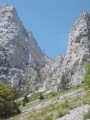
Day2 of a traverse of the Vercors via the balcony path.
Cabane de la Peyrouse - Cabane des Aiguillettes
 11.34 mi
+4,938 ft
-4,009 ft
9h 30
Difficult
Departure from Saint-Andéol (Isère) (Isère)
11.34 mi
+4,938 ft
-4,009 ft
9h 30
Difficult
Departure from Saint-Andéol (Isère) (Isère)
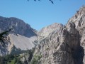
Day3 of our traverse: setting off from the Cabane de la Peyrouse to reach Gresse en Vercors. We go round the Grand Veymond to climb back up onto the plateau via the Col des Bachassons (water), then stop at the Cabane de l’Aiguillette.
Cabane des Aiguillettes - Corrençon-en-Vercors
15.15 mi
+666 ft
-3,110 ft
7h 35
Difficult
Departure from Gresse-en-Vercors (Isère)
The fourth and final day of the circular route leading from the L'Aiguillette hut at the foot of the Grand Veymont to the car park at the Corrençon-en-Vercors ski stadium, where we will have left a car.
Saint-Nizier-du-Moucherotte - Cabane de Roybon
 12.38 mi
+4,573 ft
-3,652 ft
9h 40
Difficult
Departure from Saint-Nizier-du-Moucherotte (Isère)
12.38 mi
+4,573 ft
-3,652 ft
9h 40
Difficult
Departure from Saint-Nizier-du-Moucherotte (Isère)
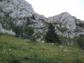
First stage of the circular route from Saint Nizier to Corrençon en Vercors, with a stop at the Cabane de Roybon below the Col Vert.Whilst the first part is easy, the section between Col de l’Arc and Col Vertis challenging, with sections over a sheer drop!Take great care.
Route via the Col de la Sarna
16.48 mi
+2,356 ft
-2,356 ft
10 hrs
Difficult
Departure from Corrençon-en-Vercors (Isère)
This is a short circular loop starting from the Corrençon ski stadium, skirting the Darbonouse plain via the Col de la Sarna, returning to the southern end of the plain and back to Corrençon via the GR®.
Traversée du Buet
 13.82 mi
+7,694 ft
-7,684 ft
10 hrs
Very difficult
Departure from Sixt-Fer-à-Cheval (Haute-Savoie)
13.82 mi
+7,694 ft
-7,684 ft
10 hrs
Very difficult
Departure from Sixt-Fer-à-Cheval (Haute-Savoie)
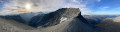
Crossing the Buet, ascending via the Refuge de Grenairon and descending via Les Fonts. It is a long loop with a significant elevation gain and a section at an altitude of 3,000 metres. Having done this hike again in the direction of Grenairon chalet to Fonts chalets, I am repeating the description as it is much easier, shorter (approx. 9 to 10 hours), and it is easier to see the rest of the path from above when descending from Beaux Prés.
Cabane de Pravouta - La Plagne
15.41 mi
+4,469 ft
-6,211 ft
12 hrs
Very difficult
Departure from Saint-Pierre-de-Chartreuse (Isère)
Third and final day of this trip to the Chartreuse to collect the car.
Aulp du Seuil Hut – Pravouta Hut
6.81 mi
+2,815 ft
-3,009 ft
8 hrs
Very difficult
Departure from Saint-Bernard (Isère) (Isère)
Day2 of this trip via the Col de Bellefont to reach the Dent de Crolles plateau.Descent via the pass above the Trou du Glaz, then down to the Col des Ayes and up the Roc d’Arguille to the Col de Pravouta and the hut of the same name.
⚠️ 27/11/2025: Route modified following a rockfall. It is no longer possible to take the path via the Trou du Glaz (5). The area remains particularly dangerous due to the high risk of further rockfall and falling boulders. Following this incident, the municipality of Saint-Pierre de Chartreuse has issued a by-law to close several hiking trails (for walking, snowshoeing and ski touring). For an ascent of the Dent de Crolles, it is possible to take the route via the Pas de l’Oeille.
You can also go via the Guiers waterfalls to reach (E).
Tête de Garnesier
 9.60 mi
+4,406 ft
-4,400 ft
8h 15
Difficult
Departure from La Cluse (Hautes-Alpes)
9.60 mi
+4,406 ft
-4,400 ft
8h 15
Difficult
Departure from La Cluse (Hautes-Alpes)
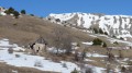
This is an easy hike with a spring halfway along the route.
We set off from La Cluse (small car park at the edge of the village) and climb up to Tête de Garnesier, following aGR® trail for most of the hike.
Grand Som loop
 8.77 mi
+4,639 ft
-4,619 ft
6 hrs
Very difficult
Departure from Saint-Pierre-de-Chartreuse (Isère)
8.77 mi
+4,639 ft
-4,619 ft
6 hrs
Very difficult
Departure from Saint-Pierre-de-Chartreuse (Isère)
This is a loop trail that passes through the Grand Som and, to avoid the crowds, descends along the Arête de la Suiffière (a little exposed but easy), then joins the Col de Freney (and the forest) and, via a path with numerous hairpin bends, returns just above La Correrie, our starting point.
The Drouillet Pass
 8.56 mi
+3,802 ft
-3,802 ft
7h 15
Difficult
Departure from Saint-Disdier (Hautes-Alpes)
8.56 mi
+3,802 ft
-3,802 ft
7h 15
Difficult
Departure from Saint-Disdier (Hautes-Alpes)
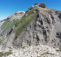
Starting from the hamlets above St Disdier en Dévoluy, several large parallel valleys climb up towards the ridge connecting Grand Ferrand to Obiou.
This hike takes you up to the Col du Douillet, just below the Petit Ferrand, via the Truchière valley, and back via the Narittes valley.
As always in Dévoluy, the landscape is rocky, but the Truchière valley is quite grassy, while the Narittes valley is much more austere.
La Tête de Lapras, starting from Saint-Disdier
 9.83 mi
+5,194 ft
-5,171 ft
9h 05
Difficult
Departure from Saint-Disdier (Hautes-Alpes)
9.83 mi
+5,194 ft
-5,171 ft
9h 05
Difficult
Departure from Saint-Disdier (Hautes-Alpes)
To round off the list of beautiful hikes in the Dévoluy, here is a circular route that takes us to the Tête de Lapras via the Crête des Samarroux.
Then, you can choose either to climb Le Nid via the Col de Lapras or, still via the Col de Lapras, descend into the Vallon du Mas to reach the Baudinard hut.
It is, of course, possible to shorten the route by simply hiking up the Vallon du Mas and back.