Country:

 City:
City:


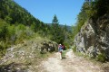
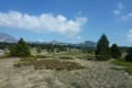
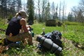
Park at the side of the road between Saint-Agnan and the Col du Rousset, just after the hamlet of Rousset (on the grassy verge).
(S/E) Walk along the road with extreme caution for about a hundred metres.
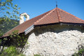
Cross over to take a track on the left which runs parallel to the road and climbs towards the Chapelle Saint-Alexis.
(1) At a place called Pont des Scies, turn left and then, at the junction at the end of the track, continue straight ahead, heading up the Combemale valley.
(2) You’ll pass close to the Trou de l’Aygue cave.
(3) Where the valley opens out onto the plateau in the Pas des Econdus area, turn left heading north-east towards the Baraque de Gerland. This is off-track terrain where a GPS will be useful, but the terrain is
well to navigation using a compass.
(4) Pass by the Jasse de la Roche and keep roughly the same direction to join a well-marked path.
(5) Follow this path to the left.
END OF MODERATION --
You’ll come across the first hut, and the Gerland hut is just beyond it.
Head left towards the west to reach a forest track
(Piste de la Baume). Simply follow it; you’ll join the Piste de Brutinel.
Carry on downhill and, shortly after the ruins of Béguières, turn right, then shortly afterwards take a small path to the left: Les Rancs de Charles
(signpost). It’s a bit steep at the start, then gentle until you reach a water intake. Head down towards the Pont des Scies to rejoin your original route.
If the Ranc des Charles is covered in snow, it’s best to avoid it as the upper section would be tricky.
In this case, do not turn right onto the track but continue along the Piste du Boeuf to return to the entrance to Combemale and descend along the route you took on the way up.



 Visorando Member
 Very difficult
 Moderate