


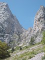
Note: if you’re not used to heights (well, for a hiker accustomed to mountainous terrain), it’s best to be careful: some sections are on quite a steep slope where it’s best to avoid cycling!
https://www.youtube.com/watch?v=dgRqgt3p...
This short film gives you an idea of the first section.
Crossing the Vercors via the Sentier Balcon


A relatively easy circular route that follows the balcony path running along the foot of the Vercors cliff from Saint-Nizier-du-Moucherotte to Gresse-en-Vercors.
You then climb up onto the plateau via the Col des Bachassons and return to theGR® via the Pas des Chatons, before heading to Corrençon-en-Vercors, where you will have left a car.
Details
Creation:
Last update:
Last review:
-
 Activity: Walking
-
 Distance: 49.75 mi
-
 Average duration: 4 days
-
 Difficulty: Difficult
-
-
 Back to start: No
-
 Ascent: + 12,359 ft
-
 Descent: - 12,490 ft
-
-
 Highest point: 6,332 ft
-
 Lowest point: 3,461 ft
-
 Country:
France
-

-
 City:
Saint-Nizier-du-Moucherotte (38250)
-
 Start: N 45.16857° / E 5.6305°
-
 End: N 45.02499° / E 5.51806°
-


 Hour-by-hour weather
Photos
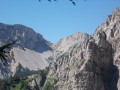


Stages of the route
This route needs several days, find the details below:
Notes
This route passes through multiple protected areas, which may be subject to special regulations:
Reviews and comments
5 / 5
Based on 1 review
Reliability of the description
5 / 5
5 / 5
Ease of following the route
5 / 5
5 / 5
Route interest
5 / 5
5 / 5

Joannès57
Overall rating : 5 / 5
Date of your route : Jul 25, 2016
Reliability of the description : ★★★★★ Very good
Ease of following the route : ★★★★★ Very good
Route interest : ★★★★★ Very good
Hello, I’ve just done this walk and it’s described very well. I skipped the first section, which I’d done last year and which isn’t particularly interesting in my view (it’s long, with lots of forest tracks and not many views), but I added Corrençon and Villard-de-Lans, where I’d set off from, as my car was parked at the Cochettes car park.
I’d just like to mention a rather significant water source: the Veymont fountain (marked on the IGN map), which is a short way before the Veymont forest hut. The climb up to the Pas des Bachassons marks the end of a long route, and this section is tough but stunning.
It’s true that there are a few sections where you need to be very careful.
A very beautiful route which certainly deserves to be classified as difficult. Don’t take beginners or people who aren’t fit. Well done on the description
As for accommodation, I took the risk of not bringing my tent and was able to sleep comfortably in Roybon, on my own at Peyrouse (sleeps 2) and at Les Aiguillettes (sleeps 4, but if worst comes to worst you can sleep on the floor). The paid lodge in Corrençon, at 15 euros a night, has the advantage of offering comfortable beds, a kitchen area and a shower at the end of the hike. Happy hiking to you all
Machine-translated

diogene412
Hello
Why don’t you stay in the huts mentioned in the description?
On the section from the Col de l’Arc down to just below the Pas de Berrieve, it would be rather tricky to pitch a tent
The terrain is steep!
Machine-translated
PAPYY
Hello everyone,
I’ve seen this hike and wanted to know where we can stay overnight, because with tents it looks really hilly – so is it possible to camp on this hike?
Kind regards
Machine-translated
Other walks in the area
Saint-Nizier-du-Moucherotte - Cabane de Roybon
 Visorando Member
 12.38 mi
+4,573 ft
-3,652 ft
9h 40
Difficult
Departure from Saint-Nizier-du-Moucherotte (Isère)
First stage of the circular route from Saint Nizier to Corrençon en Vercors, with a stop at the Cabane de Roybon below the Col Vert.Whilst the first part is easy, the section between Col de l’Arc and Col Vertis challenging, with sections over a sheer drop!Take great care.
Le Moucherotte starting from Saint-Nizier
 5.97 mi
+2,349 ft
-2,349 ft
4h 45
 Moderate
Departure from Saint-Nizier-du-Moucherotte (Isère)
Here is another route for climbing the Moucherotte, a little more challenging than the one starting from Lans-en-Vercors. The elevation gain is slightly greater and the route follows a mountain path that requires sturdy footwear. The 360° panorama is as stunning as ever, and the bird’s-eye view over the Grenoble basin is just as impressive.
Saint-Nizier-du-Moucherotte - La Fauge Shelter
 12.57 mi
+2,559 ft
-2,070 ft
8h 00
Difficult
Departure from Saint-Nizier-du-Moucherotte (Isère)
The second stage of the Vercors crossing, offering stunning views of the villages of the Vercors.
Circular walk around Saint-Nizier-du-Moucherotte
 3.92 mi
+778 ft
-787 ft
2h 30
Difficult
Departure from Saint-Nizier-du-Moucherotte (Isère)
This circular route takes you past several vantage points overlooking the 3 Pucelles.It features a tricky but short section – the passage beneath the cliff, which is narrow and steep but absolutely stunning. (Hence its ‘difficult’ classification).On this walk, you’ll have the chance to enjoy unique views of the village of Saint-Nizier-du-Moucherotte and the local farming landscape, without having to tackle the rather technical climbs of the Pas de la Corne and the Pas du Curé from Engins, or theGR®®9from La Tour sans Venin.
Saint-Nizier - Lans-en-Vercors circular via Le Moucherotte
 11.50 mi
+3,675 ft
-3,684 ft
8h 30
Difficult
Departure from Saint-Nizier-du-Moucherotte (Isère)
A fairly long circular route (20 km in reality) which takes you up the classic Moucherotte climb, but descends via the Pas de la Tinette, Les Jeux and Les Traverses, which are less well known.
The return from Lans-en-Vercors to Saint-Nizier is via a new, well-marked and well-maintained path, which keeps hikers away from the road.
The Coulou Pass, the Pas du Curé and the Pas de la Corne
 2.72 mi
+1,181 ft
-1,194 ft
2h 15
Moderate
Departure from Saint-Nizier-du-Moucherotte (Isère)
A short loop offering a pretty passage through the Défilé du Coulou gorge to reach the Pas du Curé before descending to the Engins dam and then, following the Furon river, reaching the Pas de la Corne climb via theGR®9.
Please note that there are some fairly technical sections in the Coulou Pass, with and without handrails. Please take great care
It is not possible to complete the loop; see the notices
Le Moucherotte
6.01 mi
+2,142 ft
-2,116 ft
4h 40
Difficult
Departure from Saint-Nizier-du-Moucherotte (Isère)
A fairly challenging hike starting from the Tremplin car park (built for the 1968 Grenoble Olympic Games) leading to the Moucherotte orientation table and its wonderful 360° panorama.
Le Moucherotte via Château Bouvier and the Trou Saint Michel
 Tourism professional
 9.94 mi
+5,279 ft
-5,295 ft
9h 10
 Very difficult
Departure from Saint-Nizier-du-Moucherotte (Isère)
A magnificent hike reserved for experienced walkers who are not daunted by steep slopes. The ascent from Château Bouvier offers lovely scenery, and there are rocky outcrops to negotiate as soon as you emerge from the woods. The Trou Saint Michel is equipped with straps and ropes to aid the descent.
Please read the route description carefully before setting out on this hike.
For more walks, use our search engine .
The GPS track and description are the property of this route's author. Please do not copy them without permission.

