Angélique en Coëvrons

 Tourist office
PRO  Premium user
Premium user Sign up:
Published route(s)
 Étiveau Route

 10.74 mi
 +449 ft
 -449 ft
 5h 20
5h 20
 Moderate
 Departure from Mézangers (Mayenne)
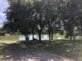
How about setting off on a walk from a peaceful pond, heading towards ancient hamlets? Here, nature shows you its best side, and you’ll discover magnificent views.
This 17 km route is suitable for walkers, horse riders and mountain bikers and is signposted “No. 21” on the yellow directional signs.
On the side of Mont Rochard
 7.30 mi
+837 ft
-807 ft
4h 05
Moderate
Departure from Sainte-Gemmes-le-Robert (Mayenne)
7.30 mi
+837 ft
-807 ft
4h 05
Moderate
Departure from Sainte-Gemmes-le-Robert (Mayenne)
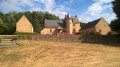
This route, which has little elevation gain, is an opportunity to discover typical villages and hamlets with rich granite architecture. This route is marked "No. 22" on the yellow directional signs.
Route de Pierre Fontaine
 5.00 mi
+682 ft
-669 ft
2h 55
5.00 mi
+682 ft
-669 ft
2h 55
 Easy
Departure from Sainte-Gemmes-le-Robert (Mayenne)
Easy
Departure from Sainte-Gemmes-le-Robert (Mayenne)
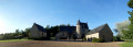
From Sainte-Gemmes-le-Robert, you can take a leisurely stroll along the slopes of Mont Rochard and enjoy the views of the lush green countryside. Along the way, you’ll discover the former manor house of Pierre Fontaine and some charming villages.
This route is signposted “No. 23” on the yellow directional signs.
Hambers circular
 9.19 mi
+820 ft
-814 ft
4h 55
Moderate
Departure from Hambers (Mayenne)
9.19 mi
+820 ft
-814 ft
4h 55
Moderate
Departure from Hambers (Mayenne)
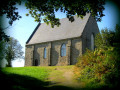
This 15 km route will take you through the magnificent sunken lanes of Hambers.
It is ideal for all nature lovers: on foot, by bike, or even on horseback!
This route is marked "No. 24" on the yellow directional signs.
Stone, water, forest and iron from Mézangers
 12.80 mi
+217 ft
-213 ft
6h 05
12.80 mi
+217 ft
-213 ft
6h 05
 Difficult
Departure from Mézangers (Mayenne)
Difficult
Departure from Mézangers (Mayenne)
This 20.5 km route invites you to linger over the beautiful granite architecture of the village of Mézangers and its superb Château du Rocher, to walk around the Étang du Gué de Selle pond while observing the rich surrounding flora and fauna, to cross the Bois d'Hermet woods and even take an ancient path.
This route is marked "No. 25" on the yellow directional signs.
Bouillé route
 5.12 mi
+436 ft
-427 ft
2h 45
Easy
Departure from Torcé-Viviers-en-Charnie (Mayenne)
5.12 mi
+436 ft
-427 ft
2h 45
Easy
Departure from Torcé-Viviers-en-Charnie (Mayenne)
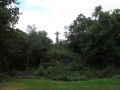
This route will take you to explore Bouillé Castle and the paths running along the edge of the Bois de la Grande-Charnie.
This route is signposted “No. 26” on the yellow directional arrows.
Tour de Viviers
 5.69 mi
+594 ft
-597 ft
3h 10
Easy
Departure from Torcé-Viviers-en-Charnie (Mayenne)
5.69 mi
+594 ft
-597 ft
3h 10
Easy
Departure from Torcé-Viviers-en-Charnie (Mayenne)
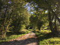
This route will take you to the edge of the Grande Charnie and allow you to explore the sunken paths of Torcé-Viviers-en-Charnie.
This route is signposted “No. 27” on the yellow directional arrows.
Between Erve and Charnie
 5.54 mi
+463 ft
-489 ft
2h 55
Easy
Departure from Sainte-Suzanne (Mayenne) (Mayenne)
5.54 mi
+463 ft
-489 ft
2h 55
Easy
Departure from Sainte-Suzanne (Mayenne) (Mayenne)
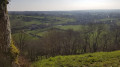
This 8.9 km route (marked yellow, no. 28) is particularly suited to walkers and mountain bikers. It combines exploring local heritage and sunken paths, and offers a glimpse of the Grande Charnie Forest.
The Table des Diables
 10.51 mi
+1,211 ft
-1,191 ft
5h 55
Moderate
Departure from Sainte-Suzanne (Mayenne) (Mayenne)
10.51 mi
+1,211 ft
-1,191 ft
5h 55
Moderate
Departure from Sainte-Suzanne (Mayenne) (Mayenne)
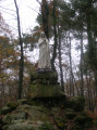
Come and discover the architectural and heritage treasures offered by this route and the sunken paths! You will get a glimpse of the Grande Charnie Forest. Marked route "No. 29".
This route can be combined with the "Tour de Viviers" route to reach Torcé-Viviers-en-Charnie.
Chammes route
 6.90 mi
+305 ft
-282 ft
3h 25
Moderate
Departure from Sainte-Suzanne (Mayenne) (Mayenne)
6.90 mi
+305 ft
-282 ft
3h 25
Moderate
Departure from Sainte-Suzanne (Mayenne) (Mayenne)
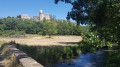
This route will take you along the hedgerow paths between Sainte-Suzanne and Chammes.
Around the town of Sainte-Suzanne
 4.26 mi
+213 ft
-240 ft
2h 10
Easy
Departure from Sainte-Suzanne (Mayenne) (Mayenne)
4.26 mi
+213 ft
-240 ft
2h 10
Easy
Departure from Sainte-Suzanne (Mayenne) (Mayenne)
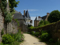
Come and discover the charming little paths north of Sainte-Suzanne. Along the way, you can visit the English camp (or Beugy camp) and enjoy a beautiful view of the Mayenne countryside.
Route of the three towns around Thorigné-en-Charnie
 8.53 mi
+358 ft
-361 ft
4h 15
Moderate
Departure from Thorigné-en-Charnie (Mayenne)
8.53 mi
+358 ft
-361 ft
4h 15
Moderate
Departure from Thorigné-en-Charnie (Mayenne)
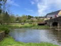
Here you will discover the rich heritage of the Coëvrons: chapels, churches, lime kilns and mills. This route will also reveal the beauty of our landscapes through the steep-sided paths, caves and Saulges canyon. You will also spot the unflappable aurochs!
Route from the Oratory starting from Saulges
 5.18 mi
+318 ft
-315 ft
2h 40
Easy
Departure from Saulges (Mayenne)
5.18 mi
+318 ft
-315 ft
2h 40
Easy
Departure from Saulges (Mayenne)
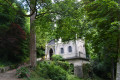
Following the marked trails, you will cross the Petite Cité de Caractère (Small Town of Character) of Saulges and enter the limestone walls of a superb canyon.
Saint-Pierre-sur-Erve walking route
 4.73 mi
+335 ft
-331 ft
2h 30
Easy
Departure from Saint-Pierre-sur-Erve (Mayenne)
4.73 mi
+335 ft
-331 ft
2h 30
Easy
Departure from Saint-Pierre-sur-Erve (Mayenne)
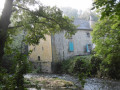
This 7.6km route is primarily aimed at walkers who want to take the time to discover the richness of our heritage.
La Vaudelle route in Izé
 5.82 mi
+358 ft
-348 ft
3h 00
Easy
Departure from Izé (Mayenne)
5.82 mi
+358 ft
-348 ft
3h 00
Easy
Departure from Izé (Mayenne)
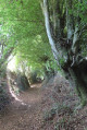
This route will take you through the hills of the Coëvrons and allow you to discover the beauty of the sunken paths in our region.
Route du Bois d’Izé
 5.80 mi
+269 ft
-249 ft
2h 55
Moderate
Departure from Izé (Mayenne)
5.80 mi
+269 ft
-249 ft
2h 55
Moderate
Departure from Izé (Mayenne)
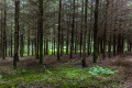
Come and explore the sunken paths of Izé and the surrounding area on this 8.6 km circular walk. This walk is signposted with yellow directional signs marked “No. 36 – Route du Bois d’Izé”.
You can combine this route with route no. 35: “Circuit de la Vaudelle”.
The Aron route starting from Bais
 11.04 mi
+764 ft
-778 ft
5h 45
Moderate
Departure from Bais (Mayenne) (Mayenne)
11.04 mi
+764 ft
-778 ft
5h 45
Moderate
Departure from Bais (Mayenne) (Mayenne)
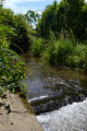
Come and explore the sunken paths of Bais, which will take you up to the ridges of Mont Rochard.Nearby, don’t miss a visit to Montesson Castle.This route is signposted No. 37 on yellow directional signs.
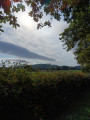
On the Hambers ridges
 11.77 mi
+610 ft
-584 ft
5h 55
Moderate
Departure from Hambers (Mayenne)
11.77 mi
+610 ft
-584 ft
5h 55
Moderate
Departure from Hambers (Mayenne)
This route will take you along pretty sunken paths and up into the hills. It is signposted with yellow directional signs: No. 38 – on the Crêtes d’Hambers. You can combine this route with No. 24 – the Hambers circular route.
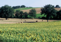
Hills and the Orthe Valley starting from Saint-Pierre-sur-Orthe
 12.37 mi
+1,188 ft
-1,194 ft
6h 45
Difficult
Departure from Saint-Pierre-sur-Orthe (Mayenne)
12.37 mi
+1,188 ft
-1,194 ft
6h 45
Difficult
Departure from Saint-Pierre-sur-Orthe (Mayenne)
A lovely walk with a succession of paths, sometimes through the forest and sometimes along sunken lanes. You will also follow a section of theGR®365.
This walk is signposted with yellow directional signs marked “No. 41 – Collines et vallée d’Orthe”