Bouillé route

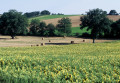
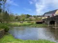
This route will take you to explore Bouillé Castle and the paths running along the edge of the Bois de la Grande-Charnie.
This route is signposted “No. 26” on the yellow directional arrows.

Details

1653956
Creation:
Last update:
Last review:
  • Walking
    Activity: Walking
  • ↔
    Distance: 5.12 mi
  • ◔
    Average duration: 2h 45 
  • ▲
    Difficulty: Easy

  • ⚐
    Back to start: Yes
  • ↗
    Ascent: + 436 ft
  • ↘
    Descent: - 427 ft

  • ▲
    Highest point: 892 ft
  • ▼
    Lowest point: 440 ft

Photos

Description of the walk

Start at the church square in Torcé-Viviers-en-Charnie.

(S/E) Walk round the back of the church, turn right onto the road towards Neuvillette-en-Charnie (D9) and follow it for about a hundred metres. Turn right into Rue de l’Avenir and continue along a path that skirts the lake.

(1) Cross the D9 with care, then the D161 (Route de Parennes), until you reach a track.

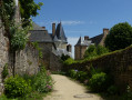
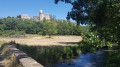
(2) Turn right and follow a wide track round Bouillé Castle.
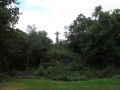
As you reach the departmental road via a small open area, take in the view of the gate (monumental entrance) and, on the other side of the road, the Tour du Trésor. Turn left to walk alongside the D161.

(3) Look for a small path on the right that crosses the plateau. At the junction between La Tellerie and Le Petit Fourneau, carry straight on. Cross the D9 with care and continue climbing towards the first patches of woodland at Bel-Air.

(4) Head down the D146 for a good 200 metres and turn left onto the Bel-Air forest track, which leads to the Haute-Croix-Mallard crossroads, skirting a lake.

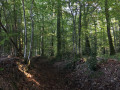
(5) Turn left to climb the forest track towards the Grande-Charnie ridge, a high barrier of Armorican sandstone quarried until the end of the 19th century to supply many of Paris’s cobblestones.

(6) At the junction, head down to the right towards Les Tuileries, follow the road to the left and turn right about a hundred metres further on.

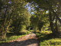
(7) Turn right onto a lovely path towards La Croix-Mallard, where you’ll rejoin the tarmac road. Then turn left.

(8) Follow the D146 to the left to head back down to the village of Torcé-Viviers-en-Charnie (S/E).

Waypoints

  1. S/E : mi 0 - alt. 528 ft - Torcé church square
  2. 1 : mi 0.43 - alt. 502 ft - Crossing the D9
  3. 2 : mi 0.67 - alt. 463 ft - Path on the right - Château de Bouillé
  4. 3 : mi 1.32 - alt. 476 ft - Path to the right of the D161
  5. 4 : mi 2.39 - alt. 666 ft - D146 turn right for 200m
  6. 5 : mi 3.06 - alt. 696 ft - Forest track to the left
  7. 6 : mi 3.43 - alt. 883 ft - Turn right towards Les Tuileries
  8. 7 : mi 4.12 - alt. 689 ft - Path to La Croix Mallard - Statue du Sacré-Coeur
  9. 8 : mi 4.64 - alt. 538 ft - D146
  10. S/E : mi 5.12 - alt. 525 ft - Church Square in Torcé

Notes

Torcé-Viviers-en-Charnie lake: covered playground, children’s play area, toilets.

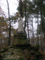
Between (6) and (7), you can take a detour via Tertre-Blanc, the highest point in the Charnie (286m), to see the statue of the Sacred Heart.

Find all the walks suggested by the Sainte-Suzanne les Coëvrons Tourist Office at www.coevrons-tourisme.com.

Worth a visit

Bouillé Castle, of which the 15th- and 16th-century remains can still be seen today, was devastated during the Hundred Years’ War and subsequently rebuilt on a grand scale. In addition to the remains of sections of fortified walls, the Treasury Tower (Archives Tower) still stands, heralding the Renaissance. It belonged to the de Bouillé family, whose prominence spanned mainly the 16th and 17th centuries. It is a rather complex site, as over the centuries many buildings have been added, including a motte, a fortified castle, a residential castle, a farm and even a lime kiln.

Statue of the Sacred Heart: this statue was erected in 1946, following a vow made by the parish priests and mayors of Torcé and Viviers during the last war. The work of the Parisian sculptor Ceras, it is made of solid-coloured concrete.
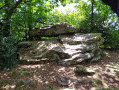
Remains of sandstone quarries nearby

Reviews and comments

4.4 / 5
Based on 3 reviews

Reliability of the description
5 / 5
Ease of following the route
4 / 5
Route interest
4.3 / 5
User 26389877

Overall rating : 4.3 / 5

Date of your route : Sep 15, 2025
Reliability of the description : ★★★★★ Very good
Ease of following the route : ★★★★☆ Good
Route interest : ★★★★☆ Good
Very busy route : No

:

Machine-translated

PHLNT72
PHLNT72

Overall rating : 4.3 / 5

Date of your route : Apr 14, 2025
Reliability of the description : ★★★★★ Very good
Ease of following the route : ★★★★☆ Good
Route interest : ★★★★☆ Good
Very busy route : No

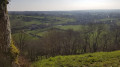
A lovely view of Les Coevrons along a section of the walk

Machine-translated

HIRONDELLE72
HIRONDELLE72

Thank you for your reply.
I’ll be doing that route again.

Machine-translated

Angélique en Coëvrons

Hello,
Thank you for your feedback, which will help us to improve the route.
See you soon in Les Coëvrons

Machine-translated

HIRONDELLE72
HIRONDELLE72

Overall rating : 4.7 / 5

Date of your route : Jun 08, 2023
Reliability of the description : ★★★★★ Very good
Ease of following the route : ★★★★☆ Good
Route interest : ★★★★★ Very good
Very busy route : Yes

On the other hand, perhaps there should be some signposting to the Sacré-Cœur statue
It’s well worth a short detour…
We discovered it...

Machine-translated

Other walks in the area

For more walks, use our search engine .

The GPS track and description are the property of this route's author. Please do not copy them without permission.