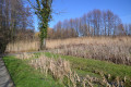
La Sauzaye Wetland

This walk will allow you to explore the Sauzaye de Chaponnay nature reserve. An easy walk, featuring some picturesque sections on stilts. Along the way, you’ll discover several ponds and their inhabitants. Sometimes in open country, sometimes in the woods, the path offers a variety of settings.
Please note: the trail is not accessible if it has rained recently.

Details

12418867
Creation:
Last update:
Last review:
  • Walking
    Activity: Walking
  • ↔
    Distance: 1.04 mi
  • ◔
    Average duration: 0h 30 
  • ▲
    Difficulty: Easy

  • ⚐
    Back to start: Yes
  • ↗
    Ascent: + 23 ft
  • ↘
    Descent: - 23 ft

  • ▲
    Highest point: 659 ft
  • ▼
    Lowest point: 633 ft
  • ⚐ Country: France
  • ⚐ City: Chaponnay (69970)
  • ⚑
    Start/End: N 45.633283° / E 4.921053°
  • ❏
    IGN map(s): Ref. 3032E
  • Hour-by-hour weather

Photos

Description of the walk

Park at the Ancien Moulin Serisiat, though other car parks are available for this walk.

(S/E) Turn left and follow the River Ozon. Pass under the power line and, directly beneath it, you’ll find a crossroads of paths.

(1) Take the path on the right. Cross the woodland and, once you’ve emerged, you’ll reach the junction with the Allée des Vergers.

(2) Turn right here to quickly reach the area of reed beds and watercress beds. Continue to the right along the Allée des Passerelles to re-enter the woods.

Carry on along the footbridges until you reach a path that leads to a junction: turn left to return to the Ancien Moulin car park (S/E).


Waypoints

  1. S/E : mi 0 - alt. 636 ft - Car park at the Old Serisiat Mill. Towards the - Ozon (ruisseau) - Affluent du Rhône
  2. 1 : mi 0.3 - alt. 646 ft - Power line junction
  3. 2 : mi 0.6 - alt. 659 ft - Allée des Vergers junction
  4. S/E : mi 1.04 - alt. 636 ft - Car park at the Old Serisiat Mill

Notes

Cycling is not permitted on this trail. There are designated areas where you can lock up your bikes.

(S/E) You can head straight to the observation hut, which offers a view over one of the ponds where you can spot wildlife.

Between (2) and (S/E), you can wander along the various trails in search of frogs and toads.

Worth a visit

Fitness trail park.

Reviews and comments

3.9 / 5
Based on 3 reviews

Reliability of the description
3.7 / 5
Ease of following the route
5 / 5
Route interest
3 / 5
User 28307979

Please note that dogs are not permitted on this route, even if kept on a lead

Machine-translated

liliane.clarens
liliane.clarens

Overall rating : 4.7 / 5

Date of your route : Feb 07, 2024
Reliability of the description : ★★★★★ Very good
Ease of following the route : ★★★★★ Very good
Route interest : ★★★★☆ Good
Very busy route : No

The start is marked by a sign from the town council, setting off from the Lino Ventura Hall towards the Allée des Prairies; from there, you’re transported to a completely different world of absolute tranquillity as you walk along paths on stilts and through a small wood.
Many thanks to the author for this surprising discovery – one well worth repeating in its entirety when the weather is fine.

Machine-translated

Caloutte
Caloutte

Overall rating : 4.7 / 5

Date of your route : Sep 24, 2023
Reliability of the description : ★★★★★ Very good
Ease of following the route : ★★★★★ Very good
Route interest : ★★★★☆ Good
Very busy route : No

We were unable to set off from the planned starting point on the site: a flooded section prevented us from reaching the main path, so we went via the Fontaines car park and the Allée des Prairies to reach point 2 on the route. After that, we had no problems on this pleasant, refreshing little walk.

Machine-translated

the_dahu
the_dahu
• Edited:

Hello,
On 3 and 4 October, the equivalent of more than a month’s worth of rain fell in 24 hours… As this is a floodplain, it acted as a buffer to prevent towns along the Ozon, such as St Symphorien d’Ozon, from being flooded.
At this time of year, it is not surprising that it takes time for more than a month’s worth of rain to drain away, as the ground is saturated and evaporation is more limited.

You were unlucky to have visited in the wake of an exceptional weather event that took place a few weeks earlier. Otherwise, the site is accessible all year round when weather conditions remain normal.

Kind regards.

Machine-translated

SPEEDWHIP
SPEEDWHIP

Overall rating : 1 / 5

Date of your route : Oct 21, 2021
Reliability of the description : ★☆☆☆☆ Very disappointing
Ease of following the route : Not used / Not applicable
Route interest : ★☆☆☆☆ Very disappointing
Very busy route : No

Walk impossible
From the starting point (car park), you cross a small bridge about ten metres long and arrive at an area… that is flooded (even though it hadn’t rained for a fortnight or more), which is impassable even in wellies.
It might be fine in summer or during a dry spell (but on that particular day it was inaccessible), when it would simply be a ‘wetland’

Machine-translated

Other walks in the area

For more walks, use our search engine .

The GPS track and description are the property of this route's author. Please do not copy them without permission.