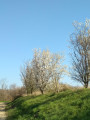
Around the Mions water tower

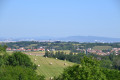
A lovely little one-hour walk in the hills above Mions, offering views of the town, the countryside and the Pilat massif.

Details

11566621
Creation:
Last update:
Last review:
  • Walking
    Activity: Walking
  • ↔
    Distance: 1.70 mi
  • ◔
    Average duration: 0h 55 
  • ▲
    Difficulty: Easy

  • ⚐
    Back to start: Yes
  • ↗
    Ascent: + 128 ft
  • ↘
    Descent: - 128 ft

  • ▲
    Highest point: 866 ft
  • ▼
    Lowest point: 738 ft
  • ⚐ Country: France
  • ⚐ City: Mions (69780)
  • ⚑
    Start/End: N 45.65945° / E 4.953741°
  • ❏
    IGN map(s): Ref. 3032E
  • Hour-by-hour weather

Photos

Description of the walk

Park at the kerb on Rue de la Libération.

(S/E) Cross the road at the pedestrian crossing and take the Sentier du Patre, which climbs up opposite the kebab shop.

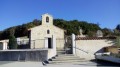
(1) Turn right. If you turn left, you’ll end up at La Madone. You’ll have to turn back as this is a dead end. Turn right-angle onto the Chemin de la Madone.

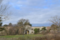
(2) Turn left onto Rue des Érables; you’ll then have a lovely view of the Pilat on your way back. Follow this road, which will take you past Mions Castle. Turn right twice, then left onto Chemin de Chatenay, passing under the power lines. You’ll come to the large oak trees.

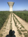
(3) Turn right, passing the water tower. Turn right immediately afterwards, heading towards the electricity pylon. Walk down past the vineyards and turn right, heading towards another electricity pylon. Continue along the path to the gate leading onto Rue des Érables. Then turn right to retrace the section you covered on the way out.

(2) Follow the outward route in the opposite direction, back to the car park on Rue de la Libération (S/E).

Waypoints

  1. S/E : mi 0 - alt. 738 ft - Car park on Rue de la Libération
  2. 1 : mi 0.12 - alt. 807 ft - Chemin de la Madone
  3. 2 : mi 0.29 - alt. 804 ft - Junction at the end of the circular loop
  4. 3 : mi 0.79 - alt. 853 ft - Turn right at the fork
  5. S/E : mi 1.7 - alt. 738 ft - Car park on Rue de la Libération

Notes

(S/E) The car park is right next to the kebab shop

Reviews and comments

4.3 / 5
Based on 3 reviews

Reliability of the description
4.7 / 5
Ease of following the route
4.7 / 5
Route interest
3.7 / 5
User 27056006

Overall rating : 4 / 5

Date of your route : Oct 20, 2025
Reliability of the description : ★★★★☆ Good
Ease of following the route : ★★★★★ Very good
Route interest : ★★★☆☆ Average
Very busy route : No

A pleasant walk. One small drawback if you are physiologically sensitive to electricity pylons, as you have to pass very close to them.
I was able to let my dog off the leash for most of the walk.
It took me 30 minutes to complete the route (at a moderate pace).
Thank you!

Machine-translated

User 27514145

Overall rating : 4.3 / 5

Date of your route : Sep 11, 2025
Reliability of the description : ★★★★★ Very good
Ease of following the route : ★★★★☆ Good
Route interest : ★★★★☆ Good
Very busy route : Yes

Do not look for the water tower, it is a buried building; only the lid of the tank protrudes from the ground and is only visible when we are close by.
A very gentle walk but with views of Lyon and Pilat.
You may wish to bring your binoculars.

Machine-translated

liliane.clarens
liliane.clarens
• Edited:

Overall rating : 4.7 / 5

Date of your route : Feb 07, 2024
Reliability of the description : ★★★★★ Very good
Ease of following the route : ★★★★★ Very good
Route interest : ★★★★☆ Good
Very busy route : No

From the city to the countryside, with panoramic views of the Pilat massif and the Lyon metropolitan area, and a walk along the edge of fields that are currently being ploughed.
Thanks to the author for this little countryside stroll
P.S. At No. 1, turn left to admire a beautiful statue of the Virgin Mary overlooking the village and the surrounding plain.1

Machine-translated

Other walks in the area

For more walks, use our search engine .

The GPS track and description are the property of this route's author. Please do not copy them without permission.