Country:
 City:


(S/E) From the car park at the Kandertalhalle in Wollbach, follow Schulstrasse 12 – with the school and community hall on your left – then take the first street on the left, Am Forsthausgarten. At the end of the street, turn right.
(1) In front of the town hall (Gemeindeverwaltung), turn left uphill onto Egisholtzerstrasse. At the next junction, turn left and walk past the cemetery. Continue straight on until you reach the small access road to the Rüttehof farm inn.
(2) Follow the road opposite for about a hundred metres, then carry on straight ahead until you reach the third path after the road leading to the farm.
(3) Turn right towards the village of Egisholz. Walk straight on through the village, up a steep hill, until you reach the edge of the forest.
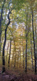
(4) Turn right and walk 50 metres. Further on, enter the forest on the left. At the next junction, take a lovely path on the right, which crosses the Buchholen forest, this time heading downhill.
(5) After the clearing, first turn left then right, then carry on straight ahead to reach a barbecue area, picnic spot and shelter.
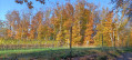
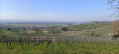
(6) Carry on straight ahead and, at the next junction, turn left onto a path that runs alongside the vineyards. Follow the path to the end and turn right. Just before you reach the road linking Wollbach and Egerten, look out for the rear courtyard of the Kreiterhof on the left. See ‘Places to visit’.
(7) Do not take the road, but take the path just before the road, on the right, which stays slightly higher up. Continue straight on until the end of the path. Turn left, then immediately right, and continue to the end of the street.
(8) Turn left, then right, and follow Postgasse. Pass the church on your right and turn left back onto Schulstrasse. Follow it to the car park (S/E).
 Visorando Member

 Moderate