From Calais to Wimereux via the GR®120

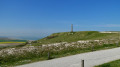
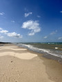
Stretching 42 km, this route will take you on a journey through the varied landscapes of the Opal Coast: its vast beaches, its opal-coloured sea, its dunes and its quirky villages.

Ideal for those who enjoy long-distance walks, the route can nevertheless be adapted to suit your preferences and abilities.

Please note: the suggested walk is a one-way route and not a circular route.

Details

35259822
Creation:
Last update:
Last review:
  • Walking
    Activity: Walking
  • ↔
    Distance: 25.51 mi
  • ◔
    Duration according to the author: 10 hrs 
  • ▲
    Difficulty: Very difficult

  • ⚐
    Back to start: No
  • ↗
    Ascent: + 1,102 ft
  • ↘
    Descent: - 1,102 ft

  • ▲
    Highest point: 476 ft
  • ▼
    Lowest point: 7 ft
  • ⚐ Country: France
  • ⚐
  • ⚐ City: Calais (62100)
  • ⚑
    Start: N 50.966484° / E 1.843947°
  • ⚑
    End: N 50.770416° / E 1.612101°
  • ❏
    IGN map(s): Ref. 2103ET, 2104ET
  • Hour-by-hour weather

Photos

Description of the walk

(S) The walk starts at the eastern end of the Gaston Berthe sea wall in Calais. There are plenty of car parks where you can leave your car (bearing in mind that the route is one-way, although you can turn back if you wish). Bus services run to the sea wall from the surrounding villages.

(1) Continue to the end of the sea wall.

(2) Turn right to reach the beach. Once on the beach, turn left and continue towards Sangatte.

(3) After about 1 km on the sand, take a narrow path on your left through the Sangatte dunes.

(4) Continue along the path through the dunes. Follow the clearly visible red and white markings ofthe GR®120.

(5) At the end of the path, turn right to reach the Sangatte sea wall.

(6) A few metres before the end of the sea wall, take the steps on the left to reach the village of Sangatte. Continue until you reach the Latham car park.

(7) Walk to the far end of the car park. Cross the small road (marked with red and white markings) and take the path. You will reach a first junction

(8) Take the path on the right. You’ll come to a road.

(9) Turn right towards Cap Blanc-Nez.

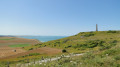
(10) TheGR®120does not pass by the Cap Blanc-Nez obelisk: however, you can easily reach it in a few minutes. It offers a magnificent view of the surrounding countryside.
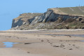
To continue on theGR®120, go down the steps on the left after passing the car park. The path descends to the foot of Cap Blanc-Nez.

(11) Carry on along the path opposite until you reach the end of the trail.

(12) Go down the steps to reach the beach. Check the tide times. Carry on to the Wissant sea wall. Follow it to its end.

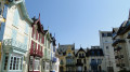
(13) Turn left onto Rue des Mouettes, following the signposts. The path takes you through the quirky village of Wissant, before joining a sandy track leading to the beach.

(14) Keep an eye on the tide times. Carry on like this for 1.5 km. Take a small (barely visible) path in the sand on your left. There are several possible entry points along the route to join theGR®120trail. You’ll reach the Tardinghen car park.

(15) Carry on straight ahead along the small country road.

(16) A few metres after the start of the path, take the track on your right. Signs for theGR®120are located here. You’ll reach the La Sirène restaurant.

(17) At the bottom of the stairs, take the road on the left to follow theGR®120.
I’d recommend taking a detour via Cap Gris-Nez. The round trip adds an extra 2 km: simply take the path opposite and follow the trail. You’ll arrive at the Cap Gris-Nez site, which has plenty of viewpoints well worth a visit.

(18) After a few minutes’ walk, take the path to the right. The signposting is always clearly visible.

(19) Follow the path along the coast. If you keep a sharp eye out, you might spot some seals in the sea.

(20) Walk through the village of Audresselles. Head down to the seaside.

(21) Carry on along the beach for a few kilometres.

(22) Head up onto the Ambleteuse sea wall when you reach it. Continue along the sea wall.

(23) At the end of the sea wall, take the road on the left. Continue for 200 metres until you turn onto a path on the right.

(24) Follow the signposts through the village to reach the end of the path.

(25) You’ll come out onto a main road.
There are several options:
- follow the main road for almost 2 km until you reach a car park,
- or carry on along the path through the Slack dunes,
- at low tide, walk along the beach,
to reach the Slack car park.

(26) Take the path through the dunes to reach the Pointe aux Oies car park

(27) Take the path that branches off to the right.

(28) The path leads to a road. Turn right.

(29) Go down the steps leading to the Wimereux sea wall and finish this route at the foot of the Wimereux stone bridge (E).

Waypoints

  1. S : mi 0 - alt. 23 ft - Calais sea wall
  2. 1 : mi 0.52 - alt. 23 ft - Calais sea wall
  3. 2 : mi 0.89 - alt. 26 ft - Beach
  4. 3 : mi 1.58 - alt. 10 ft - Blériot-Plage
  5. 4 : mi 2.42 - alt. 13 ft - Sangatte
  6. 5 : mi 3.52 - alt. 20 ft - Sangatte sea wall
  7. 6 : mi 4.97 - alt. 10 ft - End of the sea wall
  8. 7 : mi 5.5 - alt. 79 ft - Hubert Latham car park
  9. 8 : mi 6.58 - alt. 436 ft - Les Noire Mottes
  10. 9 : mi 7.07 - alt. 472 ft - Mont-d’Hubert - Mont d'Hubert
  11. 10 : mi 7.47 - alt. 394 ft - Cap Blanc-Nez - Cap Blanc-Nez
  12. 11 : mi 8.21 - alt. 82 ft - Le Cran d’Escalles
  13. 12 : mi 9.54 - alt. 23 ft - Strouanne Beach
  14. 13 : mi 11.73 - alt. 33 ft - Wissant sea wall
  15. 14 : mi 12.66 - alt. 13 ft - Aval Dunes
  16. 15 : mi 13.68 - alt. 20 ft - Châtelet Dunes
  17. 16 : mi 13.91 - alt. 23 ft - The Berniques Trail
  18. 17 : mi 15.15 - alt. 39 ft - La Sirène Restaurant - Cap Gris-Nez
  19. 18 : mi 15.53 - alt. 128 ft - Framezelle
  20. 19 : mi 18.72 - alt. 39 ft - Coastal Path
  21. 20 : mi 19.25 - alt. 39 ft - Audresselles
  22. 21 : mi 19.37 - alt. 20 ft - Audresselles Beach
  23. 22 : mi 20.28 - alt. 26 ft - Ambleteuse seawall - Slack (fleuve)
  24. 23 : mi 20.71 - alt. 23 ft - Streets of Ambleteuse
  25. 24 : mi 20.93 - alt. 82 ft - Coastal Route
  26. 25 : mi 21.51 - alt. 62 ft - Main road
  27. 26 : mi 23.49 - alt. 49 ft - Slack Dunes car park
  28. 27 : mi 23.91 - alt. 49 ft - Pointe aux Oies car park
  29. 28 : mi 24.72 - alt. 125 ft - Football stadium
  30. 29 : mi 25.05 - alt. 75 ft - Wimereux sea wall
  31. E : mi 25.51 - alt. 23 ft - Stone bridge at the - Wimereux (fleuve)

Notes

The route is signposted as the GR®120, red and white. The walk presents no particular difficulties, apart from the distance. Signposting is clearly visible throughout the walk.

Please be aware of tide times.

The path passes through numerous villages: toilets are available at regular intervals (Calais, Sangatte, Escalles, Wissant, Wimereux).

Worth a visit

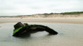
(1) The Dragon of Calais
(10) Cap Blanc-Nez Obelisk
(13) The village of Wissant
(17) Viewpoint at Cap Gris-Nez

Always be cautious and plan ahead when you're outdoors. Visorando and the author of this route cannot be held responsible for any accidents occurring on this route.

The GR® and PR® markings are the intellectual property of the Fédération Française de Randonnée Pédestre.

Reviews and comments

4.5 / 5
Based on 2 reviews

Reliability of the description
4.5 / 5
Ease of following the route
4 / 5
Route interest
5 / 5
VIVELARETRAITE
VIVELARETRAITE
• Edited:

Overall rating : 4.3 / 5

Date of your route : Jul 11, 2026
Reliability of the description : ★★★★☆ Good
Ease of following the route : ★★★★☆ Good
Route interest : ★★★★★ Very good
Very busy route : Yes

Please note that this route is very challenging, not only because of its length but also due to the elevation gain
The Visorando page states an elevation gain of 336 metres; in fact, it is 957 metres
We were equipped with a hiking GPS, which enabled us to follow the route easily.
As for the bus route, it’s the 427, a regular service in the Nord-Pas-de-Calais region.

Machine-translated

lippocampe
lippocampe

Overall rating : 4.7 / 5

Date of your route : Mar 30, 2024
Reliability of the description : ★★★★★ Very good
Ease of following the route : ★★★★☆ Good
Route interest : ★★★★★ Very good
Very busy route : No

Very easy, scenic and varied, and accessible by train.
At point 7, you can also follow the PR path, which runs along the coast and takes you straight to Cap Blanc Nez.
I recommend spending the night in Audresselles, a charming village.
At point 26, I think it’s nicer to follow the route through the Dunes de la Slack.
From Wimereux, you can reach Boulogne SNCF station in 1 hour 30 minutes.

Machine-translated

bernardino
bernardino ★

Hello
It is true that the author did not suggest returning; however, he did mention the following:
Bus routes run to the sea wall from the surrounding villages.
It would be much clearer if he included a link to these coach companies.
Thank you for pointing that out.

Machine-translated

virgule
virgule

Hello,

How do we go about returning it?

Machine-translated

Other walks in the area

For more walks, use our search engine .

The GPS track and description are the property of this route's author. Please do not copy them without permission.