


 Country:
 City:
City:


Access: D164, towards Hennezel, Lemoine Parquetry car park (park as far away from the parquetry workshop as possible).
(S/E) From the car park, follow Rue de la Gare (D164) to the left, towards Darney (take care).
Walk past the wayside shrine and be sure to admire it (take care, as it is close to the road).
(1) At the entrance to the town, go down a flight of steps on the left, cross the footbridge to reach Rue des Fabriques, turn right onto it and follow it until you reach the steps on the left. Go up the steps and, at the top, turn right then cross the park to reach Place du Château.
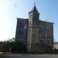
(2) Walk past the castle, going round Place Barbier. Leave the square by turning left onto Rue du Château, then left onto Rue de la Collégiale to reach the steps, which you go down. Return to Rue des Fabriques on the right and follow it until you reach a three-way junction.
At the three-way junction, turn right onto Côte Marchand and follow it until you reach the Route d’Attigny. As you go, walk past the Delisvosges sweet factory. At the road, follow it to the right (take care).
(3) Turn left towards the Franco-Czechoslovak monument. Walk round it, exit via the entrance and go round the site on the right.
(4) Follow a path through the fields which turns left (this path may be obscured by the crops). Follow this path straight on for approximately 1,500 metres, heading south, until you reach the road that descends to the right towards Attigny. Enter Attigny and head down to the church.
(5) Turn right after the wash house onto Rue de Monthureux and continue along this street until you reach the village hall. Leave the road, cross the car park on the left and take a path between the village hall and the stream.
(6) Please note: along a clearing, the path branches off to the right alongside a high wall, crosses a field and, via a turnstile, joins a track a few metres further on.
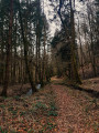
(7) Follow this sunken, grassy path to the left. At the junction of forest tracks, continue straight ahead, heading south-west, along the Route Forestière du Petit Bois
(8) At the road in the hamlet of Grange Huard, turn left, cross the Saône, then the D5, and continue straight ahead up a short, steep slope. Pass in front of the Cabiole farm and carry on until you reach a wide forest track, which you follow to the right, downhill, to the D5.
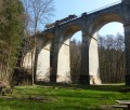
(9) At the road, turn left (take care), cross the first small road bridge, and carry on to the railway viaduct known as the Pont Tatal.
(Alternative route: after crossing the road bridge, you can reach Pont Tatal via a short, picturesque path running alongside the River Ourche below the road (involves walking down a slope).
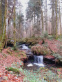
(10) Beneath the Pont Tatal, there are picnic tables, access to the stream and a climbing area.
Leave the site by retracing your steps until you reach the road, cross it and continue along a wide path opposite, which you immediately leave via a path that climbs to the left (marked with a Red Triangle) until you reach a wide track (former railway line), which you follow to the left to reach the Pont Tatal.
After crossing the bridge and admiring the picnic area from above, leave the old railway track via the path on the right, which climbs slightly to a small bridge, and carry on until you reach the Cabiole cutting.
(11) Follow this white track until you reach a forest road, which you follow to the left.
(12) You’ll arrive at a car park. Be careful not to take the Quatre Mares nature trail, which leads back to the car park. Turn right onto the Tranchée des Quatre Mares (dirt track) and carry on straight ahead. The path becomes grassy; head downhill and, once at the bottom, follow the path to the right.
(13) Please note: right next to a viewpoint, take the path on the left and head downhill until you reach a wider path, which you take to the left. Continue downhill until you come to another white track; take this to the right to reach the ‘Tranchée de Coné de Chèvre’. Turn sharply left.
(14) After this right-angle bend, take the second small path on the right which leads into the woodland. Follow it straight on until you reach the large Tranchée de l’Étang de la Chesnaye, which you follow to the right (passing a pond on your left-hand side; private property).
(15) At the end of this dirt track, where the track widens, turn left onto a path that is barely visible at first, which descends northwards towards La Grange au Bois.
When you reach the tarmac road, follow it to the left and carry on straight ahead until you reach the D164, which you take to the left until you reach the car park (Take care) (S/E).




 Visorando Member
 Tourism professional
 Easy
Easy 
 Difficult
