Country:

 City:


Coming from the Tinée Valley, park in the Port car park at the entrance to La Bolline.
(S/E) From the car park, take the only road leading uphill, known as the “Route du Chalvin”, which, after a few metres, turns into a path paved with stones cut from reddish-coloured pelite rock. The path climbs straight away through a beautiful forest with a variety of tree species. Yellow markings are in place. Continue to the crossroads at marker 152. (Please note that marker 152 is incorrectly positioned on the map; it is 100 metres further on, past the small hamlet.)
(1) At marker 152, after the small hamlet, turn left towards Rimplas.
(2) At the barely visible path junction, carry on straight ahead. Magnificent views to the west and over the Tinée valley.
(3) At marker 159, the ‘Carrière de la Brune’ junction, continue towards Rimplas.
(4) At marker 158, continue towards Rimplas. Here there is a water reservoir, from which water flows along the path to supply the village of Rimplas; there are sweeping views down over Rimplas. Continue down the slope to the tarmac road, which marks the eastern edge of the village of Rimplas.
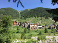
(5) Follow the tarmac road down towards the village centre until you reach the first hairpin bend. Pass this and then turn right onto the steps to reach the village centre, a veritable sentinel overlooking the valley below. At the end of the steps, turn left onto Ruelle des Zuorts. Take the time to wander through the village’s streets and alleys, taking in the colours, shapes and wall decorations, and discover the works of art by Serge Doglio, the village artist.
(6) Below the village, turn left, heading due east, onto Promenade Saint-Roch. Marker 153 is situated just in front of the chapel. Leave the road and follow the signs for La Bolline. After about twenty metres, at marker 153a, continue in the same direction; a long descent into the valley begins. When you reach the track, follow it down. Change of markings: say goodbye to the yellow markings; follow the white and red markings ofthe GR®5andGR®52.
(7) The path resumes at the level of, and to the left of, a private property.
(8) Cross and walk down the Route de la Colmiane with care, continuing to the next hairpin bend.
At signpost 154, follow the signs for La Bolline. Leave the road at this bend. About twenty metres further on, the path begins on the right
(9) Cross an old bridge, then take an old, wide cobbled track on the right. At the crossroads marked by signpost 150, turn right towards Chapelle Saint-Donat. Continue along this ascending path to the chapel.
(10) Behind the chapel, a crossroads of paved slanting streets, dating back to ancient times, branches off to the left. You will follow this after visiting the area around the chapel. The view of Rimplas from this spot is captivating. Walk back behind the chapel.
(10) Take the Chemin du Villar.
(11) At signpost 149, continue straight on towards La Bolline. At the entrance to La Bolline, turn left at signpost 148, still heading towards La Bolline.
(12). Cross the Route de la Colmiane with care, take the Rue du Bial opposite and stroll through the streets of La Bolline, heading north, to return to the car park (S/E).

 Visorando Member
 Easy

 Moderate
 Very difficult
 Association / Club / Walk leader