Mont Giraud

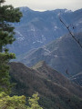
A superb hike, though very demanding. The route, which crosses a mountain zone as far as the Rimplas dairy, quickly becomes alpine from the ascent to the Pas de Rimplas. At the summit of Mont Giraud, your efforts will soon be forgotten and you will be rewarded with the magnificent panorama stretching from the Queyras and Mont Viso in the north to the Argentera and the Mercantour in the east.

Details

12578422
Creation:
Last update:
Last review:
  • Walking
    Activity: Walking
  • ↔
    Distance: 9.34 mi
  • ◔
    Duration according to the author: 10 hrs 
  • ▲
    Difficulty: Very difficult

  • ⚐
    Back to start: Yes
  • ↗
    Ascent: + 5,217 ft
  • ↘
    Descent: - 5,180 ft

  • ▲
    Highest point: 8,537 ft
  • ▼
    Lowest point: 3,320 ft

Photos

Description of the walk

Start at the car park in the village of Rimplas.

Yellow signposting

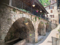
(S/E) From the car park, take the narrow, paved, stepped lane that climbs towards the north of the village – marker 157a.

(1) Turn right and join the Route du Serre at a bend; continue along this road to the end.

(2) The path begins to the right of a transformer; start a fairly steep climb heading north and reach two ruined chalets – marker 158a.

(3) At the marker, stay on the path on the right, continuing northwards; pass marker 158, go over a reservoir and reach marker 159.

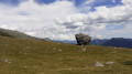
(4) Leave the Rouagne path on your right. Follow the signs for Les Vacheries de Rimplas. Enter a wooded area that runs very close to the Cime de Ballour. At an altitude of around 2,000 metres, follow an almost flat path to Las Planas. A large, isolated boulder serves as a landmark here.

(5) At the large rock, the path continues eastwards towards the Millefonts cattle pastures. From the rock, facing north-west, cut across the meadow for about 200 m to find marker 160 and the Vacherie de Rimplas, which is not visible from this point.

Red markings – cairns

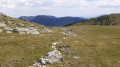
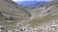
(6) Pass to the left of the last building at the dairy, and heading north, begin the ascent towards the Pas de Rimplas. Follow the red markings and cairns carefully and reach this pass without difficulty.

No signposting

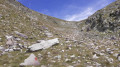
(7) At the pass, face the western ridge of Mont Giraud. Begin a gruelling climb up the very steep grassy slope (there is no real path). At the top of this steep climb, you’ll find the summit, topped with an aerial and a cross.

(8) Follow a narrow, almost flat ridge path to reach the summit of Mont Giraud.

(9) At the summit of Mont Giraud, enjoy a superb panorama stretching from Mont Viso in the north to the Vallée des Merveilles in the east, taking in the Argentera and Mont Gélas. The descent follows the reverse route of the ascent to (S/E).

Waypoints

  1. S/E : mi 0 - alt. 3,320 ft - Rimplas car park
  2. 1 : mi 0.11 - alt. 3,432 ft - Marker 157a
  3. 2 : mi 0.35 - alt. 3,586 ft - Transformer
  4. 3 : mi 0.76 - alt. 4,081 ft - Marker 158a – Le Serre
  5. 4 : mi 1.22 - alt. 4,642 ft - Marker 159 – towards Vacherie de Rimplas
  6. 5 : mi 3.15 - alt. 6,709 ft - Isolated rock outcrop
  7. 6 : mi 3.3 - alt. 6,818 ft - Marker 160: Rimplas Dairy
  8. 7 : mi 4.22 - alt. 8,015 ft - No Rimplas
  9. 8 : mi 4.4 - alt. 8,346 ft - Western ridge of Mont Giraud
  10. 9 : mi 4.71 - alt. 8,537 ft - Mont Giraud
  11. S/E : mi 9.34 - alt. 3,356 ft - Rimplas car park

Notes

On the return journey, descend with extreme caution along the section between points (8) and (7)

? Mountain kit, including good walking boots, warm clothing and sun protection.
? Make sure you have enough water.

Worth a visit

  • Rimplas.
  • Rimplas Fort.
  • La Bolline.
  • Saint Dalmas Valdeblore.
  • Rimplas Dairy.
  • Rimplas Pass.
  • Mont Giraud.

Reviews and comments

4.7 / 5
Based on 2 reviews

Reliability of the description
5 / 5
Ease of following the route
4.5 / 5
Route interest
4.5 / 5
JLouisA
JLouisA

Overall rating : 4.7 / 5

Date of your route : Jun 16, 2025
Reliability of the description : ★★★★★ Very good
Ease of following the route : ★★★★★ Very good
Route interest : ★★★★☆ Good
Very busy route : No

Route with magnificent views
Walking time: 6.5 hours

Machine-translated

fontaolive
fontaolive
• Edited:

Overall rating : 4.7 / 5

Date of your route : Sep 19, 2021
Reliability of the description : ★★★★★ Very good
Ease of following the route : ★★★★☆ Good
Route interest : ★★★★★ Very good
Very busy route : No

A really lovely, challenging walk. We only came across two people on this Sunday in September 🤗!!.
Just one thing to note: at La Vacherie de Rimplas, when you head left from the last building, the red markings and cairns are nowhere to be found!!! No problem, though, as the tricky climb can be tackled either by heading in a straight line or (my choice) along the ridge line, which you always have on your left from La Vacherie when looking towards Mont Giraud opposite.... What a 360° view – wow 👍.

Machine-translated

Other walks in the area

For more walks, use our search engine .

The GPS track and description are the property of this route's author. Please do not copy them without permission.