


 Country:

 City:


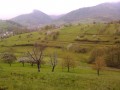
Start in Triembach-au-Val, on the square in front of the town hall and the school. Parking is available nearby in the village hall car park (Rue Saint-Gilles).
(S/E) With your back to the town hall, turn right onto Rue des Guerriers, which climbs past the school.
(1) At the top of this street, you’ll come to a Y-junction marked by a cross. Head right (Blue Saltire signposting) along a grassy path that climbs quite steeply. Once at the top, turn right onto a path leading into the forest.
Further on, the path veers left along the edge of a meadow, then turn left (Red Ring markings). Next, turn right to pass in front of an aerial.
At the next junction, carry on straight ahead (Red Ring) and enjoy an unobstructed view of Villé.
(2) At the next junction, turn sharply right (marked with a Red Cross). Go through a gate and continue along the main path for about 200 m until you reach the next junction.
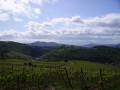
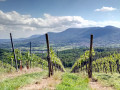
(3) Turn left towards Albé, following the Blue Saltire and Red Disc markings. Ignore the turnings to the right and left to reach Albé via the higher ground. There’s a lovely view of the vineyards. Continue along the main road on the right, Rue de l’Erlenbach, towards the church and carry on to Vins Barthel.
(4) Turn left onto Rue de l’Église, following the Red Saltire signpost, and cross the bridge over the River Erlenbach. Then turn immediately right onto Rue du Baechling, towards “Chemin des Ânes”. At the last houses, turn left (Red Saltire signpost). Continue along the forest track, which climbs for quite a while, until you reach the spot known as Sohlkreuz (bench + cross), where you can once again enjoy a lovely view of the Albé vineyards.
(5) Carry on straight ahead, then follow the Red Saltire signposting down towards Breitenbach. (Ignore the Red Rectangle signposting which heads towards Villé via the Chemin des Ânes)
(6) As you emerge from the forest, carry on straight ahead for a short round trip to a cross, where you can enjoy a lovely view of Breitenbach.
(7) Return to the fork in the path with the bench and the hut.
(6) Turn right onto the path marked with a Red Ring, which runs on level ground through the orchards above Breitenbach.
(8) At the hairpin bend with a bench known as the ‘Banc des Retraités’, head straight on, following the Yellow Cross and Red Disc markings, along the ‘Sentier de l’Exilé Volontaire’. You’ll reach the Grotte de la Vierge.
(9) Take the path below the grotto which runs alongside the river. You’ll reach Saint-Martin via Rue de la Grotte; continue downhill along Rue du Moulin, then turn left onto the main street until you reach the junction at the Freppel bar.
(10) Turn right along the departmental road to the Renault garage, then head downhill to the left towards the vehicle inspection centre. Continue past Château Honcourt. After the château, veer slightly to the right uphill to complete a circular route through the forest.
(11) When you reach the forest track, turn left, following the Red Disc signposting towards Villé. Stay on this track, ignoring all the paths on either side, and emerge from the forest at the sports centre and secondary school.
(12) Turn left above the secondary school car park, then pass under the primary school (cycle path).
(13) Follow the stream known as the Giessen as far as the Crédit Mutuel, then cross the main road (Rue Louis Pasteur), first turning right then left to cross the bridge. Continue along the Giessen, then head straight on to Intersport (Place de l’Ancienne Gare).
(14) Cross the departmental road, head up the road opposite, then turn slightly right onto Rue du Soleil. At the end of the housing estate, take the path at the bottom on the right, which leads back to Rue des Guerriers in Triembach-au-Val (S/E).


 Visorando Member
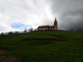

 Easy
 Difficult
 Tourist office

