Schrann Route

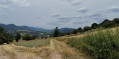
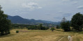
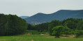
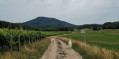
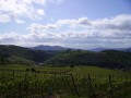
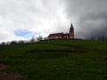
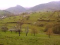
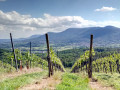
Route on the hills above Triembach-au-Val and Villé. This route offers lovely views over the hills of Albé and its vineyards.

Details

n°28582173
Creation:
Last update:
Last review:
  • Walking
    Activity: Walking
  • ↔
    Distance: 4.13 mi
  • ◔
    Average duration: 2h 25 
  • ▲
    Difficulty: Easy

  • ⚐
    Back to start: Yes
  • ↗
    Ascent: + 600 ft
  • ↘
    Descent: - 571 ft

  • ▲
    Highest point: 1,339 ft
  • ▼
    Lowest point: 833 ft

Photos

Description of the walk

Park near the town hall and church in Triembach-au-Val – Place de Tilleuls car park or near the village hall.
The route starts on Rue des Guerriers.

(S/E) From the school, take Rue des Guerriers towards Villé (Red Triangle). After about 300 m of gentle climb, you’ll reach a fork in the road with a wayside cross.

(1) Turn left (Red Triangle) and take Chemin du Sonnenbach (bench with a view of the industrial estate) to Villé. You’ll come to a road.

(2) Turn left onto Rue du Soleil and continue to the junction with Rue de la Schrann.

(3) Head uphill, turning right onto Rue de la Schrann, then follow the sunken path (Red Cross) to the Schrann kiosk (shelter with tables and benches – panoramic view of Villé and the valley behind). Continue along the path across the Schrann plateau and through the Albé vineyard towards the airfield. Walk alongside the airfield and stay on this old road until you reach the junction with the RD 539.

(4) Just past the airfield runway, take a path on the right (Green Ring), then turn left towards the football pitch and walk alongside it on the right-hand side. Walk past the changing rooms and turn immediately right in front of the buildings of the Albéville holiday village to head into the forest via a path that leads onto a wider forest track. Follow it straight on, ignoring the path leading left to the memorial. You’ll come out onto a tarmac road at a crossroads (there’s a bench here).

(5) Follow it to the right for about 400 m until you reach a Y-junction.

(6) Leave the road by turning right onto a grassy track (marked with a Yellow Triangle), and continue straight on to the centre of Triembach.

(7) Turn left to return to the town hall and the car park (S/E).

Waypoints

  1. S/E : mi 0 - alt. 833 ft - Triembach Town Hall - Église Saint-Christophe (Triembach-au-Val)
  2. 1 : mi 0.19 - alt. 912 ft - Calvary. Chemin du Sonnenbach. Near the - Giessen (rivière)
  3. 2 : mi 0.64 - alt. 961 ft - Junction. Rue du Soleil
  4. 3 : mi 0.87 - alt. 879 ft - Junction: turn right onto Rue de la Schrann
  5. 4 : mi 2.18 - alt. 1,227 ft - Airfield. Fork in the road, turn right
  6. 5 : mi 3.04 - alt. 1,096 ft - Bench. Crossroads, road to the right
  7. 6 : mi 3.35 - alt. 1,066 ft - Junction, grassy path on the right
  8. 7 : mi 4.02 - alt. 886 ft - Junction, turn left
  9. S/E : mi 4.13 - alt. 833 ft - Triembach Town Hall - Église Saint-Christophe (Triembach-au-Val)

Notes

Avoid periods of extreme heat as there are many exposed areas.

Worth a visit

There is a kiosk and picnic tables at the top of Rue de la Schrann.

Reviews and comments

4.2 / 5
Based on 2 reviews

Reliability of the description
4.5 / 5
Ease of following the route
5 / 5
Route interest
3 / 5
weissguyot
weissguyot

Overall rating : 4.7 / 5

Date of your route : May 20, 2024
Reliability of the description : ★★★★★ Very good
Ease of following the route : ★★★★★ Very good
Route interest : ★★★★☆ Good
Very busy route : Yes

A really lovely walk, taking in a variety of scenery. From flower-filled meadows to the surroundings of a surreal airfield. A walk best done in spring to admire the flowers… although some sections of the walk through the forest are really muddy at this time of year…

Machine-translated

Ddec.62
Ddec.62

Overall rating : 3.7 / 5

Date of your route : Oct 16, 2023
Reliability of the description : ★★★★☆ Good
Ease of following the route : ★★★★★ Very good
Route interest : ★★☆☆☆ Disappointing
Very busy route : No

The route runs partly through the town with views of an industrial estate; outside the town, the path is poorly maintained. There is a beautiful panoramic view at the end of the route.

Machine-translated

Other walks in the area

For more walks, use our search engine .

The GPS track and description are the property of this route's author. Please do not copy them without permission.