Country:

 City:
City:


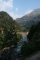
The walk starts from the car park at the Val de Bujaruelo campsite (it is also possible to continue for 3 km to reach San Nicolás de Bujaruelo, thereby shortening the distance). To reach the starting point from Torta-Ordesa, follow signs for the Bujaruelo Valley.
(S) From the car park, head south-east and go downhill.
(1) Take the footbridge over the torrent. On the other side, follow the path to the left as it climbs. Walk alongside the River Ara, which lies below on the left. After a long walk, you’ll reach a pretty stone bridge at a place called San Nicolás de Bujaruelo.
(2) Cross the river via this bridge.
(3) On the other side (with the chapel opposite), turn right twice and take a track. Walk alongside the river on your right along a flat stretch.
(4) At a fork in the road, turn left onto a path that climbs. Further on, turn right to rejoin the track immediately.
(5) Follow the track to the left and continue climbing. Stay on the track, which makes two hairpin bends – first to the left, then to the right – and crosses the previous path several times. You’ll reach a junction as you come out of the left-hand bend.
(6) Carry on straight ahead along the track for about fifty metres.
(7) Then turn right onto a path and climb more steeply.
(8) Join the track on the right and shortly afterwards reach another junction with a path.
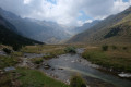
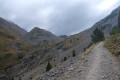
(9) Continue straight on along the track and pass Collado de Otal, where the view opens out across the whole valley. Descend slightly and cross the river. Continue along the track which leads to the bottom of the valley and, after a long straight stretch, reach the Otal Refuge.
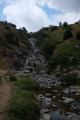
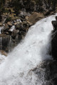
(10) Carry on along the track and, after about 400 m, you’ll reach a waterfall.
(11) Retrace your steps and follow the outward route in the opposite direction. Pass the refuge, cross the river again, go over the pass and immediately reach a junction you have already passed.
(9) Turn left and head down a path.
(6) Join the track and follow it to the left.
(5) Turn sharply left. After a hairpin bend to the right, you’ll reach a junction.
(12) Then turn left.
(13) Cross the Puente de Oncins and turn right to quickly reach a Fork in the road.
(14) Take the track on the right to head back and follow the river on your right-hand side. Walk for a long while. At a T-junction, turn right and you’ll soon reach the stone bridge at San Nicolás de Bujaruelo.
(2) Cross the river again.
(3) On the other side, carry on straight ahead, leaving the chapel on your right. Follow the track for a long way, with the river below on your left. This will take you back to the car park where you started (S/E).
 Visorando Member
 Difficult
 Very difficult