Please take careful note of the practical information and read the route description before setting out on the full circular route.


 Country:

 City:
City:


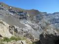
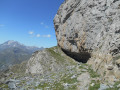
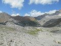
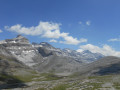
Park in the car park at the Col de Tentes.
(S/E) Follow the track to easily reach the Col de Boucharo.
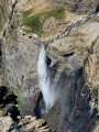
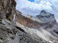
(1) Leave the path descending towards the valley on your right and continue left towards the Brèche de Roland. The path is very busy in summer with walkers heading for the Brèche. After passing the path coming from Gavarnie, you’ll reach a waterfall.
(2) Cross it; it is situated below the Taillon Glacier.
If the rocks are completely dry, it is best to cross as quickly as possible and continue the ascent on the other side – which is made possible by a gently sloping slab – rather than climbing directly up the waterfall.
At the Col des Sarradets, follow the rocks to the right towards the refuge. The path continues up a very steep and sometimes slippery slope until it reaches the plateau.
Once on the plateau, cross the Brèche Glacier (crampons recommended), keeping to the right initially to avoid the steep slopes. The track is normally clearly visible in summer. Reach the Brèche de Roland.
(3) From the Brèche, follow the path descending to the right. The start is barely visible, but the path below is clearly visible. The rest of the route is well marked, with cairns indicating the less obvious sections. This leads to the start of the sharp limestone pavement.
(4) The final part of the descent is over a sharp limestone pavement, where the path sometimes disappears completely and where the abundance of cairns can occasionally be misleading. Continue keeping as far to the right as possible; a path regularly appears to guide the way. Caution is advised on certain sections where you will need to use your hands to descend.
Once you reach the Plano de Millaris, a grassy plateau at the foot of the sharp limestone pavement, follow the path and the cairns to the right (westwards) towards the Collado de Catuarta. The climb is moderately steep, with the high peaks of Ordesa, including Monte Perdido, behind you. Be careful, however, as the path disappears and the cairns are sometimes few and far between.
(5) After the Collado de Catuarta, follow the path and the cairns towards Plana Catuarta. The section is gently sloping and presents no difficulty; opposite you can see the Col de l’Escuzana, which appears steeper than it actually is. Be careful, though: under no circumstances should you attempt to cut across the rocks on the left, due to the presence of rocky outcrops and faults in the ground.
(6) From Plana Catuarta, you can make out a path in the scree below the Col de l’Escuzana. To reach it, climb up the grassy slopes beneath the long rocky ridge, then ascend the scree slope to the left at the far end of the ridge. There is no clear route (no path or cairns on this short stretch), so it is best to join the path as quickly as possible by continuing to climb slightly to the left above the ridge.
Once you’ve reached the path, follow it to the Col de l’Escuzana across a scree slope which includes some steep sections, but presents no particular difficulty.
(7) From the pass, it is possible to climb Pic Mondarruego. Superb views of the Ordesa peaks on one side and the upper Ara valley on the other, with a panorama stretching as far as the Enfers peaks. Descend the scree slope, following the cairns, to the start of the Escuzana ledge.
(8) An exposed section but not particularly difficult, as the path is fairly wide. A 2–3-metre descent over a rock requires a bit of care; it is best to avoid getting too close to the cliff face. In July 2020, a ring was fixed to the top of the rock, allowing a rope to be secured if necessary. The rest of the ledge presents no particular difficulty in dry weather, although you should always avoid getting too close to the cliff face.
(9) At the end of the ledge, follow a well-marked path through scree until you cross the stream below the Gabiétou. The path then turns left to reach the Forqueta de Gabieto. The markings (white dots) can sometimes be obscured by lichens and the path is not always visible. A few (very easy) climbing steps are required to reach the pass. Be careful not to climb up to the ridge before the pass, as the other side is very steep. You will then need to descend a little to find a safe and easier route. You will arrive at the Col de la Forqueta de Gabieto.
(10) After a short, steep descent over rocks, a clearly visible path winds its way through scree and grassy slopes to the Col de Boucharo. A final section over rocks requires a little care just before the pass.
(1) Follow the same route back as on the way up to return to the Col des Tentes car park (S/E).



 ? What makes Visorando so good is the description and the base map attached to each suggestion.
 .
. Visorando Member
 Moderate
 Difficult