Circular route via the Boucharo, Tentes and Especières passes from Bujaruelo

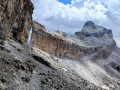
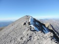
A lovely cross-border circular route starting from the Bujaruelo Valley, taking in varied landscapes and beautiful views over the Taillon and the Otal Valley. The route passes through woodland and over scree before passing two lakes after the Col des Tentes, then descends.

Details

n°108054716
Creation:
Last update:
Last review:
–
  • Walking
    Activity: Walking
  • ↔
    Distance: 8.45 mi
  • ◔
    Average duration: 7h 05 
  • ▲
    Difficulty: Difficult

  • ⚐
    Back to start: Yes
  • ↗
    Ascent: + 3,717 ft
  • ↘
    Descent: - 3,701 ft

  • ▲
    Highest point: 7,651 ft
  • ▼
    Lowest point: 4,373 ft

Photos

Description of the walk

Start from the large car park at San Nicolás de Bujaruelo (mountain hut, hermitage). To reach the start from Torta-Ordesa, follow signs for the Bujaruelo Valley to the end of the road.

(S/E) From the car park, head north-east, leaving the hermitage on your left.

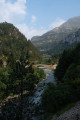
(1) Cross the river via the stone bridge. On the other side, continue north-east towards Port de Boucharo along a path that climbs through the forest. The path winds several times before reaching a Fork in the road.

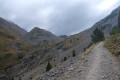
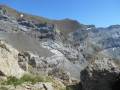
(3) Take the steep path climbing up to the right. You’ll soon emerge from the forest to a view opening out to the west over the Otal valley.

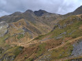
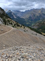
(4) At another Fork in the road, take the path on the right, heading towards the Port de Boucharo. Climb up to the pass, with a few sections over scree.

(5) Take the path furthest to the left (north-north-east), a track that descends gently. This will take you to the Col des Tentes, which, on a clear day, offers unobstructed views of the Pic du Taillon.

(6) Turn left (west) towards Lac des Especières.

(7) Go round the lake on the right and climb up to reach the pass of the same name, the highest point of the walk.

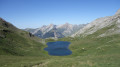
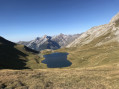
(8) Descend on the other side. Soon head south-west (veering left) to reach the western end of another lake (Ibon de Lapazosa).

(9) Continue the descent south-west and, further on, rejoin a junction you passed at the start of the walk.

(4) Carry on westwards and, following the outward route in the opposite direction, return to the car park at San Nicolás de Bujaruelo(S/E).

Waypoints

  1. S/E : mi 0 - alt. 4,373 ft - Car park - Refugio de Bujaruelo
  2. 1 : mi 0.05 - alt. 4,390 ft - Puente de Bujaruelo
  3. 2 : mi 0.81 - alt. 5,246 ft - Fork
  4. 3 : mi 0.84 - alt. 5,335 ft - Junction of the circular loop
  5. 4 : mi 2.06 - alt. 6,486 ft - Fork in the road
  6. 5 : mi 3.12 - alt. 7,434 ft - Port de Boucharo (Puerto de Bujaruelo)
  7. 6 : mi 4.12 - alt. 7,244 ft - Col de Tentes
  8. 7 : mi 4.5 - alt. 7,274 ft - Lac des Espécières
  9. 8 : mi 4.98 - alt. 7,651 ft - Col des Espécières / Puerto de Lapazosa (2334 m)
  10. 9 : mi 5.42 - alt. 7,392 ft - Ibon de Lapazosa
  11. S/E : mi 8.45 - alt. 4,373 ft - Car park - Ermita de San Nicolas de Bujaruelo

Notes

No technical difficulties but a significant elevation gain.

The route is well signposted.

This route passes through a protected area, which may be subject to special regulations:

Worth a visit

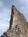
On a clear day, there are lovely panoramic views from the various passes, particularly of the Pic du Taillon.

Other walks in the area

For more walks, use our search engine .

The GPS track and description are the property of this route's author. Please do not copy them without permission.