


Ibon de Bernatuara from Bujaruelo


A very beautiful round-trip walk with a spectacular view of the lake at the end. The slope is sometimes very steep and there are plenty of stones on the path, particularly at the lower and upper sections. In between, there’s a short stretch through alpine pastures where cows graze freely. You’re accompanied all the way by streams fed by melting glaciers, and the scenery is magnificent.
Details
Creation:
Last update:
Last review:
–
–
-
 Activity: Walking
 -
 Distance: 6.45 mi
 -
 Average duration: 6h 00
 -
 Difficulty: Difficult
 -
-
 Back to start: Yes
 -
 Ascent: + 3,461 ft
 -
 Descent: - 3,445 ft
 -
-
 Highest point: 7,569 ft
 -
 Lowest point: 4,373 ft
-
 Country:
Spain
Country:
Spain
-
 Area: Pyrenees
 -
 City:
Torla-Ordesa
City:
Torla-Ordesa -
 Start/End: N 42.694378° / W 0.10675°
 -
 IGN map(s): Ref. 1748OT, 1748OTR
 -


 Hour-by-hour weather


Waypoints
- S/E : mi 0 - alt. 4,373 ft - Bujarello
- 1 : mi 3.06 - alt. 7,520 ft - Ibon de Bernatuara
- S/E : mi 6.45 - alt. 4,373 ft - Bujarello
Other walks in the area
Circular route via the Boucharo, Tentes and Especières passes from Bujaruelo
 Visorando Member
 8.45 mi
+3,717 ft
-3,701 ft
7h 05
Difficult
8.45 mi
+3,717 ft
-3,701 ft
7h 05
Difficult
 Departure from Torla-Ordesa (Huesca)
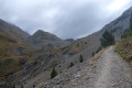
A lovely cross-border circular route starting from the Bujaruelo Valley, taking in varied landscapes and beautiful views over the Taillon and the Otal Valley. The route passes through woodland and over scree before passing two lakes after the Col des Tentes, then descends.
The Otal Valley via several circular loops starting from the Val de Bujaruelo campsite
 11.10 mi
+1,673 ft
-1,670 ft
6h 35
11.10 mi
+1,673 ft
-1,670 ft
6h 35
 Moderate
Departure from Torla-Ordesa (Huesca)
Moderate
Departure from Torla-Ordesa (Huesca)
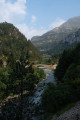
Explore the pretty Otal valley with several waterfalls and a river that winds its way along the entire route. The view opens up as you climb the Mont Perdu massif. This walk can be shortened by 6 km by starting from San Nicolás de Bujaruelo.
The Brèche de Roland
 6.87 mi
+2,103 ft
-2,100 ft
5h 00
Difficult
Departure from Gavarnie (Hautes-Pyrénées)
6.87 mi
+2,103 ft
-2,100 ft
5h 00
Difficult
Departure from Gavarnie (Hautes-Pyrénées)
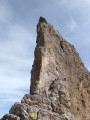
Hike above the Cirque de Gavarnie to visit a mountain pass made famous by its name.
The Taillon circuit via the Brèche de Roland and the Escuzana ledge
 10.27 mi
+4,236 ft
-4,229 ft
10 hrs
10.27 mi
+4,236 ft
-4,229 ft
10 hrs
 Very difficult
Departure from Gavarnie (Hautes-Pyrénées)
Very difficult
Departure from Gavarnie (Hautes-Pyrénées)
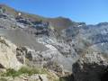
This hike will take you around the Taillon and the Gabiétous, passing through the legendary Brèche de Roland and the Escuzana ledge. Good weather will allow you to admire the Cirque de Gavarnie, as well as the 3,000-metre peaks of Ordesa National Park, such as Mont Perdu.
Please take careful note of the practical information and read the route description before setting out on the full circular route.
Pic entre les Ports via Lac des Espécières.
 2.58 mi
+994 ft
-971 ft
2h 05
Moderate
Departure from Gavarnie (Hautes-Pyrénées)
2.58 mi
+994 ft
-971 ft
2h 05
Moderate
Departure from Gavarnie (Hautes-Pyrénées)
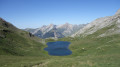
A border ridge walk with magnificent views down over the blue lakes of Les Espécières and Lapazosa, leading to a summit offering a panoramic view of the stunning high peaks.
Pic de Saint-André
 2.87 mi
+1,355 ft
-1,352 ft
2h 30
Moderate
Departure from Gavarnie (Hautes-Pyrénées)
2.87 mi
+1,355 ft
-1,352 ft
2h 30
Moderate
Departure from Gavarnie (Hautes-Pyrénées)
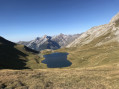
A border route featuring two lovely lakes and the ascent of a peak offering a breathtaking panoramic view.
Le Casque du Marboré via the normal route
 8.37 mi
+3,340 ft
-3,323 ft
6h 45
Difficult
Departure from Gavarnie (Hautes-Pyrénées)
8.37 mi
+3,340 ft
-3,323 ft
6h 45
Difficult
Departure from Gavarnie (Hautes-Pyrénées)
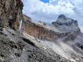
Want to climb one of the legendary "3000" peaks of the Cirque de Gavarnie with breathtaking views? The Casque du Marboré could be your next goal! The entire route offers magnificent views of the surrounding mountains: Vignemale, Néouvielle, Mont Perdu, Canyon d'Ordesa. However, it is important to bear in mind that part of this hike takes place in a high mountain environment, with sometimes unstable scree and passages where you will need to use your hands.
Taillon and Breche de Roland from the Col des Tentes
 8.62 mi
+3,442 ft
-3,428 ft
7h 00
Difficult
Departure from Gavarnie (Hautes-Pyrénées)
8.62 mi
+3,442 ft
-3,428 ft
7h 00
Difficult
Departure from Gavarnie (Hautes-Pyrénées)
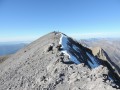
Landscapes “rich in nature” on this hike in the area of Gavarnie, accompany your steps towards the peak of Taillon, through the legendary Roland breach. Taillon, a summit that at the top of its 3144 m, offers a stunning panorama and striking views as far as the eye can see.
For more walks, use our search engine .
The GPS track and description are the property of this route's author. Please do not copy them without permission.

